Estimated Value: $182,000 - $246,000
About This Home
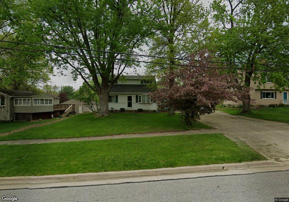
This home is located at 1819 Hibbard Dr, Stow, OH 44224 and is currently estimated at $213,882, approximately $277 per square foot. 1819 Hibbard Dr is a home located in Summit County with nearby schools including Stow-Munroe Falls High School, Primrose School of Hudson, and Holy Family Elementary School.
Ownership History
We collect this data history from publicly available records. To have your information removed, we recommend requesting removal directly through your county’s website.
Purchase Details
Purchase Details
Purchase Details
Home Financials for this Owner
Home Financials are based on the most recent Mortgage that was taken out on this home.Purchase Details
Home Financials for this Owner
Home Financials are based on the most recent Mortgage that was taken out on this home.Purchase Details
Home Financials for this Owner
Home Financials are based on the most recent Mortgage that was taken out on this home.Home Values in the Area
Average Home Value in this Area
Purchase History
We collect this data history from publicly available records. To have your information removed, we recommend requesting removal directly through your county’s website.
| Date | Buyer | Sale Price | Title Company |
|---|---|---|---|
| -- | Wigley Title Agency Inc | ||
| -- | None Available | ||
| $136,200 | Magellan Title | ||
| $127,500 | Minnesota Title | ||
| $119,000 | -- |
Mortgage History
We collect this data history from publicly available records. To have your information removed, we recommend requesting removal directly through your county’s website.
| Date | Status | Borrower | Loan Amount |
|---|---|---|---|
| Open | $71,000 | ||
| Previous Owner | $77,500 | ||
| Previous Owner | $95,200 |
Tax History
We collect this data history from publicly available records. To have your information removed, we recommend requesting removal directly through your county’s website.
| Year | Tax Paid | Tax Assessment Tax Assessment Total Assessment is a certain percentage of the fair market value that is determined by local assessors to be the total taxable value of land and additions on the property. | Land | Improvement |
|---|---|---|---|---|
| 2026 | $4,959 | $61,996 | $14,763 | $47,233 |
| 2024 | $3,027 | $61,996 | $14,763 | $47,233 |
| 2023 | $3,027 | $61,996 | $14,763 | $47,233 |
| 2022 | $3,024 | $55,381 | $10,857 | $44,524 |
| 2021 | $2,712 | $55,381 | $10,857 | $44,524 |
| 2020 | $2,667 | $55,380 | $10,860 | $44,520 |
| 2019 | $2,157 | $43,740 | $10,860 | $32,880 |
| 2018 | $2,123 | $43,740 | $10,860 | $32,880 |
| 2017 | $1,999 | $43,740 | $10,860 | $32,880 |
| 2016 | $2,031 | $40,700 | $10,860 | $29,840 |
| 2015 | $1,999 | $40,700 | $10,860 | $29,840 |
| 2014 | $2,001 | $40,700 | $10,860 | $29,840 |
| 2013 | $2,000 | $40,890 | $10,860 | $30,030 |
Map
- 1528 Spruce Hill Dr
- 1946 Leisure Ln
- 1979 Sandy Hook
- 1480 Meadowbrook Blvd
- 4457 Forest Lake Ct
- 4436 Forest Lake Ct
- 5005 Bar Harbor Ln Unit 5005
- 5111 Rockport Cove
- 1969 Willowdale Dr
- 4760 Sunnyside Dr
- 4748 Sunnyside Dr
- 4994 Comanche Trail
- 1826 Arndale Rd
- 1671 Sapphire Dr
- 2323 Call Rd
- 2450 Wrens Dr S
- 2077 King Dr
- 2292 Echo Valley Dr
- 4756 Fox Run Dr
- 2230 Lynnwood Dr
- 1827 Hibbard Dr
- 1752 Clearbrook Dr
- 1768 Clearbrook Dr
- 1837 Hibbard Dr
- 4692 Trillium Dr
- 1792 Clearbrook Dr
- 1751 Clearbrook Dr
- 1845 Hibbard Dr
- 1838 Hibbard Dr
- 1806 Hibbard Dr
- 4684 Trillium Dr
- 1769 Clearbrook Dr
- 1796 Hibbard Dr
- 1763 Clearbrook Dr
- 4683 Trillium Dr
- 1853 Hibbard Dr
- 1773 Clearbrook Dr
- 1779 Clearbrook Dr
- 4674 Trillium Dr
- 1787 Clearbrook Dr
Ask me questions while you tour the home.