Estimated Value: $306,270 - $395,000
Studio
--
Bath
2,216
Sq Ft
$158/Sq Ft
Est. Value
About This Home
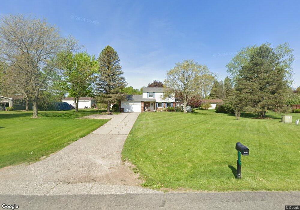
This home is located at 182 S Every Rd, Mason, MI 48854 and is currently estimated at $350,818, approximately $158 per square foot. 182 S Every Rd is a home located in Ingham County with nearby schools including Mason High School.
Ownership History
Date
Name
Owned For
Owner Type
Purchase Details
Closed on
Oct 8, 1999
Sold by
Doran Rodocker Caroline Olds and Doran Caroline Olds
Bought by
Tackaberry Mark A and Tackaberry Julie A
Current Estimated Value
Home Financials for this Owner
Home Financials are based on the most recent Mortgage that was taken out on this home.
Original Mortgage
$95,000
Outstanding Balance
$28,860
Interest Rate
7.91%
Estimated Equity
$321,958
Create a Home Valuation Report for This Property
The Home Valuation Report is an in-depth analysis detailing your home's value as well as a comparison with similar homes in the area
Home Values in the Area
Average Home Value in this Area
Purchase History
We collect this data history from publicly available records. To have your information removed, we recommend requesting removal directly through your county’s website.
| Date | Buyer | Sale Price | Title Company |
|---|---|---|---|
| Tackaberry Mark A | $140,000 | -- |
Source: Public Records
Mortgage History
We collect this data history from publicly available records. To have your information removed, we recommend requesting removal directly through your county’s website.
| Date | Status | Borrower | Loan Amount |
|---|---|---|---|
| Open | Tackaberry Mark A | $95,000 |
Source: Public Records
Tax History
| Year | Tax Paid | Tax Assessment Tax Assessment Total Assessment is a certain percentage of the fair market value that is determined by local assessors to be the total taxable value of land and additions on the property. | Land | Improvement |
|---|---|---|---|---|
| 2025 | $2,572 | $151,300 | $13,300 | $138,000 |
| 2024 | $3,957 | $145,700 | $12,750 | $132,950 |
| 2023 | $3,957 | $129,200 | $12,250 | $116,950 |
| 2022 | $3,757 | $118,850 | $12,100 | $106,750 |
| 2021 | $3,699 | $115,100 | $10,200 | $104,900 |
| 2020 | $3,611 | $97,700 | $10,200 | $87,500 |
| 2019 | $3,510 | $95,250 | $9,250 | $86,000 |
| 2018 | $2,539 | $72,150 | $8,300 | $63,850 |
| 2017 | $2,177 | $70,600 | $8,050 | $62,550 |
| 2016 | -- | $68,550 | $8,000 | $60,550 |
| 2015 | -- | $65,650 | $14,434 | $51,216 |
| 2014 | -- | $62,500 | $13,184 | $49,316 |
Source: Public Records
Map
Nearby Homes
- 1284 W Dansville Rd
- 1280 W Dansville Rd
- 318 Ives Rd
- 974 W Dansville Rd
- 1191 W Dexter Trail
- 582 Baldwin Rd
- 917 Chickasaw Dr
- 896 Fields Rd
- 110 Stratford Dr
- 202 Stratford Dr
- 609 W Dexter Trail
- 880 Sanctuary Dr
- 227 Steven St
- 0 Sanctuary
- 567 E South St
- 1345 Ives Rd
- 424 E Columbia St
- 334 E Elm St
- 32 Aviemore Dr Unit 32
- 690 Okemos Rd
- 194 S Every Rd
- 1011 Killdeer Dr
- 1019 Killdeer Dr
- 208 S Every Rd
- 220 S Every Rd
- 1030 Bobolink Way
- 1016 Killdeer Dr
- 1047 Killdeer Dr
- 1044 Bobolink Way
- 244 S Every Rd
- 1065 Killdeer Dr
- 1068 Bobolink Way
- 1031 Bobolink Way
- 1060 Killdeer Dr
- 1045 Bobolink Way
- 1057 Bobolink Way
- 1031 Pelican Place
- 252 S Every Rd
- 98 S Every Rd
- 1066 Killdeer Dr
Your Personal Tour Guide
Ask me questions while you tour the home.