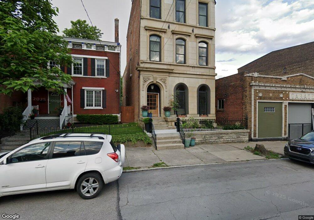
1820 Freeman Ave Cincinnati, OH 45214
West End NeighborhoodEstimated Value: $322,000 - $866,000
About This Home
This home is located at 1820 Freeman Ave, Cincinnati, OH 45214 and is currently estimated at $588,128, approximately $129 per square foot. 1820 Freeman Ave is a home located in Hamilton County with nearby schools including Hays-Porter School, Robert A. Taft Information Technology High School, and Gilbert A. Dater High School.
Ownership History
We collect this data history from publicly available records. To have your information removed, we recommend requesting removal directly through your county’s website.
Purchase Details
Home Financials for this Owner
Home Financials are based on the most recent Mortgage that was taken out on this home.Purchase Details
Home Values in the Area
Average Home Value in this Area
Purchase History
We collect this data history from publicly available records. To have your information removed, we recommend requesting removal directly through your county’s website.
| Date | Buyer | Sale Price | Title Company |
|---|---|---|---|
| $121,000 | None Available | ||
| -- | Prominent Title Agency Llc |
Mortgage History
We collect this data history from publicly available records. To have your information removed, we recommend requesting removal directly through your county’s website.
| Date | Status | Borrower | Loan Amount |
|---|---|---|---|
| Open | $213,448 |
Tax History
We collect this data history from publicly available records. To have your information removed, we recommend requesting removal directly through your county’s website.
| Year | Tax Paid | Tax Assessment Tax Assessment Total Assessment is a certain percentage of the fair market value that is determined by local assessors to be the total taxable value of land and additions on the property. | Land | Improvement |
|---|---|---|---|---|
| 2025 | $6,371 | $196,655 | $7,046 | $189,609 |
| 2023 | $6,373 | $196,655 | $7,046 | $189,609 |
| 2022 | $2,997 | $127,925 | $3,878 | $124,047 |
| 2021 | $8,380 | $127,925 | $3,878 | $124,047 |
| 2020 | $8,625 | $127,925 | $3,878 | $124,047 |
| 2019 | $1,891 | $25,166 | $3,525 | $21,641 |
| 2018 | $1,893 | $25,166 | $3,525 | $21,641 |
| 2017 | $1,809 | $25,166 | $3,525 | $21,641 |
| 2016 | $1,707 | $23,283 | $3,497 | $19,786 |
| 2015 | $1,533 | $23,283 | $3,497 | $19,786 |
| 2014 | $1,543 | $23,283 | $3,497 | $19,786 |
| 2013 | $1,634 | $24,256 | $3,644 | $20,612 |
Map
- 1722 Freeman Ave
- 916 Findlay St
- 923 Findlay St
- 916 York St
- 918 York St
- 1835 Baymiller St
- 1900 Colerain Ave
- 912 Livingston St
- 1912 Colerain Ave
- 909 Dayton St
- 1816 Baymiller St
- 845 Charlotte St
- 1142 Dayton St
- 837 Dayton St
- 2008 Colerain Ave
- 830 York St
- 923 Bank St
- 832 Livingston St
- 1117 Dayton St
- 830 Livingston St
- 1818 Freeman Ave
- 1822 Freeman Ave
- 1826 Freeman Ave
- 1814 Freeman Ave
- 1828 Freeman Ave
- 1812 Freeman Ave
- 1810 Freeman Ave
- 1808 Freeman Ave
- 1806 Freeman Ave
- 1804 Freeman Ave
- 936 Findlay St
- 1802 Freeman Ave
- 1800 Freeman Ave
- 1800 Freeman Ave Unit 2
- 933 York St
- 934 Findlay St
- 930 Findlay St
- 1815 Freeman Ave
- 929 York St
- 1906 Freeman Ave
Ask me questions while you tour the home.