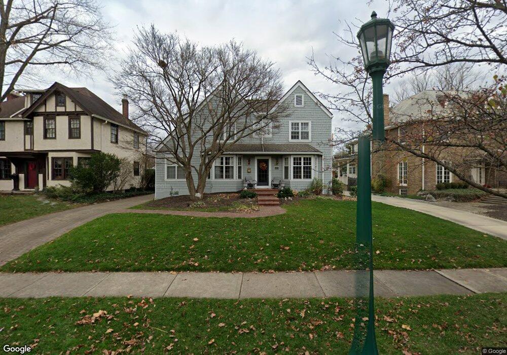
1821 N Devon Rd Columbus, OH 43212
Estimated Value: $1,113,781 - $1,196,000
4
Beds
3
Baths
3,250
Sq Ft
$355/Sq Ft
Est. Value
About This Home
This home is located at 1821 N Devon Rd, Columbus, OH 43212 and is currently estimated at $1,154,445, approximately $355 per square foot. 1821 N Devon Rd is a home located in Franklin County with nearby schools including Barrington Road Elementary School, Jones Middle School, and Upper Arlington High School.
Ownership History
Date
Name
Owned For
Owner Type
Purchase Details
Closed on
Jun 19, 2000
Sold by
Ricker Scott G and Ricker Marilyn J
Bought by
Cotter Thomas P and Cotter Patricia E
Current Estimated Value
Purchase Details
Closed on
Aug 23, 1990
Bought by
Ricker Scott G
Purchase Details
Closed on
May 1, 1980
Create a Home Valuation Report for This Property
The Home Valuation Report is an in-depth analysis detailing your home's value as well as a comparison with similar homes in the area
Home Values in the Area
Average Home Value in this Area
Purchase History
| Date | Buyer | Sale Price | Title Company |
|---|---|---|---|
| Cotter Thomas P | $435,000 | -- | |
| Ricker Scott G | $170,000 | -- | |
| -- | $91,500 | -- |
Source: Public Records
Tax History
| Year | Tax Paid | Tax Assessment Tax Assessment Total Assessment is a certain percentage of the fair market value that is determined by local assessors to be the total taxable value of land and additions on the property. | Land | Improvement |
|---|---|---|---|---|
| 2025 | $16,164 | $279,200 | $115,360 | $163,840 |
| 2024 | $16,164 | $279,200 | $115,360 | $163,840 |
| 2023 | $15,963 | $279,195 | $115,360 | $163,835 |
| 2022 | $15,154 | $216,860 | $62,930 | $153,930 |
| 2021 | $13,414 | $216,860 | $62,930 | $153,930 |
| 2020 | $13,296 | $216,860 | $62,930 | $153,930 |
| 2019 | $13,356 | $192,360 | $62,930 | $129,430 |
| 2018 | $14,958 | $192,360 | $62,930 | $129,430 |
| 2017 | $14,845 | $192,360 | $62,930 | $129,430 |
| 2016 | $16,454 | $248,850 | $61,040 | $187,810 |
| 2015 | $16,439 | $248,850 | $61,040 | $187,810 |
| 2014 | $16,458 | $248,850 | $61,040 | $187,810 |
| 2013 | $7,858 | $226,205 | $55,475 | $170,730 |
Source: Public Records
Map
Nearby Homes
- 1942 Bedford Rd
- 1921 Wyandotte Rd
- 2006 Cambridge Blvd
- 2015 W 5th Ave Unit 211
- 2015 W 5th Ave Unit 102
- 2015 W 5th Ave Unit 108
- 1631 Roxbury Rd Unit D2
- 1585 Arlington Ave Unit 1585A
- 1951 Glenn Ave
- 1579 Arlington Ave Unit 1579B
- 1780 Waltham Rd
- 1876 Westwood Ave
- 1561 Glenn Ave
- 1530 Lincoln Rd
- 1960 Hillside Dr
- 1523 Wyandotte Rd
- 2151 Fairfax Rd
- 1810 Ashland Ave
- 1654-1656 Ashland Ave
- 1648 Ashland Ave
- 1815 N Devon Rd
- 1829 N Devon Rd
- 1835 N Devon Rd
- 1828 Arlington Ave
- 1838 Arlington Ave
- 1800 Cambridge Blvd
- 1816 Cambridge Blvd
- 1843 N Devon Rd
- 1842 Arlington Ave
- 1816 N Devon Rd
- 1822 N Devon Rd
- 1810 N Devon Rd
- 1830 N Devon Rd
- 1846 Arlington Ave
- 1800 N Devon Rd
- 1838 N Devon Rd
- 1901 Tremont Rd
- 1858 Arlington Ave
- 1790 Cambridge Blvd
- 1899 Tremont Rd
Your Personal Tour Guide
Ask me questions while you tour the home.