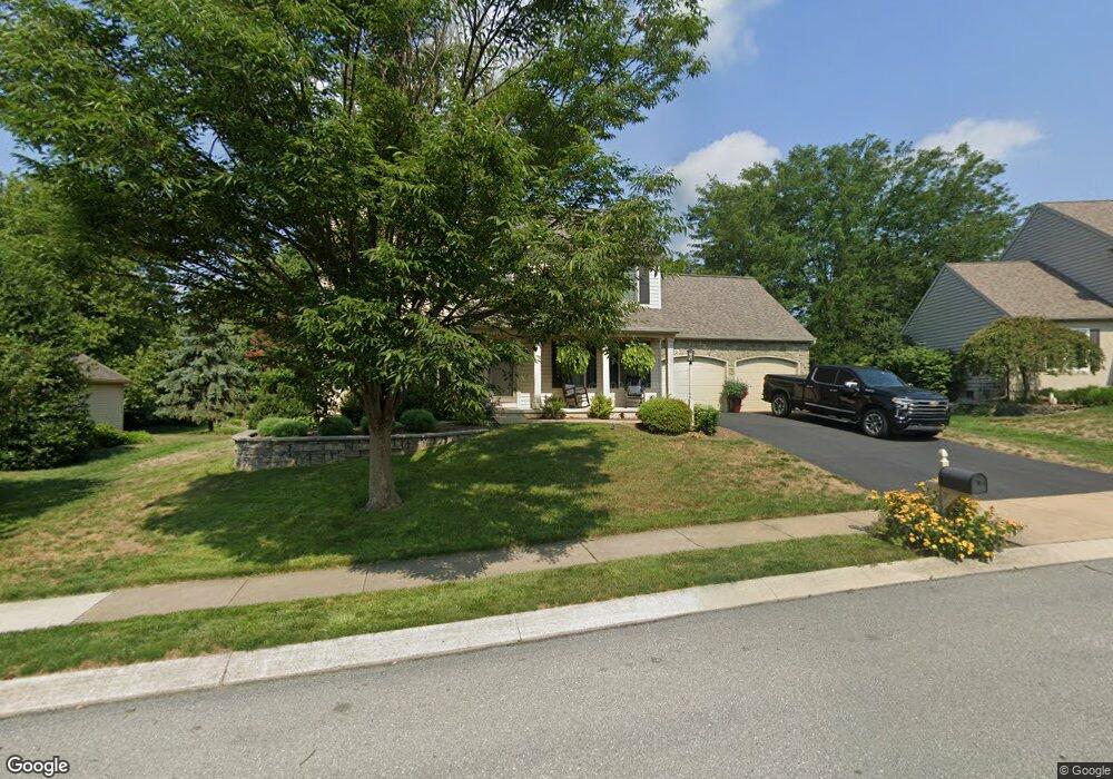
1833 Windrow Dr Lancaster, PA 17602
Bridgeport NeighborhoodEstimated Value: $487,218 - $583,000
4
Beds
4
Baths
2,116
Sq Ft
$255/Sq Ft
Est. Value
About This Home
This home is located at 1833 Windrow Dr, Lancaster, PA 17602 and is currently estimated at $539,805, approximately $255 per square foot. 1833 Windrow Dr is a home located in Lancaster County with nearby schools including Smoketown Elementary School, Gerald G. Huesken Middle School, and Conestoga Valley High School.
Create a Home Valuation Report for This Property
The Home Valuation Report is an in-depth analysis detailing your home's value as well as a comparison with similar homes in the area
Home Values in the Area
Average Home Value in this Area
Tax History
| Year | Tax Paid | Tax Assessment Tax Assessment Total Assessment is a certain percentage of the fair market value that is determined by local assessors to be the total taxable value of land and additions on the property. | Land | Improvement |
|---|---|---|---|---|
| 2025 | $5,695 | $281,300 | $69,700 | $211,600 |
| 2024 | $5,695 | $281,300 | $69,700 | $211,600 |
| 2023 | $5,563 | $281,300 | $69,700 | $211,600 |
| 2022 | $5,425 | $281,300 | $69,700 | $211,600 |
| 2021 | $5,234 | $281,300 | $69,700 | $211,600 |
| 2020 | $5,234 | $281,300 | $69,700 | $211,600 |
| 2019 | $5,121 | $281,300 | $69,700 | $211,600 |
| 2018 | $7,343 | $281,300 | $69,700 | $211,600 |
| 2017 | $5,202 | $240,300 | $67,200 | $173,100 |
| 2016 | $5,140 | $240,300 | $67,200 | $173,100 |
| 2015 | $1,313 | $240,300 | $67,200 | $173,100 |
| 2014 | $3,469 | $240,300 | $67,200 | $173,100 |
Source: Public Records
Map
Nearby Homes
- 1829 Krystle Dr
- 257 Longfellow Dr
- 32 Greenfield Rd
- 142 Hostetter Ln
- 319 Dahlia Rd
- 314 Dahlia Rd
- 77 Highland Dr
- 89 Greenfield Rd
- 83 Highland Dr
- 8 White Tail Path
- 26 Midway Farms Ln
- 312 Laurel Oak Ln
- 225 Black Oak Dr
- 305 Greenland Dr Unit 385
- 352 Dohner Dr Unit 69
- 2009 Millstream Rd
- 40 Harvest Rd
- 38 Conestoga Dr
- 47 Riverside Ave
- 2187 Lincoln Hwy E
- 1831 Windrow Dr
- 1835 Windrow Dr
- 1837 Windrow Dr
- 1836 Windrow Dr
- 1829 Windrow Dr
- 1835 Fritz Ln
- 1832 Krystle Dr
- 1834 Krystle Dr
- 175 Crest Ave
- 1839 Windrow Dr
- 1838 Windrow Dr
- 1836 Krystle Dr
- 1831 Southrun Dr
- 1828 Krystle Dr
- 1832 Fritz Ln
- 1839 Fritz Ln
- 1838 Krystle Dr
- 1841 Windrow Dr
- 1829 Southrun Dr
- 177 Crest Ave
Your Personal Tour Guide
Ask me questions while you tour the home.