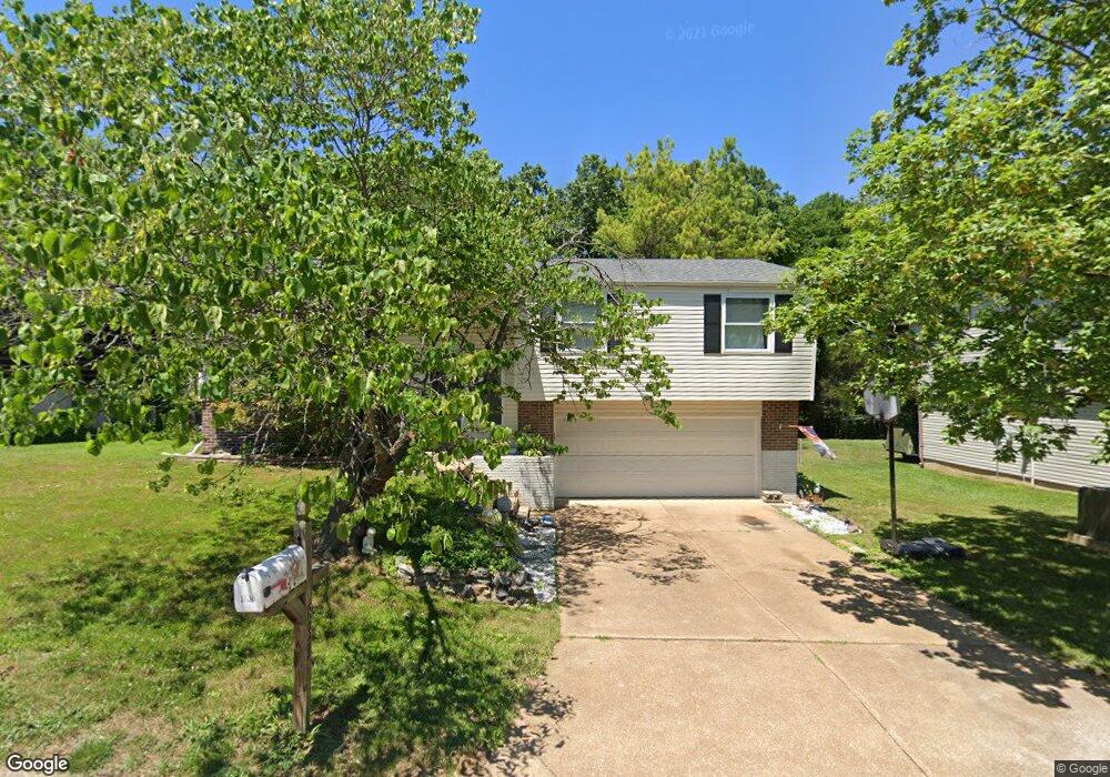
1839 Marriott Ln Barnhart, MO 63012
Estimated Value: $247,119 - $281,000
Studio
--
Bath
1,196
Sq Ft
$226/Sq Ft
Est. Value
About This Home
This home is located at 1839 Marriott Ln, Barnhart, MO 63012 and is currently estimated at $270,280, approximately $225 per square foot. 1839 Marriott Ln is a home located in Jefferson County with nearby schools including Windsor High School and St. Joseph Catholic School.
Ownership History
Date
Name
Owned For
Owner Type
Purchase Details
Closed on
Dec 14, 2007
Sold by
Cope John W
Bought by
Cope Patti M
Current Estimated Value
Purchase Details
Closed on
Sep 26, 2000
Sold by
Cope John E and Cope Patti M
Bought by
Cope John E and Cope Patti M
Home Financials for this Owner
Home Financials are based on the most recent Mortgage that was taken out on this home.
Original Mortgage
$14,700
Interest Rate
7.99%
Purchase Details
Closed on
Sep 9, 1999
Sold by
Poepper John A and Poepper Sheryl L
Bought by
Cope John W and Cope Pattie M
Home Financials for this Owner
Home Financials are based on the most recent Mortgage that was taken out on this home.
Original Mortgage
$100,878
Outstanding Balance
$30,091
Interest Rate
7.9%
Mortgage Type
VA
Estimated Equity
$240,189
Purchase Details
Closed on
Feb 12, 1998
Sold by
Peopper John and Suedkamp Sheryl
Bought by
Poepper John A and Poepper Sheryl L
Home Financials for this Owner
Home Financials are based on the most recent Mortgage that was taken out on this home.
Original Mortgage
$4,500
Interest Rate
6.91%
Create a Home Valuation Report for This Property
The Home Valuation Report is an in-depth analysis detailing your home's value as well as a comparison with similar homes in the area
Home Values in the Area
Average Home Value in this Area
Purchase History
| Date | Buyer | Sale Price | Title Company |
|---|---|---|---|
| Cope Patti M | -- | None Available | |
| Cope John E | -- | Capital Title | |
| Cope John W | -- | Capital Title | |
| Poepper John A | -- | Commonwealth Title |
Source: Public Records
Mortgage History
| Date | Status | Borrower | Loan Amount |
|---|---|---|---|
| Closed | Cope John E | $14,700 | |
| Open | Cope John W | $100,878 | |
| Previous Owner | Poepper John A | $4,500 |
Source: Public Records
Tax History
| Year | Tax Paid | Tax Assessment Tax Assessment Total Assessment is a certain percentage of the fair market value that is determined by local assessors to be the total taxable value of land and additions on the property. | Land | Improvement |
|---|---|---|---|---|
| 2025 | $1,759 | $25,600 | $4,800 | $20,800 |
| 2024 | $1,759 | $24,000 | $4,800 | $19,200 |
| 2023 | $1,759 | $24,000 | $4,800 | $19,200 |
| 2022 | $1,572 | $21,500 | $2,300 | $19,200 |
| 2021 | $1,573 | $21,500 | $2,300 | $19,200 |
| 2020 | $1,455 | $19,300 | $1,900 | $17,400 |
| 2019 | $1,454 | $19,300 | $1,900 | $17,400 |
| 2018 | $1,434 | $19,300 | $1,900 | $17,400 |
| 2016 | $1,248 | $17,400 | $1,900 | $15,500 |
Source: Public Records
Map
Nearby Homes
- 0 Hwy Mm Unit MAR24032005
- 1955 Parkton Way
- 1660 Old State Road M
- 6788 Haven Hill Rd
- 2117 S Oaks Dr
- 1767 Williamsburg Dr
- 7213 Burgess Dr
- 1721 Burgess Way
- 2525 Castle Pines Dr
- 7098 Ridge Dr
- 1530 1st St
- 1962 Birchwood Dr
- 6570 Ike Dr
- 1516 Southridge Dr
- 7701 Locust Dr
- 1022 Graystone Park
- 4891 Sierra View Place
- 2727 Red Maple Dr
- 1702 Springbrook Dr
- 1473 Grey Wolf Dr
- 1845 Marriott Ln
- 1833 Marriott Ln
- 1851 Marriott Ln
- 1827 Marriott Ln
- 1840 Marriott Ln
- 1846 Marriott Ln
- 1834 Marriott Ln
- 1852 Marriott Ln
- 1855 Marriott Ln
- 1828 Marriott Ln
- 1863 Marriott Ln
- 1857 Clemens Ct
- 1822 Marriott Ln
- 1851 Clemens Ct
- 1863 Clemens Ct
- 1869 Clemens Ct
- 1864 Marriott Ln
- 1845 Clemens Ct
- 1816 Marriott Ln
- 1869 Marriott Ln
Your Personal Tour Guide
Ask me questions while you tour the home.