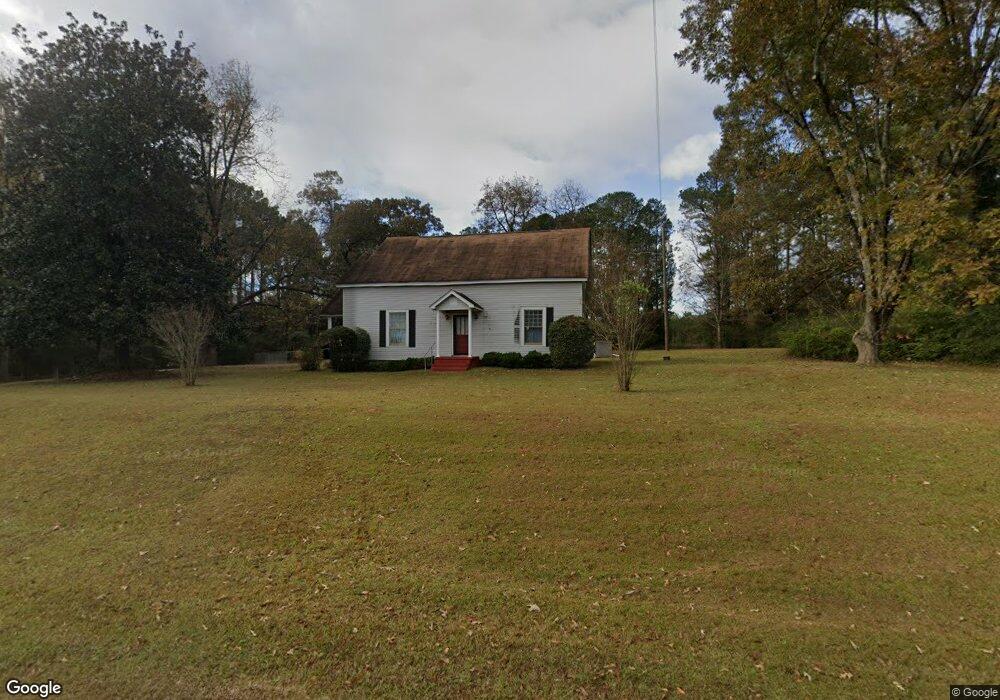
184 Stovall Rd Lagrange, GA 30241
Estimated Value: $244,000 - $377,000
4
Beds
3
Baths
2,377
Sq Ft
$130/Sq Ft
Est. Value
About This Home
This home is located at 184 Stovall Rd, Lagrange, GA 30241 and is currently estimated at $308,509, approximately $129 per square foot. 184 Stovall Rd is a home located in Troup County with nearby schools including Rosemont Elementary School, Whitesville Road Elementary School, and Berta Weathersbee Elementary School.
Ownership History
Date
Name
Owned For
Owner Type
Purchase Details
Closed on
Oct 26, 1984
Sold by
Harry John L and Harry Margaret D
Bought by
Mccollough Aaron and Mccollough Marianne
Current Estimated Value
Purchase Details
Closed on
Nov 17, 1981
Sold by
First Federal Savings & Loan
Bought by
Harry John L and Harry Margaret D
Purchase Details
Closed on
Jun 4, 1972
Sold by
Harry Margaret D and Harry John L
Bought by
First Federal Savings & Loan
Purchase Details
Closed on
Jan 1, 1972
Sold by
Dominick Robert B
Bought by
Harry Margaret D and Harry John L
Purchase Details
Closed on
Sep 1, 1965
Sold by
Dominick Carolyn Jean
Bought by
Dominick Robert B
Create a Home Valuation Report for This Property
The Home Valuation Report is an in-depth analysis detailing your home's value as well as a comparison with similar homes in the area
Purchase History
| Date | Buyer | Sale Price | Title Company |
|---|---|---|---|
| Mccollough Aaron | $25,000 | -- | |
| Harry John L | -- | -- | |
| First Federal Savings & Loan | -- | -- | |
| Harry Margaret D | $12,000 | -- | |
| Dominick Robert B | -- | -- |
Source: Public Records
Tax History
| Year | Tax Paid | Tax Assessment Tax Assessment Total Assessment is a certain percentage of the fair market value that is determined by local assessors to be the total taxable value of land and additions on the property. | Land | Improvement |
|---|---|---|---|---|
| 2025 | $2,163 | $79,320 | $15,400 | $63,920 |
| 2024 | $1,840 | $67,480 | $15,400 | $52,080 |
| 2023 | $1,357 | $49,760 | $15,400 | $34,360 |
| 2022 | $1,335 | $47,840 | $15,400 | $32,440 |
| 2021 | $1,264 | $41,920 | $15,400 | $26,520 |
| 2020 | $1,264 | $41,920 | $15,400 | $26,520 |
| 2019 | $1,291 | $42,800 | $15,400 | $27,400 |
| 2018 | $1,216 | $40,320 | $15,400 | $24,920 |
| 2017 | $1,216 | $40,320 | $15,400 | $24,920 |
| 2016 | $1,204 | $39,921 | $15,400 | $24,521 |
| 2015 | $1,206 | $39,921 | $15,400 | $24,521 |
| 2014 | $1,109 | $38,630 | $15,400 | $23,230 |
| 2013 | -- | $40,495 | $15,400 | $25,095 |
Source: Public Records
Map
Nearby Homes
- 37.23 ACRES / 0 Smokey Rd
- 158 S Glenn Rd
- 0 Briley Rd Unit 10582531
- 0 Briley Rd Unit 214353
- 264 S Glenn Rd
- 0 Lower Big Springs Rd Unit 10718109
- 0 Lower Big Springs Rd Unit 26695797
- 0 Smokey Rd Unit 10570471
- 829 Thrash Rd
- 950 John Lovelace Rd
- 830 John Lovelace Rd
- 23 Nantucket Dr
- 5656 Hamilton Rd
- 5656 Hamilton Rd
- 123 Wexford Dr
- 2477 Upper Big Springs Rd
- 137 Robertson Rd
- 86 John Lovelace Rd
- 142 Carr Rd
- 810 Callaway Church Rd
- 248 Stovall Rd
- 2516 Lower Big Springs Rd
- 269 Stovall Rd
- 297 Stovall Rd
- 87 Stovall Rd
- 318 Stovall Rd
- 2546 Lower Big Springs Rd
- 2594 Lower Big Springs Rd
- 379 Stovall Rd
- 2560 Lower Big Springs Rd
- 2576 Lower Big Springs Rd
- 2391 Lower Big Springs Rd
- 1005 Smokey Rd
- 2629 Lower Big Springs Rd
- 2632 Lower Big Springs Rd
- 2631 Lower Big Springs Rd
- 2315 Lower Big Springs Rd
- 2673 Lower Big Springs Rd
- 827 Smokey Rd
- 2722 Lower Big Springs Rd
Your Personal Tour Guide
Ask me questions while you tour the home.