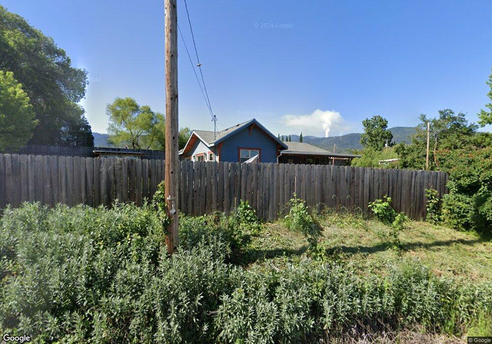
1840 E Main St Ashland, OR 97520
Estimated Value: $266,000 - $411,000
1
Bed
1
Bath
512
Sq Ft
$659/Sq Ft
Est. Value
About This Home
This home is located at 1840 E Main St, Ashland, OR 97520 and is currently estimated at $337,630, approximately $659 per square foot. 1840 E Main St is a home located in Jackson County with nearby schools including Bellview Elementary School, Ashland Middle School, and Ashland High School.
Ownership History
Date
Name
Owned For
Owner Type
Purchase Details
Closed on
Dec 20, 2021
Sold by
Porto Joseph A
Bought by
Lucille Charles Properties Llc
Current Estimated Value
Home Financials for this Owner
Home Financials are based on the most recent Mortgage that was taken out on this home.
Original Mortgage
$144,100
Outstanding Balance
$127,527
Interest Rate
2.98%
Mortgage Type
Credit Line Revolving
Estimated Equity
$210,103
Purchase Details
Closed on
Dec 16, 1999
Sold by
Bessette Anne
Bought by
Porto Joseph A
Home Financials for this Owner
Home Financials are based on the most recent Mortgage that was taken out on this home.
Original Mortgage
$73,000
Interest Rate
8%
Purchase Details
Closed on
Oct 1, 1999
Sold by
Hardwick Eugene Russell and Hardwick Patricia Joan
Bought by
Bassette Anne
Create a Home Valuation Report for This Property
The Home Valuation Report is an in-depth analysis detailing your home's value as well as a comparison with similar homes in the area
Purchase History
We collect this data history from publicly available records. To have your information removed, we recommend requesting removal directly through your county’s website.
| Date | Buyer | Sale Price | Title Company |
|---|---|---|---|
| Lucille Charles Properties Llc | -- | Wfg Lender Services | |
| Porto Joseph A | $75,000 | Jackson County Title | |
| Bassette Anne | $25,000 | -- |
Source: Public Records
Mortgage History
We collect this data history from publicly available records. To have your information removed, we recommend requesting removal directly through your county’s website.
| Date | Status | Borrower | Loan Amount |
|---|---|---|---|
| Open | Lucille Charles Properties Llc | $144,100 | |
| Previous Owner | Porto Joseph A | $73,000 |
Source: Public Records
Tax History
| Year | Tax Paid | Tax Assessment Tax Assessment Total Assessment is a certain percentage of the fair market value that is determined by local assessors to be the total taxable value of land and additions on the property. | Land | Improvement |
|---|---|---|---|---|
| 2026 | $2,432 | $170,580 | -- | -- |
| 2025 | $2,382 | $165,620 | $115,780 | $49,840 |
| 2024 | $2,382 | $160,800 | $118,770 | $42,030 |
| 2023 | $2,304 | $156,120 | $115,310 | $40,810 |
| 2022 | $2,229 | $156,120 | $115,310 | $40,810 |
| 2021 | $2,152 | $151,580 | $111,960 | $39,620 |
| 2020 | $2,091 | $147,170 | $108,700 | $38,470 |
| 2019 | $2,046 | $138,730 | $102,470 | $36,260 |
| 2018 | $1,933 | $134,690 | $99,490 | $35,200 |
| 2017 | $1,922 | $134,690 | $99,490 | $35,200 |
| 2016 | $1,877 | $126,970 | $93,800 | $33,170 |
| 2015 | $1,802 | $126,970 | $93,800 | $33,170 |
| 2014 | $1,742 | $119,690 | $88,430 | $31,260 |
Source: Public Records
Map
Nearby Homes
- 369 Meadow Dr
- 235 Meadow Dr
- 2122 Creek Dr
- 267 Meadow Dr
- 262 Meadow Dr
- 2082 E Main St
- 321 Clay St Unit SPC 3
- 321 Clay St Unit 82
- 81 Crocker St
- 112 N Wightman St
- 147 Blue Heron Ln
- 144 Crocker St
- 159 N Wightman St
- 215 Tolman Creek Rd Unit 31
- 215 Tolman Creek Rd Unit 16
- 215 Tolman Creek Rd Unit SPC 10
- 115 California St
- 2205 Ashland St Unit 210
- 0 Oregon 66 Unit 220203024
- 140 Lincoln St
- 1830 E Main St
- 144 Normal Ave
- 1920 E Main St
- 145 Normal Ave
- 1800 E Main St
- 1965 E Main St
- 1980 E Main St
- 1807 E Main St
- 1780 E Main St
- 1779 E Main St
- 2035 E Main St
- 1735 E Main St
- 1700 E Main St
- 160 Normal Ave
- 1807 E Main 1779 St
- 229 Normal Ave
- 2120 E Main St
- 253 Normal Ave
- 280 Normal Ave
- 2105 E Main St
Your Personal Tour Guide
Ask me questions while you tour the home.