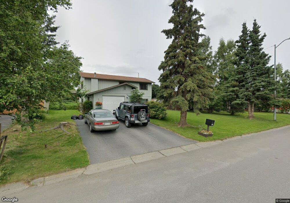
1840 State St Anchorage, AK 99504
Northeast Anchorage NeighborhoodEstimated Value: $258,000 - $443,000
3
Beds
3
Baths
1,920
Sq Ft
$183/Sq Ft
Est. Value
About This Home
This home is located at 1840 State St, Anchorage, AK 99504 and is currently estimated at $350,781, approximately $182 per square foot. 1840 State St is a home located in Anchorage Municipality with nearby schools including Susitna Elementary School, Nicholas J. Begich Middle School, and Bartlett High School.
Ownership History
Date
Name
Owned For
Owner Type
Purchase Details
Closed on
Jun 25, 1997
Sold by
Nardi Leslie J and Nardi Eugene L
Bought by
Riley Keith D and Riley Dawnmarie
Current Estimated Value
Home Financials for this Owner
Home Financials are based on the most recent Mortgage that was taken out on this home.
Original Mortgage
$104,397
Outstanding Balance
$15,506
Interest Rate
7.91%
Mortgage Type
FHA
Estimated Equity
$335,275
Create a Home Valuation Report for This Property
The Home Valuation Report is an in-depth analysis detailing your home's value as well as a comparison with similar homes in the area
Home Values in the Area
Average Home Value in this Area
Purchase History
| Date | Buyer | Sale Price | Title Company |
|---|---|---|---|
| Riley Keith D | -- | -- |
Source: Public Records
Mortgage History
| Date | Status | Borrower | Loan Amount |
|---|---|---|---|
| Open | Riley Keith D | $104,397 |
Source: Public Records
Tax History
| Year | Tax Paid | Tax Assessment Tax Assessment Total Assessment is a certain percentage of the fair market value that is determined by local assessors to be the total taxable value of land and additions on the property. | Land | Improvement |
|---|---|---|---|---|
| 2025 | $4,285 | $369,600 | $87,000 | $282,600 |
| 2024 | $4,285 | $340,400 | $87,000 | $253,400 |
| 2023 | $5,387 | $316,300 | $87,000 | $229,300 |
| 2022 | $4,385 | $310,400 | $87,000 | $223,400 |
| 2021 | $5,114 | $283,800 | $87,000 | $196,800 |
| 2020 | $3,789 | $273,200 | $87,000 | $186,200 |
| 2019 | $3,598 | $269,900 | $87,000 | $182,900 |
| 2018 | $3,413 | $258,100 | $87,000 | $171,100 |
| 2017 | $3,962 | $273,000 | $87,000 | $186,000 |
| 2016 | $3,603 | $269,900 | $84,300 | $185,600 |
| 2015 | $3,603 | $266,000 | $84,300 | $181,700 |
| 2014 | $3,603 | $257,500 | $79,000 | $178,500 |
Source: Public Records
Map
Nearby Homes
- 1640 Parkway Dr
- 1801 Greendale Dr
- 1900 Muldoon Rd
- 8111 Northview Dr
- 1542 Northview Dr Unit E8
- 1542 Northview Dr Unit E5
- 1541 State St Unit B-3
- 2221 Muldoon Rd Unit 280
- 2221 Muldoon Rd Unit 68
- 2221 Muldoon Rd Unit 524
- 2291 Duncanshire Place Unit 154
- 8500 Moss Ct Unit 13
- 8041 Astonshire Ct Unit 85
- 1477 Shallow Pool Dr Unit J3
- 1482 Shallow Pool Dr Unit M3
- 7989 Hillshire Ct Unit 39
- 7515 E 20th Ave
- 7532 Eastbrook Cir
- 7426 E 20th Ave
- 7339 E 17th Ave
Your Personal Tour Guide
Ask me questions while you tour the home.