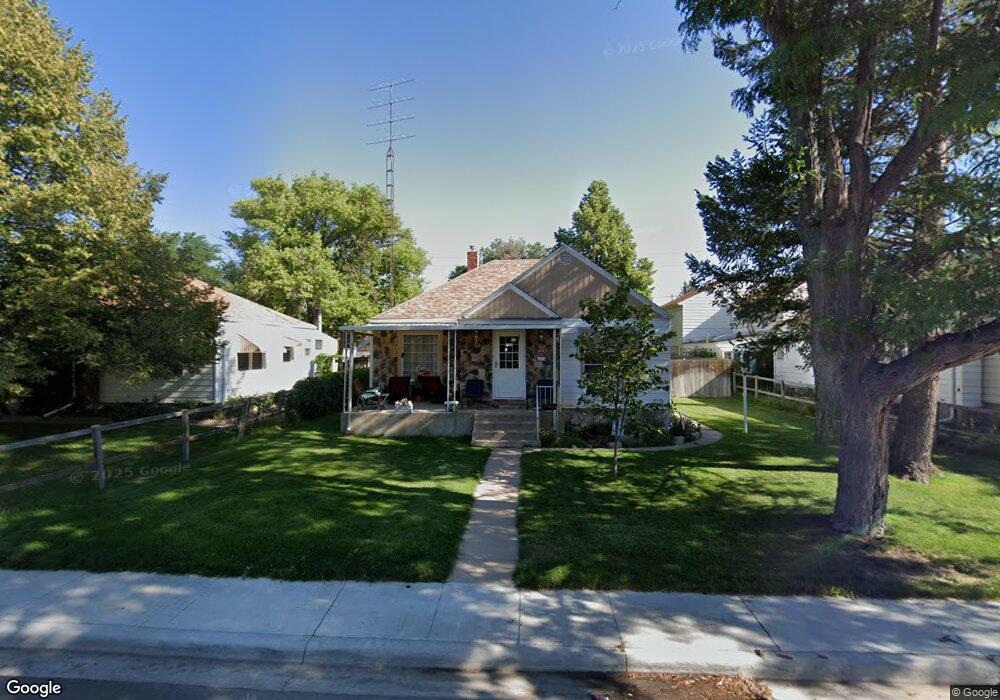
1842 E 21st St Cheyenne, WY 82001
Estimated Value: $315,000 - $346,755
Studio
--
Bath
990
Sq Ft
$333/Sq Ft
Est. Value
About This Home
This home is located at 1842 E 21st St, Cheyenne, WY 82001 and is currently estimated at $329,689, approximately $333 per square foot. 1842 E 21st St is a home located in Laramie County with nearby schools including Alta Vista Elementary School, Carey Junior High School, and East High School.
Ownership History
Date
Name
Owned For
Owner Type
Purchase Details
Closed on
May 24, 2019
Sold by
Jerralee Byers Family Truist
Bought by
Hunter George O and Hunter Karen K
Current Estimated Value
Home Financials for this Owner
Home Financials are based on the most recent Mortgage that was taken out on this home.
Original Mortgage
$209,699
Outstanding Balance
$183,993
Interest Rate
4.1%
Mortgage Type
VA
Estimated Equity
$145,696
Create a Home Valuation Report for This Property
The Home Valuation Report is an in-depth analysis detailing your home's value as well as a comparison with similar homes in the area
Purchase History
We collect this data history from publicly available records. To have your information removed, we recommend requesting removal directly through your county’s website.
| Date | Buyer | Sale Price | Title Company |
|---|---|---|---|
| Hunter George O | -- | None Available |
Source: Public Records
Mortgage History
We collect this data history from publicly available records. To have your information removed, we recommend requesting removal directly through your county’s website.
| Date | Status | Borrower | Loan Amount |
|---|---|---|---|
| Open | Hunter George O | $209,699 |
Source: Public Records
Tax History
| Year | Tax Paid | Tax Assessment Tax Assessment Total Assessment is a certain percentage of the fair market value that is determined by local assessors to be the total taxable value of land and additions on the property. | Land | Improvement |
|---|---|---|---|---|
| 2025 | $1,642 | $23,278 | $2,667 | $20,611 |
| 2024 | $2,176 | $30,779 | $3,556 | $27,223 |
| 2023 | $2,110 | $29,846 | $3,556 | $26,290 |
| 2022 | $1,946 | $26,958 | $3,556 | $23,402 |
| 2021 | $1,644 | $22,720 | $3,556 | $19,164 |
| 2020 | $1,496 | $20,744 | $3,556 | $17,188 |
| 2019 | $1,448 | $20,054 | $3,556 | $16,498 |
| 2018 | $1,266 | $17,704 | $2,685 | $15,019 |
| 2017 | $1,234 | $17,095 | $2,685 | $14,410 |
| 2016 | $1,177 | $16,301 | $2,589 | $13,712 |
| 2015 | $1,203 | $16,655 | $2,589 | $14,066 |
| 2014 | $1,219 | $16,767 | $2,589 | $14,178 |
Source: Public Records
Map
Nearby Homes
- 1818 E 22nd St
- 1851 E Pershing Blvd
- 1910 E 22nd St
- 1919 E 22nd St
- 1907 E Pershing Blvd
- 1911 Garrett St
- 1902 Cheyenne Place
- 1813 E 19th St
- TBD Charles St
- TBD E Lincolnway
- 1955 Newton Dr
- 1749 Oxford Dr
- 1911 E 17th St
- 2123 E 18th St
- 1841 Crook Ave
- 1605 E 16th St
- 2219 E 17th St
- 1400 E 18th St
- 1630 Crook Ave
- 1410 Carbon Ave Unit A-D
Your Personal Tour Guide
Ask me questions while you tour the home.