Estimated Value: $203,426 - $648,000
Studio
--
Bath
1,370
Sq Ft
$373/Sq Ft
Est. Value
About This Home
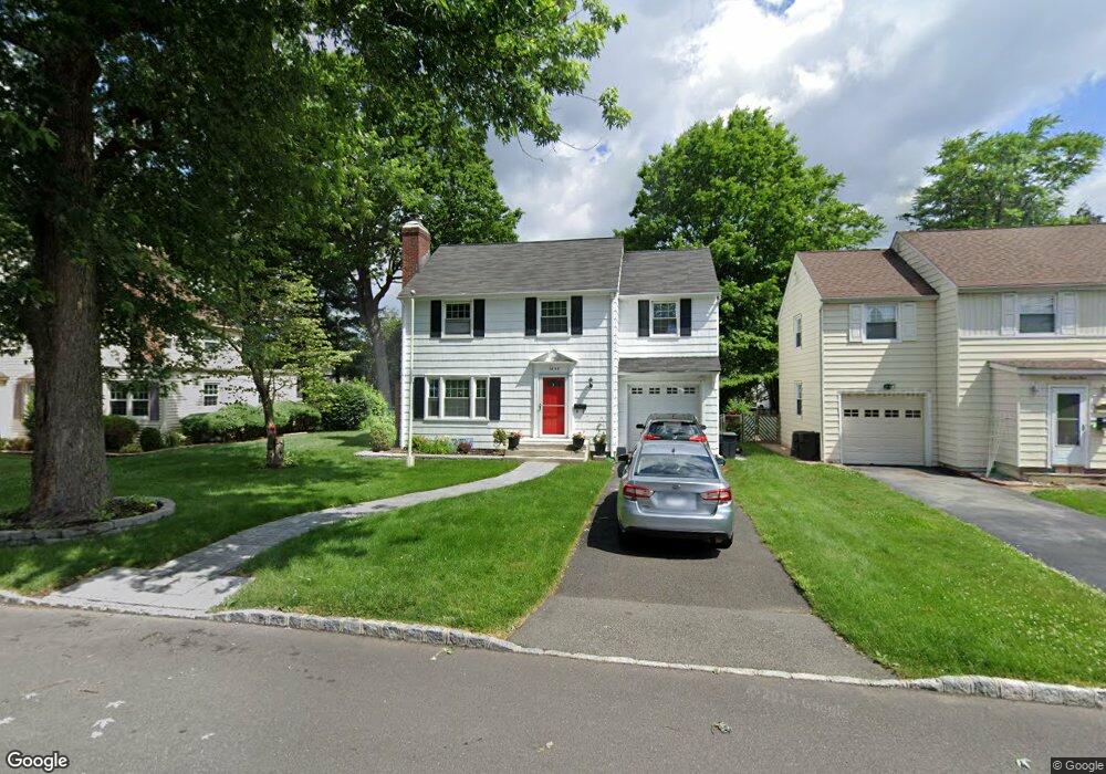
This home is located at 1845 Arbor Ln, Union, NJ 07083 and is currently estimated at $510,607, approximately $372 per square foot. 1845 Arbor Ln is a home located in Union County with nearby schools including Franklin Elementary School, Burnet Middle School, and Union High School.
Ownership History
Date
Name
Owned For
Owner Type
Purchase Details
Closed on
Oct 6, 2022
Sold by
Singh Ann P
Bought by
Singh Ann P
Current Estimated Value
Purchase Details
Closed on
Mar 26, 2008
Sold by
Singh Ann P
Bought by
Singh Ann P and Singh Anita
Home Financials for this Owner
Home Financials are based on the most recent Mortgage that was taken out on this home.
Original Mortgage
$246,000
Interest Rate
6.1%
Mortgage Type
New Conventional
Purchase Details
Closed on
Aug 6, 2003
Sold by
Singh Mohan
Bought by
Singh Mohan and Singh Ann
Home Financials for this Owner
Home Financials are based on the most recent Mortgage that was taken out on this home.
Original Mortgage
$225,000
Interest Rate
5.52%
Create a Home Valuation Report for This Property
The Home Valuation Report is an in-depth analysis detailing your home's value as well as a comparison with similar homes in the area
Home Values in the Area
Average Home Value in this Area
Purchase History
We collect this data history from publicly available records. To have your information removed, we recommend requesting removal directly through your county’s website.
| Date | Buyer | Sale Price | Title Company |
|---|---|---|---|
| Singh Ann P | -- | -- | |
| Singh Ann P | -- | None Listed On Document | |
| Singh Ann P | -- | New Vision Title Agency Llc | |
| Singh Mohan | -- | -- |
Source: Public Records
Mortgage History
We collect this data history from publicly available records. To have your information removed, we recommend requesting removal directly through your county’s website.
| Date | Status | Borrower | Loan Amount |
|---|---|---|---|
| Previous Owner | Singh Ann P | $246,000 | |
| Previous Owner | Singh Mohan | $225,000 |
Source: Public Records
Tax History
| Year | Tax Paid | Tax Assessment Tax Assessment Total Assessment is a certain percentage of the fair market value that is determined by local assessors to be the total taxable value of land and additions on the property. | Land | Improvement |
|---|---|---|---|---|
| 2025 | $10,796 | $48,300 | $21,700 | $26,600 |
| 2024 | $10,466 | $48,300 | $21,700 | $26,600 |
| 2023 | $10,466 | $48,300 | $21,700 | $26,600 |
| 2022 | $10,102 | $48,300 | $21,700 | $26,600 |
| 2021 | $9,858 | $48,300 | $21,700 | $26,600 |
| 2020 | $9,661 | $48,300 | $21,700 | $26,600 |
| 2019 | $9,275 | $47,000 | $21,700 | $25,300 |
| 2018 | $9,117 | $47,000 | $21,700 | $25,300 |
| 2017 | $8,982 | $47,000 | $21,700 | $25,300 |
| 2016 | $8,763 | $47,000 | $21,700 | $25,300 |
| 2015 | $8,617 | $47,000 | $21,700 | $25,300 |
| 2014 | $8,424 | $47,000 | $21,700 | $25,300 |
Source: Public Records
Map
Nearby Homes
- 1841 Cider Mill Rd
- 1868 Pilgrim Way
- 1307 Dartmouth Terrace
- 1781 Union Ave
- 1875 Pilgrim Way
- 1263 Coolidge Ave
- 1217 Coolidge Ave
- 1244 Grandview Ave
- 120 Parkside Dr
- 2011 Kay Ave
- 2024 Balmoral Ave
- 1584 Walker Ave
- 1334 Barbara Ave
- 2047 Gless Ave
- 2044 High St
- 1017 Grandview Ave
- 987 Floyd Terrace
- 1397 Orange Ave
- 1508 Elaine Terrace
- 2062 Emerson Ave
- 1849 Arbor Ln
- 1841 Arbor Ln
- 1810 Quaker Way
- 1814 Quaker Way
- 1853 Arbor Ln
- 1833 Arbor Ln
- 1806 Quaker Way
- 1820 Quaker Way
- 1844 Arbor Ln
- 1840 Arbor Ln
- 1800 Quaker Way
- 1859 Arbor Ln
- 1850 Arbor Ln
- 1832 Arbor Ln
- 1854 Arbor Ln
- 1863 Arbor Ln
- 1830 Quaker Way
- 1858 Arbor Ln
- 1798 Columbia Terrace
- 1815 Quaker Way
Your Personal Tour Guide
Ask me questions while you tour the home.