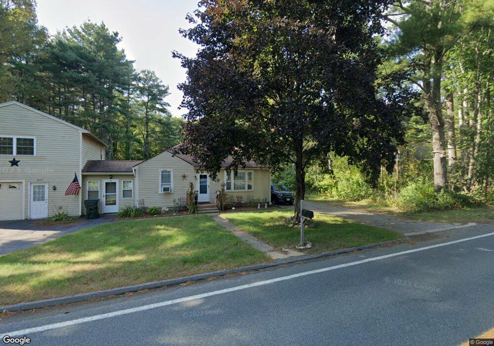
1845 Barre Rd New Braintree, MA 01531
Estimated Value: $407,292 - $799,000
4
Beds
2
Baths
1,416
Sq Ft
$419/Sq Ft
Est. Value
About This Home
This home is located at 1845 Barre Rd, New Braintree, MA 01531 and is currently estimated at $593,073, approximately $418 per square foot. 1845 Barre Rd is a home located in Worcester County with nearby schools including Quabbin Regional Middle School and Quabbin Regional High School.
Ownership History
Date
Name
Owned For
Owner Type
Purchase Details
Closed on
Mar 31, 2024
Sold by
Bonneau Samuel R and Bonneau Isabel R
Bought by
Bonneau Samuel R
Current Estimated Value
Purchase Details
Closed on
Mar 26, 1999
Sold by
Millet Helen I
Bought by
Bonneau Samuel R and Bonneau Isabel R
Home Financials for this Owner
Home Financials are based on the most recent Mortgage that was taken out on this home.
Original Mortgage
$200,000
Interest Rate
6.78%
Mortgage Type
Purchase Money Mortgage
Create a Home Valuation Report for This Property
The Home Valuation Report is an in-depth analysis detailing your home's value as well as a comparison with similar homes in the area
Home Values in the Area
Average Home Value in this Area
Purchase History
We collect this data history from publicly available records. To have your information removed, we recommend requesting removal directly through your county’s website.
| Date | Buyer | Sale Price | Title Company |
|---|---|---|---|
| Bonneau Samuel R | -- | None Available | |
| Bonneau Samuel R | $199,000 | -- |
Source: Public Records
Mortgage History
We collect this data history from publicly available records. To have your information removed, we recommend requesting removal directly through your county’s website.
| Date | Status | Borrower | Loan Amount |
|---|---|---|---|
| Previous Owner | Bonneau Samuel R | $200,000 | |
| Previous Owner | Bonneau Samuel R | $57,000 |
Source: Public Records
Tax History
| Year | Tax Paid | Tax Assessment Tax Assessment Total Assessment is a certain percentage of the fair market value that is determined by local assessors to be the total taxable value of land and additions on the property. | Land | Improvement |
|---|---|---|---|---|
| 2025 | $43 | $289,100 | $58,500 | $230,600 |
| 2024 | $4,204 | $289,100 | $58,500 | $230,600 |
| 2023 | $3,936 | $268,100 | $58,700 | $209,400 |
| 2022 | $3,538 | $217,700 | $47,600 | $170,100 |
| 2021 | $3,609 | $206,600 | $44,200 | $162,400 |
| 2020 | $3,693 | $213,200 | $43,700 | $169,500 |
| 2019 | $4,106 | $241,500 | $72,000 | $169,500 |
| 2018 | $4,121 | $234,700 | $76,200 | $158,500 |
| 2017 | $3,684 | $204,000 | $49,600 | $154,400 |
| 2016 | $3,537 | $203,300 | $48,900 | $154,400 |
| 2015 | $3,565 | $219,500 | $55,500 | $164,000 |
| 2014 | $3,467 | $212,200 | $48,200 | $164,000 |
Source: Public Records
Map
Nearby Homes
- 1940 Barre Rd
- 2266 Old Turnpike Rd
- 716 Hardwick Rd
- 661 Wheelwright Rd
- 572 Wheelwright Rd
- 1776 Old Turnpike Rd
- 0 Station Rd
- 70 Skyline Dr
- 23 Trafalgar Square Unit 23
- 12-16 Church St
- 865 S Barre Rd
- lt3 West Rd
- 1215 South St
- 49 Bullard Rd
- 926 Old Turnpike Rd
- Lot 3 Clapp Rd
- 0 Clapp Rd + 0 North Rd Unit 73505086
- 0 Lower Rd
- 67 Maple St
- Lot 2 North Rd
Your Personal Tour Guide
Ask me questions while you tour the home.