Estimated Value: $173,138 - $228,000
3
Beds
1
Bath
1,084
Sq Ft
$180/Sq Ft
Est. Value
About This Home
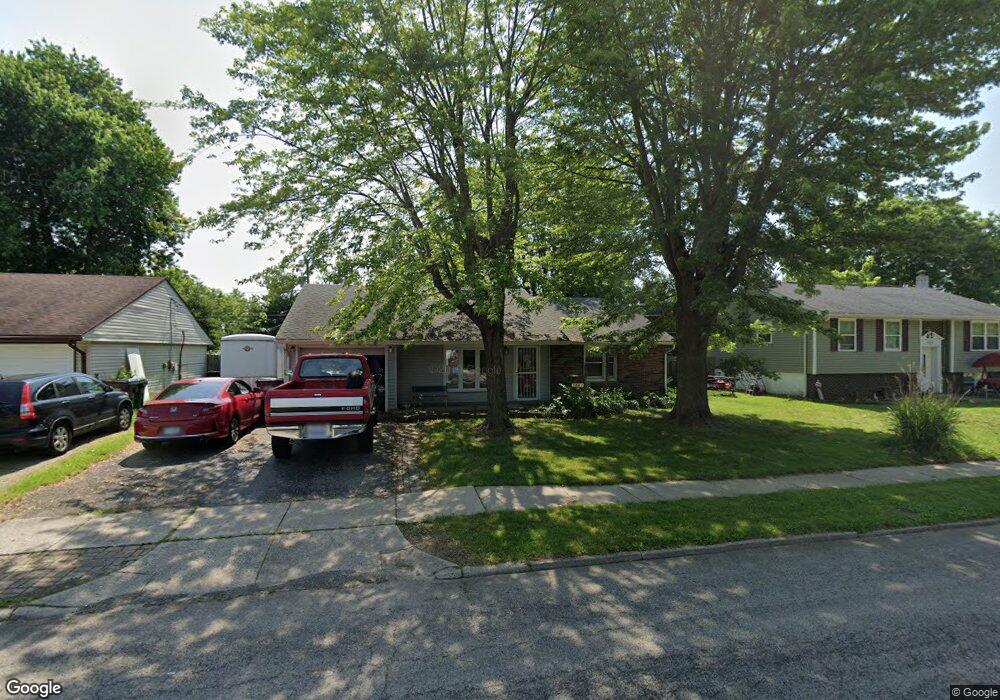
This home is located at 1847 Commonwealth Dr, Xenia, OH 45385 and is currently estimated at $195,535, approximately $180 per square foot. 1847 Commonwealth Dr is a home located in Greene County with nearby schools including Xenia High School, Summit Academy Community School for Alternative Learners - Xenia, and Legacy Christian Academy.
Ownership History
Date
Name
Owned For
Owner Type
Purchase Details
Closed on
May 4, 2018
Sold by
Mullin Ann C
Bought by
Mullin John J
Current Estimated Value
Home Financials for this Owner
Home Financials are based on the most recent Mortgage that was taken out on this home.
Original Mortgage
$54,400
Outstanding Balance
$30,444
Interest Rate
4.4%
Mortgage Type
New Conventional
Estimated Equity
$165,091
Purchase Details
Closed on
Feb 10, 2006
Sold by
Estate Of Thomas Richard Mullin
Bought by
Mullin Ann C
Purchase Details
Closed on
Oct 9, 2002
Sold by
Mullin Ann C
Bought by
Mullin Thomas R
Purchase Details
Closed on
Sep 14, 1999
Sold by
Mullin Mary C and Mullin Thomas R
Bought by
Mullin Thomas R and Mullin Ann C
Home Financials for this Owner
Home Financials are based on the most recent Mortgage that was taken out on this home.
Original Mortgage
$30,000
Interest Rate
8.21%
Mortgage Type
Credit Line Revolving
Create a Home Valuation Report for This Property
The Home Valuation Report is an in-depth analysis detailing your home's value as well as a comparison with similar homes in the area
Home Values in the Area
Average Home Value in this Area
Purchase History
| Date | Buyer | Sale Price | Title Company |
|---|---|---|---|
| Mullin John J | $68,000 | None Available | |
| Mullin Ann C | -- | None Available | |
| Mullin Thomas R | -- | -- | |
| Mullin Thomas R | -- | -- |
Source: Public Records
Mortgage History
| Date | Status | Borrower | Loan Amount |
|---|---|---|---|
| Open | Mullin John J | $54,400 | |
| Previous Owner | Mullin Thomas R | $30,000 |
Source: Public Records
Tax History
| Year | Tax Paid | Tax Assessment Tax Assessment Total Assessment is a certain percentage of the fair market value that is determined by local assessors to be the total taxable value of land and additions on the property. | Land | Improvement |
|---|---|---|---|---|
| 2025 | $1,876 | $43,070 | $10,270 | $32,800 |
| 2024 | $1,876 | $43,070 | $10,270 | $32,800 |
| 2023 | $1,843 | $43,070 | $10,270 | $32,800 |
| 2022 | $1,532 | $30,530 | $6,040 | $24,490 |
| 2021 | $1,552 | $30,530 | $6,040 | $24,490 |
| 2020 | $1,487 | $30,530 | $6,040 | $24,490 |
| 2019 | $1,202 | $23,220 | $6,160 | $17,060 |
| 2018 | $1,206 | $23,220 | $6,160 | $17,060 |
| 2017 | $1,095 | $23,220 | $6,160 | $17,060 |
| 2016 | $1,095 | $20,690 | $6,160 | $14,530 |
| 2015 | $1,098 | $20,690 | $6,160 | $14,530 |
| 2014 | $1,052 | $20,690 | $6,160 | $14,530 |
Source: Public Records
Map
Nearby Homes
- 1955 Roxbury Dr
- 1816 Atkinson Dr
- 1772 Pueblo Dr
- 1715 Sioux Dr
- 1731 Navajo Dr
- 1861 Nebraska Dr
- 1291 Commonwealth Dr
- 2247 Dundee Dr
- 2216 Minnesota Dr
- 2516 Jenny Marie Dr
- 1632 Otoole Dr
- 1321 Massachusetts Dr
- 1182 Bellbrook Ave
- 1540 Crockett Ct
- 0 Berkshire Dr Unit 949217
- 2632 Ketki Ct
- 1978 Lakeview Dr
- 2015 Pennsylvania Dr
- 1407 Navajo Dr
- 779 Buckskin Trail
- 1833 Commonwealth Dr
- 1859 Commonwealth Dr
- 1819 Commonwealth Dr
- 1867 Commonwealth Dr
- 1848 Commonwealth Dr
- 1860 Commonwealth Dr
- 1834 Commonwealth Dr
- 1807 Commonwealth Dr
- 1820 Commonwealth Dr
- 1876 Commonwealth Dr
- 1806 Commonwealth Dr
- 1793 Commonwealth Dr
- 1843 Roxbury Dr
- 1827 Roxbury Dr
- 1855 Roxbury Dr
- 1890 Commonwealth Dr
- 1895 Commonwealth Dr
- 1815 Roxbury Dr
- 1792 Commonwealth Dr
- 1867 Roxbury Dr
Your Personal Tour Guide
Ask me questions while you tour the home.