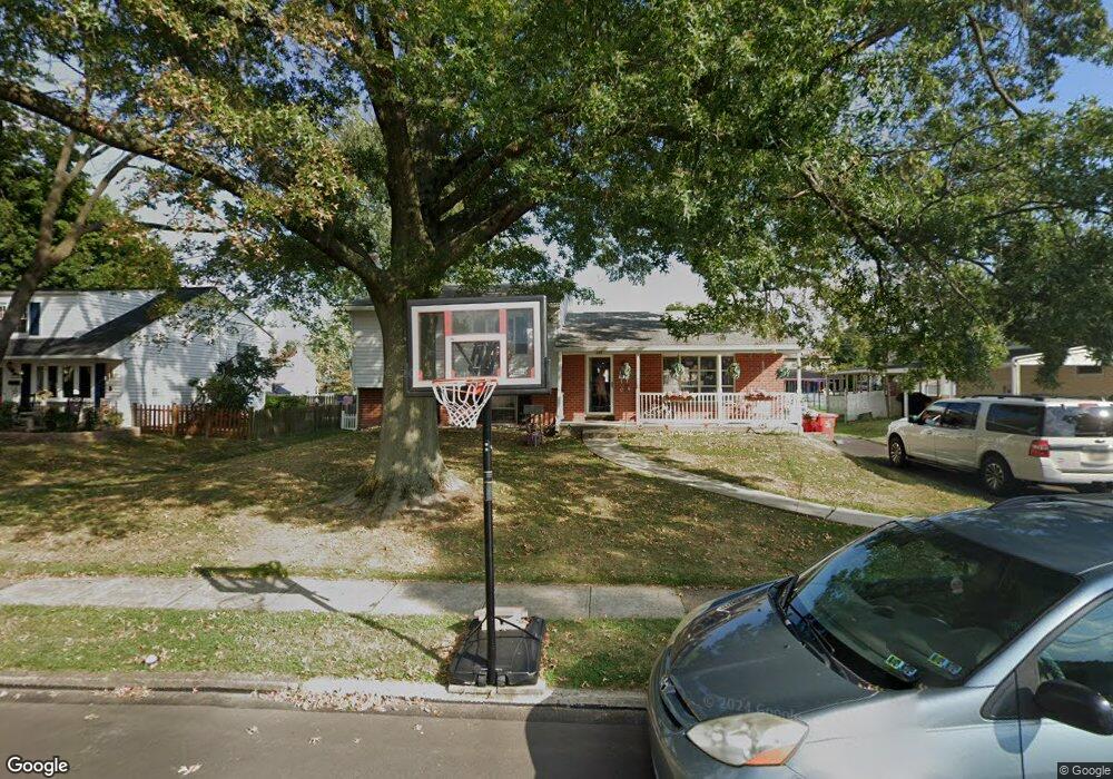
185 Kipling Dr Warminster, PA 18974
Estimated Value: $413,000 - $449,000
3
Beds
1
Bath
1,316
Sq Ft
$325/Sq Ft
Est. Value
About This Home
This home is located at 185 Kipling Dr, Warminster, PA 18974 and is currently estimated at $428,129, approximately $325 per square foot. 185 Kipling Dr is a home located in Bucks County with nearby schools including Willow Dale Elementary School, Log College Middle School, and William Tennent High School.
Ownership History
Date
Name
Owned For
Owner Type
Purchase Details
Closed on
Dec 14, 2012
Sold by
Lytle Sheri E
Bought by
Larew Robert J and Larew Emily L
Current Estimated Value
Home Financials for this Owner
Home Financials are based on the most recent Mortgage that was taken out on this home.
Original Mortgage
$119,790
Outstanding Balance
$83,268
Interest Rate
3.44%
Mortgage Type
FHA
Estimated Equity
$344,861
Purchase Details
Closed on
Jul 20, 2001
Sold by
Holden Charles and Holden Barbara Y
Bought by
Holden Charles and Holden Barbara Y
Create a Home Valuation Report for This Property
The Home Valuation Report is an in-depth analysis detailing your home's value as well as a comparison with similar homes in the area
Home Values in the Area
Average Home Value in this Area
Purchase History
| Date | Buyer | Sale Price | Title Company |
|---|---|---|---|
| Larew Robert J | $122,000 | None Available | |
| Holden Charles | -- | -- |
Source: Public Records
Mortgage History
| Date | Status | Borrower | Loan Amount |
|---|---|---|---|
| Open | Larew Robert J | $119,790 |
Source: Public Records
Tax History
| Year | Tax Paid | Tax Assessment Tax Assessment Total Assessment is a certain percentage of the fair market value that is determined by local assessors to be the total taxable value of land and additions on the property. | Land | Improvement |
|---|---|---|---|---|
| 2025 | $5,319 | $25,200 | $4,280 | $20,920 |
| 2024 | $5,319 | $25,200 | $4,280 | $20,920 |
| 2023 | $5,155 | $25,200 | $4,280 | $20,920 |
| 2022 | $5,045 | $25,200 | $4,280 | $20,920 |
| 2021 | $4,927 | $25,200 | $4,280 | $20,920 |
| 2020 | $4,858 | $25,200 | $4,280 | $20,920 |
| 2019 | $4,600 | $25,200 | $4,280 | $20,920 |
| 2018 | $4,490 | $25,200 | $4,280 | $20,920 |
| 2017 | $4,359 | $25,200 | $4,280 | $20,920 |
| 2016 | $4,359 | $25,200 | $4,280 | $20,920 |
| 2015 | $4,279 | $25,200 | $4,280 | $20,920 |
| 2014 | $4,279 | $25,200 | $4,280 | $20,920 |
Source: Public Records
Map
Nearby Homes
- 240 Clearfield Cir
- 64 Villa Dr Unit 206
- 253 Kent Rd
- 60 Caledonia Dr
- 1228 Clyde Rd
- 173 Villa Dr Unit 100
- 532 Sherwood Ln
- 1171 W County Line Rd
- 327 S Norristown Rd
- 607 America Dr
- 602 America Dr Unit FARADAY MODEL HOME
- 604 America #Northbrook Model Dr
- 1413 Foster Rd
- 619 America Dr
- 604 Liberty Ridge Rd
- 18 Patriot Ln
- 616 Liberty Ridge Rd
- 619 Liberty Ridge Rd
- 25 Patriot Ln
- 623 Liberty Ridge Rd
- 177 Kipling Dr
- 191 Kipling Dr
- 184 Westbury Dr
- 192 Westbury Dr
- 169 Kipling Dr
- 199 Kipling Dr
- 184 Kipling Dr
- 198 Westbury Dr
- 192 Kipling Dr
- 168 Westbury Dr
- 176 Kipling Dr
- 207 Kipling Dr
- 161 Kipling Dr
- 206 Westbury Dr
- 1297 Victoria Rd
- 1265 Victoria Rd
- 206 Kipling Dr
- 1307 Victoria Rd
- 213 Kipling Dr
- 214 Westbury Dr
Your Personal Tour Guide
Ask me questions while you tour the home.