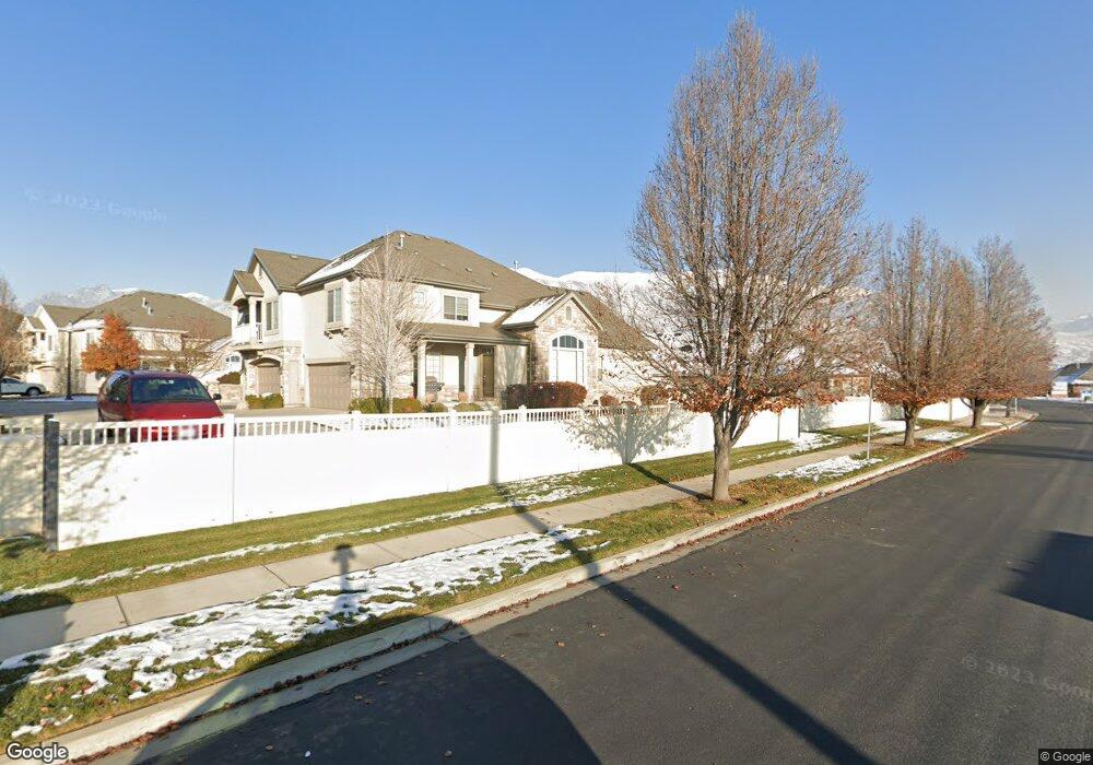
185 S 930 E American Fork, UT 84003
Estimated Value: $435,000 - $449,000
3
Beds
4
Baths
2,483
Sq Ft
$178/Sq Ft
Est. Value
About This Home
This home is located at 185 S 930 E, American Fork, UT 84003 and is currently estimated at $442,014, approximately $178 per square foot. 185 S 930 E is a home located in Utah County with nearby schools including Barratt Elementary School, American Fork Junior High School, and American Fork High School.
Ownership History
Date
Name
Owned For
Owner Type
Purchase Details
Closed on
Feb 13, 2025
Sold by
Lana Bryner Llc
Bought by
Round Bale-185S 930E Lls
Current Estimated Value
Purchase Details
Closed on
Sep 12, 2019
Sold by
Moll Kraig S and Moll Nelleen E
Bought by
Lana Bryner Llc
Purchase Details
Closed on
May 2, 2018
Sold by
Miller Richard K and Miller Julia
Bought by
Moll Kraig S and Moll Nellen E
Home Financials for this Owner
Home Financials are based on the most recent Mortgage that was taken out on this home.
Original Mortgage
$175,600
Interest Rate
4.45%
Mortgage Type
New Conventional
Purchase Details
Closed on
Jun 30, 2015
Sold by
Scown V Stanley and Scown Kathleen R
Bought by
Miller Richard K and Miller Julia
Home Financials for this Owner
Home Financials are based on the most recent Mortgage that was taken out on this home.
Original Mortgage
$168,750
Interest Rate
3.85%
Mortgage Type
New Conventional
Purchase Details
Closed on
Dec 14, 2011
Sold by
Scown V Stanley and Scown Kathleen R
Bought by
Scown V Stanley and Scown Kathleen R
Home Financials for this Owner
Home Financials are based on the most recent Mortgage that was taken out on this home.
Original Mortgage
$125,500
Interest Rate
3.94%
Mortgage Type
New Conventional
Purchase Details
Closed on
Apr 23, 2010
Sold by
Scown V Stanley and Scown Kathleen R
Bought by
Scown V Stanley and Scown Kathleen R
Home Financials for this Owner
Home Financials are based on the most recent Mortgage that was taken out on this home.
Original Mortgage
$148,800
Interest Rate
4.94%
Mortgage Type
New Conventional
Purchase Details
Closed on
Jan 4, 2007
Sold by
Haymaker Retreat Llc
Bought by
Scown V Stanley and Scown Kathleen R
Home Financials for this Owner
Home Financials are based on the most recent Mortgage that was taken out on this home.
Original Mortgage
$194,800
Interest Rate
6.16%
Mortgage Type
Purchase Money Mortgage
Purchase Details
Closed on
Jan 3, 2007
Sold by
Scown V Stanley and Scown Kathleen R
Bought by
Scown V Stanley and Scown Kathleen R
Home Financials for this Owner
Home Financials are based on the most recent Mortgage that was taken out on this home.
Original Mortgage
$194,800
Interest Rate
6.16%
Mortgage Type
Purchase Money Mortgage
Create a Home Valuation Report for This Property
The Home Valuation Report is an in-depth analysis detailing your home's value as well as a comparison with similar homes in the area
Home Values in the Area
Average Home Value in this Area
Purchase History
We collect this data history from publicly available records. To have your information removed, we recommend requesting removal directly through your county’s website.
| Date | Buyer | Sale Price | Title Company |
|---|---|---|---|
| Round Bale-185S 930E Lls | -- | None Listed On Document | |
| Lana Bryner Llc | -- | First American Title Ins Co | |
| Moll Kraig S | -- | First American Title | |
| Miller Richard K | -- | First American | |
| Scown V Stanley | -- | First American American For | |
| Scown V Stanley | -- | First American Lenders Ti | |
| Scown V Stanley | -- | First American Lenders Ti | |
| Scown V Stanley | -- | Utah First Title Insurance | |
| Scown V Stanley | -- | Utah First Title Insurance |
Source: Public Records
Mortgage History
We collect this data history from publicly available records. To have your information removed, we recommend requesting removal directly through your county’s website.
| Date | Status | Borrower | Loan Amount |
|---|---|---|---|
| Previous Owner | Moll Kraig S | $175,600 | |
| Previous Owner | Miller Richard K | $168,750 | |
| Previous Owner | Scown V Stanley | $125,500 | |
| Previous Owner | Scown V Stanley | $148,800 | |
| Previous Owner | Scown V Stanley | $194,800 |
Source: Public Records
Tax History
| Year | Tax Paid | Tax Assessment Tax Assessment Total Assessment is a certain percentage of the fair market value that is determined by local assessors to be the total taxable value of land and additions on the property. | Land | Improvement |
|---|---|---|---|---|
| 2025 | $2,228 | $231,660 | -- | -- |
| 2024 | $2,228 | $247,500 | $0 | $0 |
| 2023 | $1,933 | $227,700 | $0 | $0 |
| 2022 | $1,964 | $228,360 | $0 | $0 |
| 2021 | $1,890 | $343,200 | $41,200 | $302,000 |
| 2020 | $1,735 | $305,500 | $36,700 | $268,800 |
| 2019 | $1,597 | $290,900 | $34,600 | $256,300 |
| 2018 | $1,344 | $234,000 | $28,100 | $205,900 |
| 2017 | $1,328 | $124,850 | $0 | $0 |
| 2016 | $1,323 | $115,500 | $0 | $0 |
| 2015 | $1,195 | $99,000 | $0 | $0 |
| 2014 | $1,029 | $84,150 | $0 | $0 |
Source: Public Records
Map
Nearby Homes
- 183 S 930 E
- 185 S 930 E Unit 212
- 183 S 930 E Unit 211
- 181 S 930 E
- 181 S 930 E Unit 210
- 184 S 930 E
- 184 S 930 E Unit 213
- 186 S 930 E Unit 214
- 188 S 930 E
- 188 S 930 E Unit 215
- 196 S 980 E
- 198 S 980 E
- 194 S 980 E
- 202 S 980 E
- 177 S 930 E Unit 209
- 173 S 930 E
- 173 S 930 E Unit 207
- 175 S 930 E
- 182 S 980 E
- 178 S 980 E
Your Personal Tour Guide
Ask me questions while you tour the home.