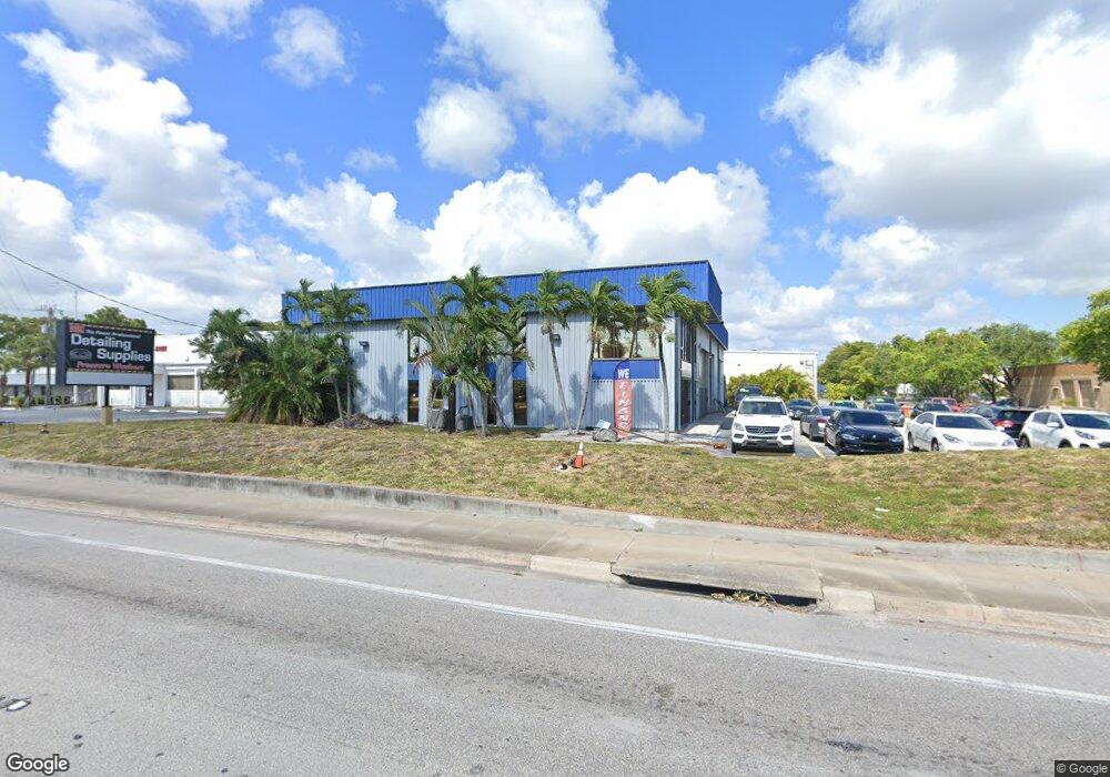
1851 N Powerline Rd Pompano Beach, FL 33069
Carver Village NeighborhoodEstimated Value: $1,477,725
Studio
--
Bath
8,740
Sq Ft
$169/Sq Ft
Est. Value
About This Home
This home is located at 1851 N Powerline Rd, Pompano Beach, FL 33069 and is currently estimated at $1,477,725, approximately $169 per square foot. 1851 N Powerline Rd is a home located in Broward County with nearby schools including Charles Drew Elementary School, Crystal Lake Middle School, and Blanche Ely High School.
Ownership History
Date
Name
Owned For
Owner Type
Purchase Details
Closed on
Jan 13, 2015
Sold by
Ritz Emilie F and Merkl Peter
Bought by
Rm Powerline Llc
Current Estimated Value
Purchase Details
Closed on
Dec 20, 1995
Sold by
Ritz Charles G and Ritz Emilie F
Bought by
Ritz Tr Charles G
Purchase Details
Closed on
Feb 1, 1994
Sold by
Available Not
Bought by
Available Not
Create a Home Valuation Report for This Property
The Home Valuation Report is an in-depth analysis detailing your home's value as well as a comparison with similar homes in the area
Home Values in the Area
Average Home Value in this Area
Purchase History
| Date | Buyer | Sale Price | Title Company |
|---|---|---|---|
| Rm Powerline Llc | -- | Attorney | |
| Ritz Emilie F | -- | Attorney | |
| Ritz Tr Charles G | $100 | -- | |
| Available Not | $360,000 | -- |
Source: Public Records
Tax History
| Year | Tax Paid | Tax Assessment Tax Assessment Total Assessment is a certain percentage of the fair market value that is determined by local assessors to be the total taxable value of land and additions on the property. | Land | Improvement |
|---|---|---|---|---|
| 2026 | $33,426 | $1,569,330 | $184,280 | $1,385,050 |
| 2025 | $30,704 | $1,442,850 | $184,280 | $1,258,570 |
| 2024 | $28,273 | $1,442,850 | $184,280 | $1,258,570 |
| 2023 | $28,273 | $1,246,980 | $0 | $0 |
| 2022 | $26,269 | $1,133,620 | $0 | $0 |
| 2021 | $24,135 | $1,030,570 | $0 | $0 |
| 2020 | $20,964 | $936,890 | $184,280 | $752,610 |
| 2019 | $20,974 | $929,900 | $184,280 | $745,620 |
| 2018 | $20,609 | $929,900 | $184,280 | $745,620 |
| 2017 | $18,245 | $846,990 | $0 | $0 |
| 2016 | $16,729 | $770,060 | $0 | $0 |
| 2015 | $15,430 | $680,450 | $0 | $0 |
| 2014 | $14,505 | $633,040 | $0 | $0 |
| 2013 | -- | $582,890 | $184,280 | $398,610 |
Source: Public Records
Map
Nearby Homes
- 0 NW 19th Ave Unit F10463589
- NW 19 NW 19th Ave
- 1591 NW 19th Ave
- 2240 Doctor Martin Luther King Junior Blvd
- 1000 NW 23rd Terrace
- 1601 Doctor Martin Luther King Blvd
- 0 Martin Luther King jr Blvd
- 1255 NW 27th Ave
- 1021 NE 24th Ave Unit 30
- 1021 NE 24th Ave Unit 4
- 2625 NW 10th St
- 2043 NW 8th St
- 850 Doctor B J McCormick Ave
- 2638 NW 10th St
- 851 NW 17th Terrace
- 0 NW 27th Ave Unit F10480514
- 1350 NW 31st Ave
- 1704 Andros Isle Unit B4
- 1703 Andros Isle Unit G4
- 1861 NW 7th Terrace
- 1861 N Powerline Rd Unit E & F
- 1861 N Powerline Rd Unit F
- 1861 N Powerline Rd Unit E
- 1861 N Powerline Rd Unit C & D
- 1861 N Powerline Rd Unit 2 - E
- 1861 N Powerline Rd Unit G
- 1861 N Powerline Rd Unit 1 - F
- 1861 N Powerline Rd
- 1841 N Powerline Rd Unit 1841
- 0 N Powerline Rd Unit A1638969
- 0 N Powerline Rd Unit A1640687
- 0 N Powerline Rd Unit A1530960
- 2175 N Powerline Rd
- 2185 N Powerline Rd
- 9 N Powerline Rd
- 401 N Powerline Rd
- 451 N Powerline Rd
- 2083 N Powerline Rd
- 1501 N Powerline Rd
- 1571 N Powerline Rd
Your Personal Tour Guide
Ask me questions while you tour the home.