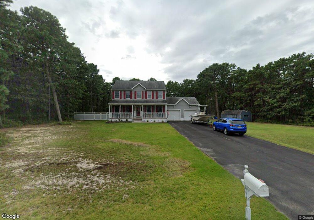
1861 Baltimore Ave Whiting, NJ 08759
Estimated Value: $616,000 - $721,000
4
Beds
3
Baths
2,144
Sq Ft
$310/Sq Ft
Est. Value
About This Home
This home is located at 1861 Baltimore Ave, Whiting, NJ 08759 and is currently estimated at $664,778, approximately $310 per square foot. 1861 Baltimore Ave is a home located in Ocean County with nearby schools including Manchester Township High School.
Ownership History
Date
Name
Owned For
Owner Type
Purchase Details
Closed on
Sep 3, 1998
Sold by
Louis Worthington Inc
Bought by
Martinson Brian F and Martinson Kathryn E
Current Estimated Value
Home Financials for this Owner
Home Financials are based on the most recent Mortgage that was taken out on this home.
Original Mortgage
$140,000
Interest Rate
6.83%
Purchase Details
Closed on
Jul 15, 1998
Sold by
Shpunder John
Bought by
Worthington Builders
Home Financials for this Owner
Home Financials are based on the most recent Mortgage that was taken out on this home.
Original Mortgage
$140,000
Interest Rate
6.83%
Create a Home Valuation Report for This Property
The Home Valuation Report is an in-depth analysis detailing your home's value as well as a comparison with similar homes in the area
Home Values in the Area
Average Home Value in this Area
Purchase History
| Date | Buyer | Sale Price | Title Company |
|---|---|---|---|
| Martinson Brian F | $175,100 | Lawyers Title Insurance Corp | |
| Worthington Builders | $22,000 | -- |
Source: Public Records
Mortgage History
| Date | Status | Borrower | Loan Amount |
|---|---|---|---|
| Previous Owner | Martinson Brian F | $140,000 |
Source: Public Records
Tax History
| Year | Tax Paid | Tax Assessment Tax Assessment Total Assessment is a certain percentage of the fair market value that is determined by local assessors to be the total taxable value of land and additions on the property. | Land | Improvement |
|---|---|---|---|---|
| 2025 | $8,324 | $572,100 | $195,000 | $377,100 |
| 2024 | $7,778 | $333,800 | $85,000 | $248,800 |
| 2023 | $7,394 | $333,800 | $85,000 | $248,800 |
| 2022 | $7,394 | $333,800 | $85,000 | $248,800 |
| 2021 | $7,233 | $333,800 | $85,000 | $248,800 |
| 2020 | $7,043 | $333,800 | $85,000 | $248,800 |
| 2019 | $7,908 | $308,300 | $85,000 | $223,300 |
| 2018 | $7,877 | $308,300 | $85,000 | $223,300 |
| 2017 | $7,908 | $308,300 | $85,000 | $223,300 |
| 2016 | $7,812 | $308,300 | $85,000 | $223,300 |
| 2015 | $7,667 | $308,300 | $85,000 | $223,300 |
| 2014 | $7,510 | $308,300 | $85,000 | $223,300 |
Source: Public Records
Map
Nearby Homes
- 1901 Baltimore Ave
- 151 Adams St
- 19 Attleboro Ln Unit 73
- 19 Attleboro Ln
- 6 Orchard Dr Unit 73
- 1580 Cabot Ave
- 1560 Cabot Ave
- 1820 Perth Amboy Ave
- 3 Apple Ln Unit 72
- 7 Eaton Ln Unit 73
- 53 Central Ave
- 53 Central Ave Unit 72
- 51 Central Ave Unit 72
- 8 Hummingbird Ln
- 55 Chelsea Dr Unit 70
- 10 Hartford Rd
- 551 Monroe Ave
- 13 S Chestnut Ave Unit 70
- 56 S Chestnut Ave
- 6 Columbus Blvd Unit C
- 1860 Baltimore Ave
- 1841 Baltimore Ave
- 1881 Baltimore Ave
- 1860 Delaware Ave
- 1840 Delaware Ave
- 1880 Delaware Ave
- 1840 Baltimore Ave
- 1880 Baltimore Ave
- 1821 Baltimore Ave
- 1820 Delaware Ave
- 1820 Baltimore Ave
- 1861 Delaware Ave
- 1861 Philadelphia Ave
- 1900 Delaware Ave
- 1881 Delaware Ave
- 1841 Delaware Ave
- 1841 Philadelphia Ave
- 1881 Philadelphia Ave
- 1900 Baltimore Ave
- 1801 Baltimore Ave
Your Personal Tour Guide
Ask me questions while you tour the home.