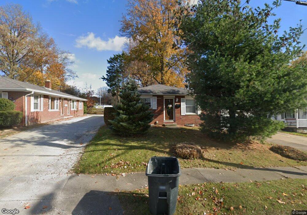
1867 Highview Ave Akron, OH 44301
Firestone Park NeighborhoodEstimated Value: $133,848 - $147,000
3
Beds
1
Bath
925
Sq Ft
$151/Sq Ft
Est. Value
About This Home
This home is located at 1867 Highview Ave, Akron, OH 44301 and is currently estimated at $139,712, approximately $151 per square foot. 1867 Highview Ave is a home located in Summit County with nearby schools including Kenmore Garfield Community Learning Center, Eagle Elementary, and Main Preparatory Academy.
Ownership History
Date
Name
Owned For
Owner Type
Purchase Details
Closed on
Oct 4, 2001
Sold by
Gruity Dorothy
Bought by
Wathey Ernest F
Current Estimated Value
Purchase Details
Closed on
Apr 12, 1999
Sold by
Gruity Dorothy
Bought by
Wathey Ernest F
Home Financials for this Owner
Home Financials are based on the most recent Mortgage that was taken out on this home.
Original Mortgage
$48,000
Interest Rate
6.94%
Mortgage Type
Seller Take Back
Create a Home Valuation Report for This Property
The Home Valuation Report is an in-depth analysis detailing your home's value as well as a comparison with similar homes in the area
Home Values in the Area
Average Home Value in this Area
Purchase History
| Date | Buyer | Sale Price | Title Company |
|---|---|---|---|
| Wathey Ernest F | $60,000 | -- | |
| Wathey Ernest F | $60,000 | -- |
Source: Public Records
Mortgage History
| Date | Status | Borrower | Loan Amount |
|---|---|---|---|
| Previous Owner | Wathey Ernest F | $48,000 |
Source: Public Records
Tax History
| Year | Tax Paid | Tax Assessment Tax Assessment Total Assessment is a certain percentage of the fair market value that is determined by local assessors to be the total taxable value of land and additions on the property. | Land | Improvement |
|---|---|---|---|---|
| 2024 | $2,186 | $40,170 | $7,942 | $32,228 |
| 2023 | $2,186 | $40,170 | $7,942 | $32,228 |
| 2022 | $2,121 | $29,589 | $5,754 | $23,835 |
| 2021 | $2,123 | $29,589 | $5,754 | $23,835 |
| 2020 | $2,093 | $29,590 | $5,750 | $23,840 |
| 2019 | $1,942 | $24,810 | $5,750 | $19,060 |
| 2018 | $1,918 | $24,810 | $5,750 | $19,060 |
| 2017 | $1,880 | $24,810 | $5,750 | $19,060 |
| 2016 | $1,881 | $24,810 | $5,750 | $19,060 |
| 2015 | $1,880 | $24,810 | $5,750 | $19,060 |
| 2014 | $1,865 | $24,810 | $5,750 | $19,060 |
| 2013 | $1,187 | $24,950 | $5,750 | $19,200 |
Source: Public Records
Map
Nearby Homes
- 502 E Woodsdale Ave
- 634 Prentiss Ave
- 1699 Sunset Ave
- 1623 Sunset Ave
- 788 Jonathan Ave
- 1646 Highview Ave
- 2146 Stonehenge Cir
- 0 Woodview Dr
- 715 E Catawba Ave
- 1620 Highview Ave
- 367 Wayne Ave
- 801 Chaffin Rd
- 1595 Redwood Ave
- 2162 Thornbury Ln
- 457 S Firestone Blvd
- 1835 Thornapple Ave
- 1842 Thornapple Ave
- 231 E Dresden Ave
- 2069 Penguin Ave
- 1597 Glenmount Ave
- 1863 Highview Ave
- 1861 & 1863 Highview Ave
- 1861 1863 Highview Ave
- 1861 Highview Ave Unit 1863
- 1873 Highview Ave
- 1859 Highview Ave
- 1844 Coventry St
- 578 Lurie Ave Unit 580
- 1883 Highview Ave
- 1868 Highview Ave
- 1864 Highview Ave
- 590 Lurie Ave Unit 592
- 1878 Highview Ave
- 1856 Coventry St
- 1858 Highview Ave
- 1887 Highview Ave Unit 1889
- 1884 Highview Ave Unit 1886
- 1866 Coventry St
- 1841 Highview Ave
- 585 Lurie Ave Unit 587
Your Personal Tour Guide
Ask me questions while you tour the home.