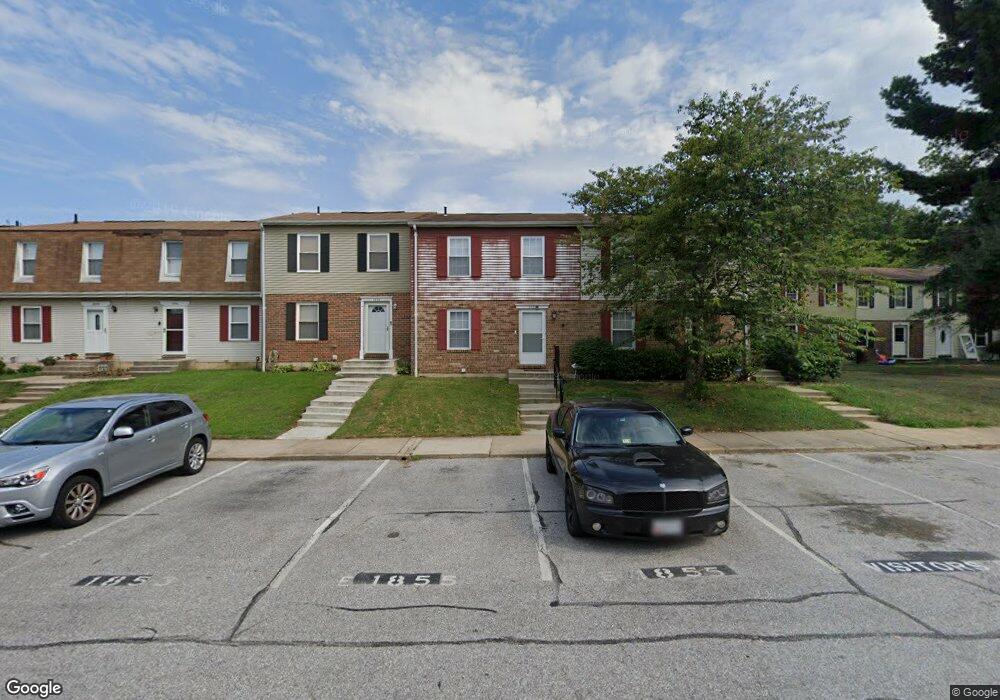
1873 Eagle Ct Severn, MD 21144
Estimated Value: $257,000 - $304,000
Studio
2
Baths
1,160
Sq Ft
$238/Sq Ft
Est. Value
About This Home
This home is located at 1873 Eagle Ct, Severn, MD 21144 and is currently estimated at $275,893, approximately $237 per square foot. 1873 Eagle Ct is a home located in Anne Arundel County with nearby schools including Meade Heights Elementary School, MacArthur Middle School, and Meade High School.
Ownership History
Date
Name
Owned For
Owner Type
Purchase Details
Closed on
Jun 12, 2024
Sold by
Brown Clifton T
Bought by
Singh Manish
Current Estimated Value
Purchase Details
Closed on
Jun 6, 2006
Sold by
Sturgis Michael K
Bought by
Brown Clifton T
Home Financials for this Owner
Home Financials are based on the most recent Mortgage that was taken out on this home.
Original Mortgage
$106,400
Interest Rate
6.02%
Mortgage Type
Purchase Money Mortgage
Purchase Details
Closed on
Jul 30, 2004
Sold by
Sturgis Michael K
Bought by
Brown Clifton T
Home Financials for this Owner
Home Financials are based on the most recent Mortgage that was taken out on this home.
Original Mortgage
$106,400
Interest Rate
6.02%
Mortgage Type
Purchase Money Mortgage
Purchase Details
Closed on
Feb 24, 1998
Sold by
Kitchen Barry E
Bought by
Sturgis Michael K
Create a Home Valuation Report for This Property
The Home Valuation Report is an in-depth analysis detailing your home's value as well as a comparison with similar homes in the area
Home Values in the Area
Average Home Value in this Area
Purchase History
| Date | Buyer | Sale Price | Title Company |
|---|---|---|---|
| Singh Manish | $250,000 | Gemini Title & Escrow | |
| Singh Manish | $250,000 | Gemini Title | |
| Brown Clifton T | $112,000 | -- | |
| Brown Clifton T | $112,000 | -- | |
| Sturgis Michael K | $75,000 | -- |
Source: Public Records
Mortgage History
| Date | Status | Borrower | Loan Amount |
|---|---|---|---|
| Previous Owner | Brown Clifton T | $106,400 | |
| Previous Owner | Brown Clifton T | $106,400 | |
| Closed | Sturgis Michael K | -- |
Source: Public Records
Tax History
| Year | Tax Paid | Tax Assessment Tax Assessment Total Assessment is a certain percentage of the fair market value that is determined by local assessors to be the total taxable value of land and additions on the property. | Land | Improvement |
|---|---|---|---|---|
| 2025 | $2,194 | $178,600 | $45,000 | $133,600 |
| 2024 | $2,194 | $161,133 | -- | -- |
| 2023 | $1,569 | $143,667 | $0 | $0 |
| 2022 | $1,319 | $126,200 | $15,000 | $111,200 |
| 2020 | $1,428 | $105,867 | $0 | $0 |
| 2019 | $2,618 | $95,700 | $15,000 | $80,700 |
| 2018 | $970 | $95,700 | $15,000 | $80,700 |
| 2017 | $1,331 | $95,700 | $0 | $0 |
| 2016 | -- | $97,300 | $0 | $0 |
| 2015 | -- | $97,300 | $0 | $0 |
| 2014 | -- | $97,300 | $0 | $0 |
Source: Public Records
Map
Nearby Homes
- 1914 Artillery Ln
- 1869 Robin Ct
- 1847 Blue Jay Ct
- 1724 Jennifer Meadows Ct
- 1803 Sparrow Ct
- 1823 Jaybird Ct
- 1819 Oriole Ct
- 8215 Tomlinson Ct
- 8225 Parham Ct
- 8221 Parham Ct
- 8210 Tomlinson Ct
- 220 Arcadia Shores Cir
- 8202 Tomlinson Ct
- 8519 Pioneer Dr
- 8221 Stewarton Ct
- 2104 Commissary Cir
- 8509 Pioneer Dr
- 8532 Golden Eagle Ln
- 299 Saint Michaels Cir
- 1969 Buckwheat Ct
- 1873 Eagle Ct Unit 2
- 1875 Eagle Ct
- 1871 Eagle Ct
- 1871 Eagle Ct Unit 3
- 1869 Eagle Ct
- 1869 Eagle Ct Unit 4
- 1867 Eagle Ct
- 1894 Eagle Ct
- 1865 Eagle Ct
- 1892 Eagle Ct
- 1892 Eagle Ct Unit 7
- 1863 Eagle Ct
- 1863 Eagle Ct Unit 7
- 1890 Eagle Ct
- 1861 Eagle Ct
- 1888 Eagle Ct
- 1886 Eagle Ct
- 1886 Eagle Ct Unit 4
- 1884 Eagle Ct
- 1857 Eagle Ct
Your Personal Tour Guide
Ask me questions while you tour the home.