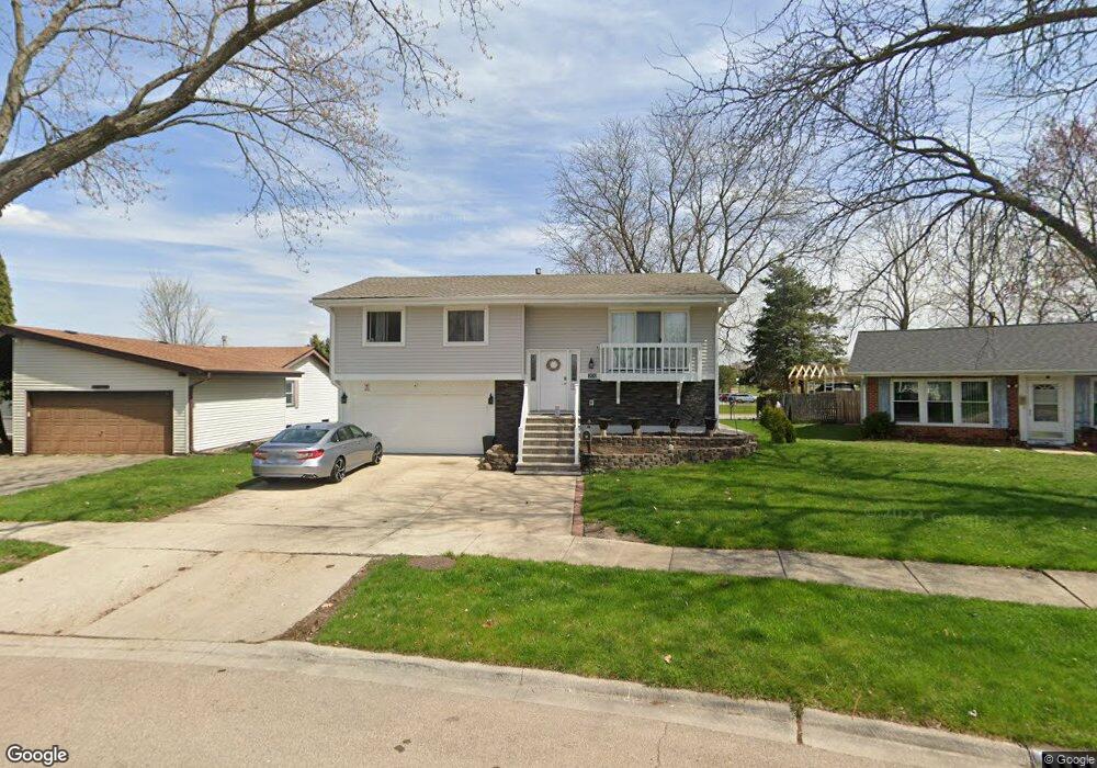
1874 Ashwood Ln Aurora, IL 60506
Edgelawn Randall NeighborhoodEstimated Value: $249,000 - $337,000
About This Home
This home is located at 1874 Ashwood Ln, Aurora, IL 60506 and is currently estimated at $300,799, approximately $193 per square foot. 1874 Ashwood Ln is a home located in Kane County with nearby schools including Fearn Elementary School, Jewel Middle School, and West Aurora High School.
Ownership History
We collect this data history from publicly available records. To have your information removed, we recommend requesting removal directly through your county’s website.
Purchase Details
Purchase Details
Home Financials for this Owner
Home Financials are based on the most recent Mortgage that was taken out on this home.Purchase Details
Home Financials for this Owner
Home Financials are based on the most recent Mortgage that was taken out on this home.Purchase Details
Home Financials for this Owner
Home Financials are based on the most recent Mortgage that was taken out on this home.Home Values in the Area
Average Home Value in this Area
Purchase History
We collect this data history from publicly available records. To have your information removed, we recommend requesting removal directly through your county’s website.
| Date | Buyer | Sale Price | Title Company |
|---|---|---|---|
| -- | None Listed On Document | ||
| -- | Avenue 365 Lender Svcs Llc | ||
| -- | Global Title Co | ||
| $102,500 | First American Title Ins Co |
Mortgage History
We collect this data history from publicly available records. To have your information removed, we recommend requesting removal directly through your county’s website.
| Date | Status | Borrower | Loan Amount |
|---|---|---|---|
| Previous Owner | $192,000 | ||
| Previous Owner | $150,400 | ||
| Previous Owner | $89,910 |
Tax History
We collect this data history from publicly available records. To have your information removed, we recommend requesting removal directly through your county’s website.
| Year | Tax Paid | Tax Assessment Tax Assessment Total Assessment is a certain percentage of the fair market value that is determined by local assessors to be the total taxable value of land and additions on the property. | Land | Improvement |
|---|---|---|---|---|
| 2024 | $5,429 | $76,563 | $12,573 | $63,990 |
| 2023 | $5,174 | $68,409 | $11,234 | $57,175 |
| 2022 | $4,994 | $62,417 | $10,250 | $52,167 |
| 2021 | $4,761 | $58,111 | $9,543 | $48,568 |
| 2020 | $5,196 | $61,503 | $8,864 | $52,639 |
| 2019 | $4,985 | $56,984 | $8,213 | $48,771 |
| 2018 | $4,615 | $52,227 | $7,597 | $44,630 |
| 2017 | $4,148 | $46,300 | $8,858 | $37,442 |
| 2016 | $3,763 | $41,417 | $7,593 | $33,824 |
| 2015 | -- | $37,086 | $6,529 | $30,557 |
| 2014 | -- | $35,668 | $6,279 | $29,389 |
| 2013 | -- | $36,195 | $6,190 | $30,005 |
Map
- 1335 Foxcroft Dr
- 1295 Foxcroft Dr
- 991 Sapphire Ln
- 975 Sapphire Ln
- 987 Sapphire Ln
- 976 Sapphire Ln
- 1240 Foxcroft Dr
- 1440 Foxcroft Dr
- 1050 Grenada Dr
- 1953 Bayview Ln
- 1221 Oakleaf Ct
- 1976 Robert St
- 1365 Colorado Ave
- 1950 Heather Dr
- 873 Hermitage Dr
- 1732 Roanoak Ave
- 1421 Heather Dr
- 1383 S Glen Cir Unit C
- 1340 Monomoy St Unit C
- 2418 Courtyard Cir Unit 3
- 1870 Ashwood Ln
- 1878 Ashwood Ln
- 1866 Ashwood Ln
- 1882 Ashwood Ln
- 1871 Ashwood Ln
- 1915 Ash Ct
- 1862 Ashwood Ln
- 1883 Ashwood Ln
- 1886 Ashwood Ln
- 1867 Ashwood Ln
- 1913 Ash Ct
- 1863 Ashwood Ln
- 1858 Ashwood Ln
- 1887 Ashwood Ln
- 1305 Appletree Ln
- 1309 Appletree Ln
- 1859 Ashwood Ln
- 1903 Ashwood Ln
- 1854 Ashwood Ln
- 1313 Appletree Ln
Ask me questions while you tour the home.