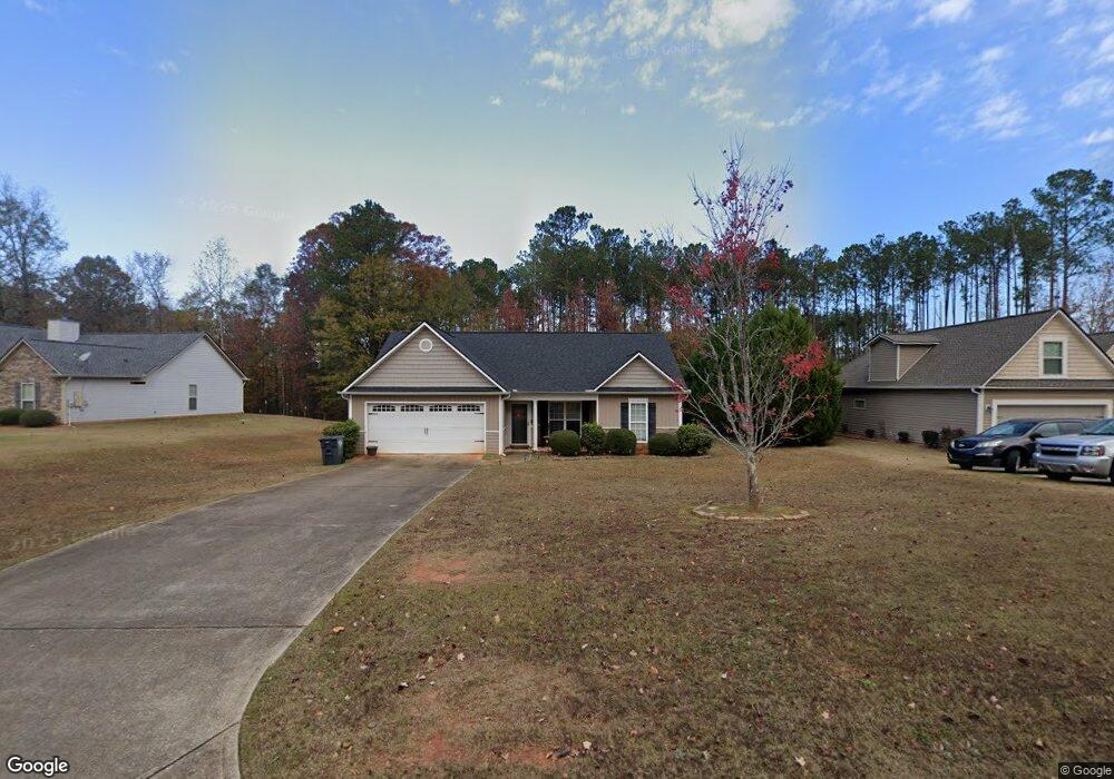
189 Amhurst Cir West Point, GA 31833
Estimated Value: $238,232 - $290,000
3
Beds
2
Baths
1,309
Sq Ft
$208/Sq Ft
Est. Value
About This Home
This home is located at 189 Amhurst Cir, West Point, GA 31833 and is currently estimated at $271,808, approximately $207 per square foot. 189 Amhurst Cir is a home located in Troup County with nearby schools including West Point Elementary School, Long Cane Elementary School, and Whitesville Road Elementary School.
Ownership History
Date
Name
Owned For
Owner Type
Purchase Details
Closed on
Dec 12, 2008
Sold by
Dri Amhurst
Bought by
Knox Brandi L
Current Estimated Value
Home Financials for this Owner
Home Financials are based on the most recent Mortgage that was taken out on this home.
Original Mortgage
$130,500
Outstanding Balance
$91,112
Interest Rate
6.1%
Mortgage Type
New Conventional
Estimated Equity
$180,696
Create a Home Valuation Report for This Property
The Home Valuation Report is an in-depth analysis detailing your home's value as well as a comparison with similar homes in the area
Home Values in the Area
Average Home Value in this Area
Purchase History
| Date | Buyer | Sale Price | Title Company |
|---|---|---|---|
| Knox Brandi L | $15,000 | -- |
Source: Public Records
Mortgage History
| Date | Status | Borrower | Loan Amount |
|---|---|---|---|
| Open | Knox Brandi L | $130,500 |
Source: Public Records
Tax History
| Year | Tax Paid | Tax Assessment Tax Assessment Total Assessment is a certain percentage of the fair market value that is determined by local assessors to be the total taxable value of land and additions on the property. | Land | Improvement |
|---|---|---|---|---|
| 2025 | $2,246 | $82,360 | $14,000 | $68,360 |
| 2024 | $1,922 | $70,480 | $14,000 | $56,480 |
| 2023 | $1,972 | $72,320 | $14,000 | $58,320 |
| 2022 | $1,740 | $62,360 | $10,000 | $52,360 |
| 2021 | $1,760 | $58,360 | $10,000 | $48,360 |
| 2020 | $1,700 | $56,360 | $8,000 | $48,360 |
| 2019 | $1,430 | $47,400 | $6,000 | $41,400 |
| 2018 | $1,430 | $47,400 | $6,000 | $41,400 |
| 2017 | $1,430 | $47,400 | $6,000 | $41,400 |
| 2016 | $1,430 | $47,422 | $6,000 | $41,422 |
| 2015 | $1,433 | $47,422 | $6,000 | $41,422 |
| 2014 | $1,372 | $45,350 | $6,000 | $39,350 |
| 2013 | -- | $40,872 | $6,000 | $34,872 |
Source: Public Records
Map
Nearby Homes
- 107 Amhurst Dr
- 101 Garden Walk
- 101 Garden Walk Unit 85
- 145 Jarrell Hogg Rd
- 648 Warner Rd
- 0 Warner Rd Unit 10686116
- 182 Lower Lovelace Rd
- 225 Harris Walk
- 211 Harris Walk
- 223 Harris Walk
- 209 Harris Walk
- 221 Harris Walk
- 215 Harris Walk
- 0 Sandtown Rd Unit 10255987
- Sandtown Road Unit: 1 2+ - Acre
- 797 Gabbettville Rd
- 143 W Drummond Rd
- 151 W Drummond Rd
- 157 W Drummond Rd
- 137 W Drummond Rd
- 187 Amhurst Cir
- 191 Amhurst Cir
- 180 Amhurst Cir Unit 73
- 192 Amhurst Cir
- 185 Amhurst Cir Unit LOT 45
- 144 Amhurst Dr Unit 49
- 183 Amhurst Cir
- 183 Amhurst Cir Unit LOT 44
- 142 Amhurst Dr Unit 50
- 178 Amhurst Cir Unit 72
- 181 Amhurst Cir Unit LOT 43
- 181 Amhurst Cir
- 140 Amhurst Dr
- 140 Amhurst Dr Unit 51
- 166 Amhurst Cir
- 194 Amhurst Cir
- 179 Amhurst Cir Unit LOT 42
- 179 Amhurst Cir
- 138 Amhurst Dr Unit 52
- 152 Amhurst Cir
Your Personal Tour Guide
Ask me questions while you tour the home.