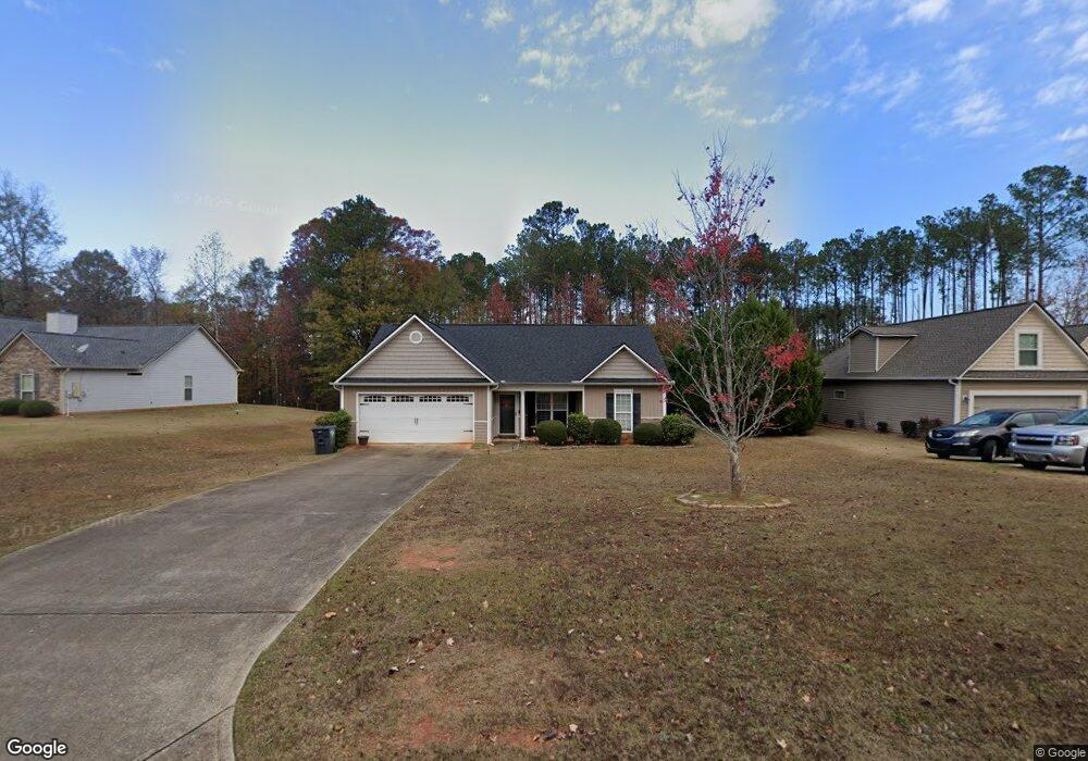
189 Amhurst Cir West Point, GA 31833
Estimated Value: $232,019 - $287,000
About This Home
This home is located at 189 Amhurst Cir, West Point, GA 31833 and is currently estimated at $264,005, approximately $201 per square foot. 189 Amhurst Cir is a home located in Troup County with nearby schools including West Point Elementary School, Long Cane Elementary School, and Whitesville Road Elementary School.
Ownership History
We collect this data history from publicly available records. To have your information removed, we recommend requesting removal directly through your county’s website.
Purchase Details
Home Financials for this Owner
Home Financials are based on the most recent Mortgage that was taken out on this home.Home Values in the Area
Average Home Value in this Area
Purchase History
We collect this data history from publicly available records. To have your information removed, we recommend requesting removal directly through your county’s website.
| Date | Buyer | Sale Price | Title Company |
|---|---|---|---|
| $15,000 | -- |
Mortgage History
We collect this data history from publicly available records. To have your information removed, we recommend requesting removal directly through your county’s website.
| Date | Status | Borrower | Loan Amount |
|---|---|---|---|
| Open | $130,500 |
Tax History
We collect this data history from publicly available records. To have your information removed, we recommend requesting removal directly through your county’s website.
| Year | Tax Paid | Tax Assessment Tax Assessment Total Assessment is a certain percentage of the fair market value that is determined by local assessors to be the total taxable value of land and additions on the property. | Land | Improvement |
|---|---|---|---|---|
| 2025 | $2,246 | $82,360 | $14,000 | $68,360 |
| 2024 | $1,922 | $70,480 | $14,000 | $56,480 |
| 2023 | $1,972 | $72,320 | $14,000 | $58,320 |
| 2022 | $1,740 | $62,360 | $10,000 | $52,360 |
| 2021 | $1,760 | $58,360 | $10,000 | $48,360 |
| 2020 | $1,700 | $56,360 | $8,000 | $48,360 |
| 2019 | $1,430 | $47,400 | $6,000 | $41,400 |
| 2018 | $1,430 | $47,400 | $6,000 | $41,400 |
| 2017 | $1,430 | $47,400 | $6,000 | $41,400 |
| 2016 | $1,430 | $47,422 | $6,000 | $41,422 |
| 2015 | $1,433 | $47,422 | $6,000 | $41,422 |
| 2014 | $1,372 | $45,350 | $6,000 | $39,350 |
| 2013 | -- | $40,872 | $6,000 | $34,872 |
Map
- 4172 Bartley Rd
- 0 Adams Rd Unit 10772389
- 3873 Bartley Rd
- 101 Garden Walk Unit 85
- 145 Jarrell Hogg Rd
- 648 Warner Rd
- 0 Warner Rd Unit 10758748
- 796 Shoemaker Rd
- 304 Baughs Cross Rd
- 221 Harris Walk
- 231 Lower Lovelace Rd
- 0 Sandtown Rd Unit 10255987
- 143 W Drummond Rd
- 151 W Drummond Rd
- 157 W Drummond Rd
- 137 W Drummond Rd
- 131 W Drummond Rd
- 269 Harris Walk
- 0 Lambert Rd
- 4517 Georgia 18
- 187 Amhurst Cir
- 191 Amhurst Cir
- 180 Amhurst Cir Unit 73
- 192 Amhurst Cir
- 185 Amhurst Cir Unit LOT 45
- 144 Amhurst Dr Unit 49
- 183 Amhurst Cir
- 183 Amhurst Cir Unit LOT 44
- 142 Amhurst Dr Unit 50
- 178 Amhurst Cir Unit 72
- 181 Amhurst Cir Unit LOT 43
- 181 Amhurst Cir
- 140 Amhurst Dr
- 140 Amhurst Dr Unit 51
- 166 Amhurst Cir
- 194 Amhurst Cir
- 179 Amhurst Cir Unit LOT 42
- 179 Amhurst Cir
- 138 Amhurst Dr Unit 52
- 152 Amhurst Cir
Ask me questions while you tour the home.