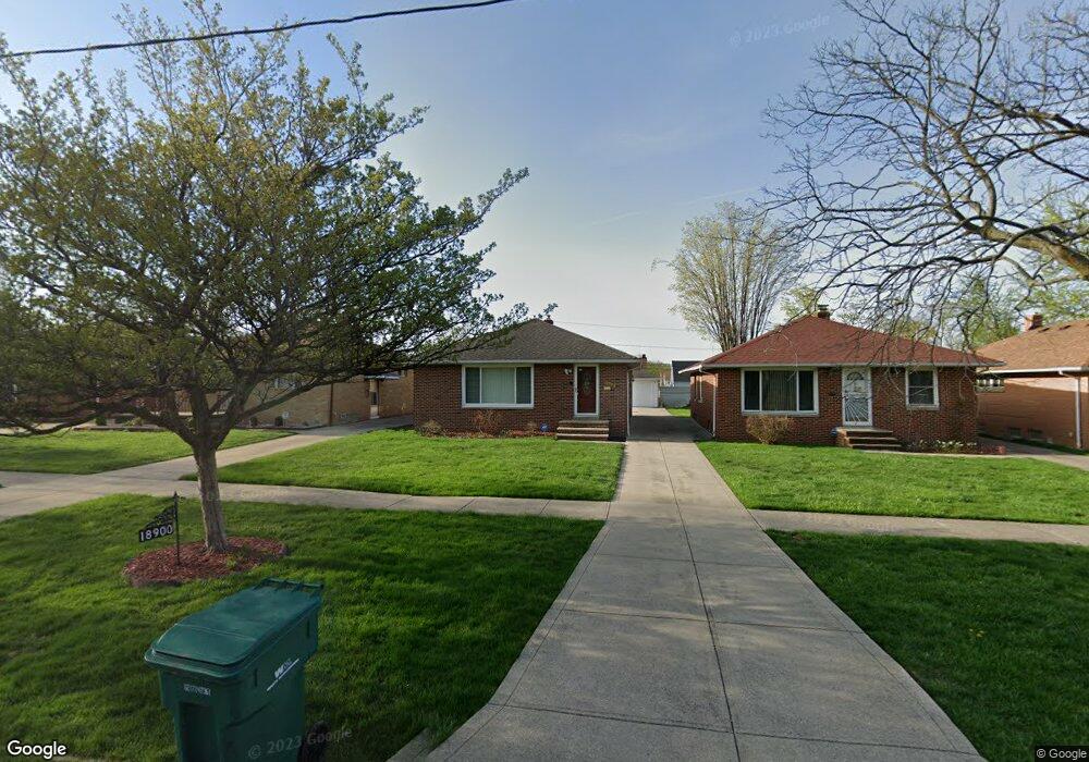
18900 Mccracken Rd Maple Heights, OH 44137
Estimated Value: $125,000 - $163,669
3
Beds
1
Bath
1,247
Sq Ft
$111/Sq Ft
Est. Value
About This Home
This home is located at 18900 Mccracken Rd, Maple Heights, OH 44137 and is currently estimated at $138,167, approximately $110 per square foot. 18900 Mccracken Rd is a home located in Cuyahoga County with nearby schools including Abraham Lincoln Elementary School, Rockside/ J.F. Kennedy School, and Barack Obama School.
Ownership History
Date
Name
Owned For
Owner Type
Purchase Details
Closed on
Jun 26, 1989
Sold by
Buell Werner and Buell Patrocinnio D
Bought by
Weatherly Roderick B
Current Estimated Value
Purchase Details
Closed on
Apr 2, 1985
Sold by
Buell Werner
Bought by
Buell Werner and Buell Patrocinnio D
Purchase Details
Closed on
Feb 23, 1979
Sold by
Tillenni Florence M
Bought by
Buell Werner
Purchase Details
Closed on
Jan 1, 1975
Bought by
Tillenni Florence M
Create a Home Valuation Report for This Property
The Home Valuation Report is an in-depth analysis detailing your home's value as well as a comparison with similar homes in the area
Home Values in the Area
Average Home Value in this Area
Purchase History
We collect this data history from publicly available records. To have your information removed, we recommend requesting removal directly through your county’s website.
| Date | Buyer | Sale Price | Title Company |
|---|---|---|---|
| Weatherly Roderick B | $69,000 | -- | |
| Buell Werner | -- | -- | |
| Buell Werner | $53,500 | -- | |
| Tillenni Florence M | -- | -- |
Source: Public Records
Tax History
| Year | Tax Paid | Tax Assessment Tax Assessment Total Assessment is a certain percentage of the fair market value that is determined by local assessors to be the total taxable value of land and additions on the property. | Land | Improvement |
|---|---|---|---|---|
| 2025 | $2,631 | $43,680 | $6,790 | $36,890 |
| 2024 | $2,961 | $43,680 | $6,790 | $36,890 |
| 2023 | $1,543 | $23,460 | $4,100 | $19,360 |
| 2022 | $1,575 | $23,450 | $4,100 | $19,360 |
| 2021 | $1,679 | $23,450 | $4,100 | $19,360 |
| 2020 | $1,212 | $17,780 | $3,120 | $14,670 |
| 2019 | $1,202 | $50,800 | $8,900 | $41,900 |
| 2018 | $1,114 | $17,780 | $3,120 | $14,670 |
| 2017 | $1,119 | $16,910 | $2,910 | $14,000 |
| 2016 | $1,078 | $16,910 | $2,910 | $14,000 |
| 2015 | $1,161 | $16,910 | $2,910 | $14,000 |
| 2014 | $1,161 | $18,590 | $3,190 | $15,400 |
Source: Public Records
Map
Nearby Homes
- 18915 Longview Ave
- 18909 Preston Rd
- 19105 Preston Rd
- 18990 Raymond St
- 19313 Longview Ave
- 18408 Raymond St
- 19703 Fairway Ave
- 19411 Marvin Rd
- 5116 Erwin St
- 18108 Mccracken Rd
- 19812 Marvin Rd
- 5150 Arch St
- 5234 Erwin St
- 18715 Libby Rd
- 5177 Cato St
- 17806 Tarkington Ave
- 18155 Libby Rd
- 19910 Mountville Dr
- 5341 Hollywood Ave
- 5147 Warrensville Center Rd
- 18880 Mccracken Rd
- 18920 Mccracken Rd
- 18860 Mccracken Rd
- 18940 Mccracken Rd
- 18840 Mccracken Rd
- 18960 Mccracken Rd
- 18915 Fairway Ave
- 18911 Fairway Ave
- 18919 Fairway Ave
- 18907 Fairway Ave
- 19003 Fairway Ave
- 18820 Mccracken Rd
- 18980 Mccracken Rd
- 18903 Fairway Ave
- 19007 Fairway Ave
- 18800 Mccracken Rd
- 19000 Mccracken Rd
- 18819 Fairway Ave
- 19011 Fairway Ave
- 18780 Mccracken Rd
Your Personal Tour Guide
Ask me questions while you tour the home.