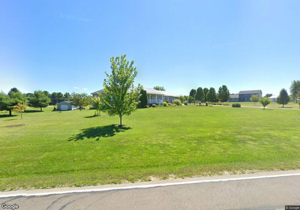
1895 E County Line Rd Springfield, OH 45502
Estimated Value: $366,000 - $468,000
3
Beds
2
Baths
2,016
Sq Ft
$203/Sq Ft
Est. Value
About This Home
This home is located at 1895 E County Line Rd, Springfield, OH 45502 and is currently estimated at $410,009, approximately $203 per square foot. 1895 E County Line Rd is a home located in Clark County with nearby schools including Northridge Elementary School, Kenton Ridge Middle & High School, and Emmanuel Christian Academy.
Ownership History
Date
Name
Owned For
Owner Type
Purchase Details
Closed on
Aug 13, 2019
Sold by
Amstutz Neal E
Bought by
Amstutz Neal E and Sothard Patricia
Current Estimated Value
Purchase Details
Closed on
May 25, 2007
Sold by
Berthold Brian C and Berthold Theresa R
Bought by
Amstutz Neal E
Home Financials for this Owner
Home Financials are based on the most recent Mortgage that was taken out on this home.
Original Mortgage
$182,700
Interest Rate
6.22%
Mortgage Type
Purchase Money Mortgage
Purchase Details
Closed on
Sep 23, 2005
Sold by
Dietrich James and Dietrich Helen F
Bought by
Berthold Brian C and Berthold Theresa R
Home Financials for this Owner
Home Financials are based on the most recent Mortgage that was taken out on this home.
Original Mortgage
$170,000
Interest Rate
5.93%
Mortgage Type
Fannie Mae Freddie Mac
Create a Home Valuation Report for This Property
The Home Valuation Report is an in-depth analysis detailing your home's value as well as a comparison with similar homes in the area
Purchase History
| Date | Buyer | Sale Price | Title Company |
|---|---|---|---|
| Amstutz Neal E | -- | None Available | |
| Amstutz Neal E | $230,000 | Attorney | |
| Berthold Brian C | $217,000 | -- |
Source: Public Records
Mortgage History
| Date | Status | Borrower | Loan Amount |
|---|---|---|---|
| Closed | Amstutz Neal E | $182,700 | |
| Closed | Berthold Brian C | $170,000 |
Source: Public Records
Tax History
| Year | Tax Paid | Tax Assessment Tax Assessment Total Assessment is a certain percentage of the fair market value that is determined by local assessors to be the total taxable value of land and additions on the property. | Land | Improvement |
|---|---|---|---|---|
| 2025 | $4,169 | $122,640 | $18,010 | $104,630 |
| 2024 | $4,058 | $105,080 | $13,980 | $91,100 |
| 2023 | $4,058 | $105,080 | $13,980 | $91,100 |
| 2022 | $3,900 | $105,080 | $13,980 | $91,100 |
| 2021 | $3,900 | $86,560 | $11,450 | $75,110 |
| 2020 | $3,903 | $86,560 | $11,450 | $75,110 |
| 2019 | $3,977 | $86,560 | $11,450 | $75,110 |
| 2018 | $3,520 | $74,830 | $10,610 | $64,220 |
| 2017 | $3,017 | $74,827 | $10,605 | $64,222 |
| 2016 | $2,996 | $74,827 | $10,605 | $64,222 |
| 2015 | $2,849 | $69,262 | $10,605 | $58,657 |
| 2014 | $2,849 | $69,262 | $10,605 | $58,657 |
| 2013 | $2,783 | $69,262 | $10,605 | $58,657 |
Source: Public Records
Map
Nearby Homes
- 1470 Oldham Dr Unit 12
- 5645 Springfield-Urbana Pike Unit Lot 67
- 4816 Middle Urbana Rd
- 1398 Elizabeth Ct Unit 66
- 1977 Willoughby Ave
- 937 Willow Rd
- 5646 Springfield-Urbana Pike Unit Lot 30
- 5646 Springfield-Urbana Pike Unit Lot 90
- 5646 Springfield-Urbana Pike Unit Lot 61
- 5646 Springfield-Urbana Pike Unit Lot 72
- 4381 Briarwood Dr
- 335 Willow Rd
- 4180 Briarwood Dr
- Tract 8 Middle Urbana Rd
- 1521 Erika Dr
- 5235 W Ridgewood Rd
- 1309 Richmoor Rd
- 5300 Brookshire Ln
- 4890 Brannan Dr W Unit 4890
- Tract 3 Middle Urbana Rd
- 1859 E County Line Rd
- 1785 E County Line Rd
- 1949 E County Line Rd
- 1823 E County Line Rd
- 1823 E County Line Rd
- 5953 Middle Urbana Rd
- 6906 Middle Urbana Rd
- 5945 Middle Urbana Rd
- 2007 E County Line Rd
- 2061 E County Line Rd
- 5861 Middle Urbana Rd
- 6767 Middle Urbana Rd
- 2135 E County Line Rd
- 6758 Middle Urbana Rd
- 1575 E County Line Rd
- 2215 E County Line Rd
- 6690 Middle Urbana Rd
- 1485 E County Line Rd
- 2267 E County Line Rd
- 6670 Middle Urbana Rd
Your Personal Tour Guide
Ask me questions while you tour the home.