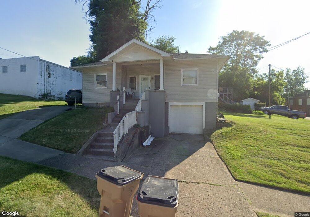
19 6th St NW Massillon, OH 44647
West Massillon NeighborhoodEstimated Value: $97,000 - $120,000
2
Beds
1
Bath
1,085
Sq Ft
$101/Sq Ft
Est. Value
About This Home
This home is located at 19 6th St NW, Massillon, OH 44647 and is currently estimated at $109,644, approximately $101 per square foot. 19 6th St NW is a home located in Stark County with nearby schools including Massillon Intermediate School, Massillon Junior High School, and Washington High School.
Ownership History
Date
Name
Owned For
Owner Type
Purchase Details
Closed on
Mar 12, 2014
Sold by
Equity Trust Company
Bought by
Equity Trust Co
Current Estimated Value
Create a Home Valuation Report for This Property
The Home Valuation Report is an in-depth analysis detailing your home's value as well as a comparison with similar homes in the area
Home Values in the Area
Average Home Value in this Area
Purchase History
| Date | Buyer | Sale Price | Title Company |
|---|---|---|---|
| Equity Trust Co | -- | None Available |
Source: Public Records
Tax History
| Year | Tax Paid | Tax Assessment Tax Assessment Total Assessment is a certain percentage of the fair market value that is determined by local assessors to be the total taxable value of land and additions on the property. | Land | Improvement |
|---|---|---|---|---|
| 2025 | -- | $21,010 | $5,150 | $15,860 |
| 2024 | -- | $21,010 | $5,150 | $15,860 |
| 2023 | $928 | $17,650 | $4,660 | $12,990 |
| 2022 | $932 | $17,650 | $4,660 | $12,990 |
| 2021 | $1,206 | $17,650 | $4,660 | $12,990 |
| 2020 | $1,185 | $14,460 | $3,820 | $10,640 |
| 2019 | $808 | $14,460 | $3,820 | $10,640 |
Source: Public Records
Map
Nearby Homes
- 508 Tremont Ave SW
- 431 5th St SW
- 514 4th St SW
- 104 12th St NW
- 1105 Tremont Ave SW
- 1301 Lincoln Way NW
- 3447 Marys Way Ave NW
- 3488 Joyce Ave NW
- 121 Chestnut Ave NE
- 1307 Main Ave W
- 217 2nd St NE
- 23 Willard Ave NE
- 817 7th St SW
- 827 9th St SW
- 831 9th St SW
- 107 4th St NE
- 411 4th St NE
- 907 Duncan St SW
- 323 Cherry Rd NE
- 1521 Tremont Ave SW
- 610 Lincoln Way W
- 16 Frances Place NW
- 526 Lincoln Way W
- 17 Frances Place NW
- 435 Water Ave NW
- 106 6th St NW
- 113 6th St NW
- 620 Lincoln Way W
- 620 Lincoln Way W Unit upstairs
- 620 Lincoln Way W Unit 2
- 620 Lincoln Way W Unit 1
- 522 Lincoln Way W
- 110 6th St NW
- 431 Water Ave NW
- 14 Houston St NW
- 434 Water Ave NW
- 112 6th St NW
- 624 Lincoln Way W
- 518 Lincoln Way W
- 518 Lincoln Way W Unit 3
Your Personal Tour Guide
Ask me questions while you tour the home.