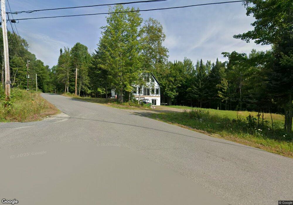
19 A and D Rd Eustis, ME 04936
Estimated Value: $283,336 - $406,000
3
Beds
1
Bath
728
Sq Ft
$454/Sq Ft
Est. Value
About This Home
This home is located at 19 A and D Rd, Eustis, ME 04936 and is currently estimated at $330,445, approximately $453 per square foot. 19 A and D Rd is a home with nearby schools including Stratton Elementary School.
Create a Home Valuation Report for This Property
The Home Valuation Report is an in-depth analysis detailing your home's value as well as a comparison with similar homes in the area
Tax History
| Year | Tax Paid | Tax Assessment Tax Assessment Total Assessment is a certain percentage of the fair market value that is determined by local assessors to be the total taxable value of land and additions on the property. | Land | Improvement |
|---|---|---|---|---|
| 2025 | $2,584 | $293,600 | $176,200 | $117,400 |
| 2024 | $2,242 | $256,200 | $140,800 | $115,400 |
| 2023 | $2,230 | $249,200 | $133,800 | $115,400 |
| 2022 | $2,181 | $229,600 | $133,800 | $95,800 |
| 2021 | $2,476 | $191,900 | $117,300 | $74,600 |
| 2020 | $2,399 | $191,900 | $117,300 | $74,600 |
| 2019 | $2,334 | $192,900 | $117,300 | $75,600 |
| 2018 | $2,539 | $193,800 | $117,300 | $76,500 |
| 2017 | $2,519 | $193,800 | $117,300 | $76,500 |
| 2016 | $2,488 | $194,800 | $117,300 | $77,500 |
| 2015 | $2,571 | $194,800 | $117,300 | $77,500 |
| 2014 | $2,166 | $196,900 | $117,300 | $79,600 |
| 2009 | -- | $209,600 | $133,000 | $76,600 |
Source: Public Records
Map
Nearby Homes
- 233 Porter Nadeau Rd
- 6-01 Eustis Ridge Rd
- 95-4 Lot D Porter Nadeau Rd
- 484 Eustis Ridge Rd
- 60&66 Gravel Pit Rd
- 118 Glidden Rd
- 999 the Arnold Trail
- 54 Eustis Village Rd
- 59 Eustis Village Rd
- 1480 Arnold Trail
- 81 B Red Pine Ln
- 11 Wing Rd
- 27 Peabody Rd
- 9 Tranquility Ln
- 186 Main St
- 14 Dam Rd
- 11 Porcupine Trail
- 27 Reed Rd
- 42 Rabbit Hollow Rd
- 64 Ip Rd
- 6 A & D Rd
- 96 Porter Nadeau Rd
- 76 Porter Nadeau Rd
- 102 Porter Nadeau Rd
- 72 Porter Nadeau Rd
- 0 Blueberry Field Dr Unit 820414
- 0 Blueberry Field Dr Unit 888175
- 110 Porter Nadeau Rd
- 66 Porter Nadeau Rd
- 152 Porter Nadeau Rd
- 160 Porter Nadeau Rd
- 150 Porter Nadeau Rd
- 156 Porter Nadeau Rd
- 64 Porter Nadeau Rd
- 15 Blueberry Field
- 114 Porter Nadeau Rd
- 164 Porter Nadeau Rd
- 60 Porter Nadeau Rd
- 58 Porter Nadeau Rd
- 54 Leons Rd
Your Personal Tour Guide
Ask me questions while you tour the home.