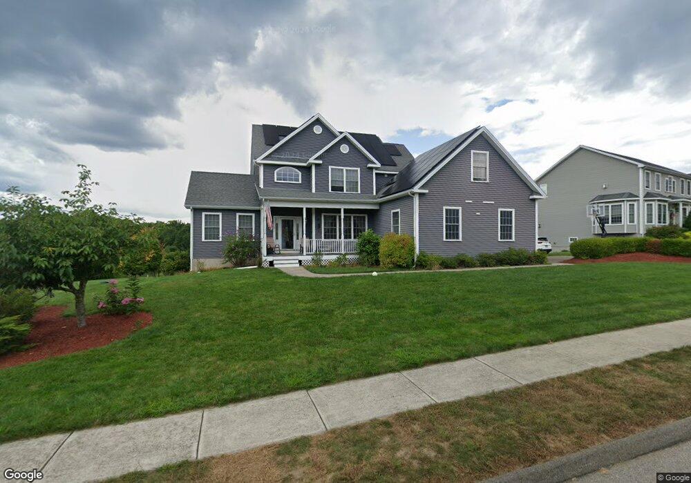
19 Butternut Dr Cromwell, CT 06416
Estimated Value: $708,252 - $812,000
3
Beds
3
Baths
2,661
Sq Ft
$289/Sq Ft
Est. Value
About This Home
This home is located at 19 Butternut Dr, Cromwell, CT 06416 and is currently estimated at $768,063, approximately $288 per square foot. 19 Butternut Dr is a home located in Middlesex County with nearby schools including Edna C. Stevens School, Woodside Intermediate School, and Cromwell Middle School.
Ownership History
Date
Name
Owned For
Owner Type
Purchase Details
Closed on
Oct 6, 2006
Sold by
Reed Builders Llc
Bought by
Feehan Joel M and Feehan Justina L
Current Estimated Value
Home Financials for this Owner
Home Financials are based on the most recent Mortgage that was taken out on this home.
Original Mortgage
$380,000
Interest Rate
6.54%
Mortgage Type
Purchase Money Mortgage
Create a Home Valuation Report for This Property
The Home Valuation Report is an in-depth analysis detailing your home's value as well as a comparison with similar homes in the area
Home Values in the Area
Average Home Value in this Area
Purchase History
We collect this data history from publicly available records. To have your information removed, we recommend requesting removal directly through your county’s website.
| Date | Buyer | Sale Price | Title Company |
|---|---|---|---|
| Feehan Joel M | $160,000 | -- | |
| Feehan Joel M | $160,000 | -- |
Source: Public Records
Mortgage History
We collect this data history from publicly available records. To have your information removed, we recommend requesting removal directly through your county’s website.
| Date | Status | Borrower | Loan Amount |
|---|---|---|---|
| Open | Feehan Joel M | $405,000 | |
| Closed | Feehan Joel M | $423,788 | |
| Closed | Feehan Joel M | $380,000 | |
| Closed | Feehan Joel M | $83,800 |
Source: Public Records
Tax History
| Year | Tax Paid | Tax Assessment Tax Assessment Total Assessment is a certain percentage of the fair market value that is determined by local assessors to be the total taxable value of land and additions on the property. | Land | Improvement |
|---|---|---|---|---|
| 2025 | $11,841 | $384,580 | $109,060 | $275,520 |
| 2024 | $11,564 | $384,580 | $109,060 | $275,520 |
| 2023 | $11,310 | $384,580 | $109,060 | $275,520 |
| 2022 | $10,352 | $310,590 | $99,050 | $211,540 |
| 2021 | $10,352 | $310,590 | $99,050 | $211,540 |
| 2020 | $10,197 | $310,590 | $99,050 | $211,540 |
| 2019 | $10,197 | $310,590 | $99,050 | $211,540 |
| 2018 | $10,197 | $310,590 | $99,050 | $211,540 |
| 2017 | $10,094 | $297,500 | $101,880 | $195,620 |
| 2016 | $10,005 | $297,500 | $101,880 | $195,620 |
| 2015 | $9,723 | $309,840 | $101,880 | $207,960 |
| 2014 | $10,311 | $309,840 | $101,880 | $207,960 |
Source: Public Records
Map
Nearby Homes
- 104 North Rd
- 107 Redwood Ln
- 3 Greenview Dr Unit 3
- 61 Greenview Dr
- 204 Gray Fox Ln
- 103 The Mews
- 105 The Mews Unit 105
- 102 Country Club Ct
- 301 Gray Fox Ln
- 170 Coles Rd
- 409 Beckley Rd
- 34 Woodsboro Cir Unit 34
- 1 Hunters Run
- 0 Country Ct Unit 137 24077628
- 0 Country Ct Unit 134 24089873
- 63 Scenic Dr Unit 63
- 202 Coles Rd
- 26 Glenview Dr Unit 26
- 66 Rivergate Ln
- 13 Concord Dr Unit 13
- 17 Butternut Dr
- 21 Butternut Dr
- 15 Butternut Dr
- 23 Butternut Dr
- 16 Butternut Dr
- 20 Butternut Dr
- 14 Butternut Dr
- 3 Grassy Hill Rd
- 22 Butternut Dr
- 25 Butternut Dr
- 12 Butternut Dr
- 11 Butternut Dr
- 26 Butternut Dr
- 10 Butternut Dr
- 9 Butternut Dr
- 8 Butternut Dr
- 20 Applewood Rd
- 18 Applewood Rd
- 16 Applewood Rd
- 86 North Rd
Your Personal Tour Guide
Ask me questions while you tour the home.