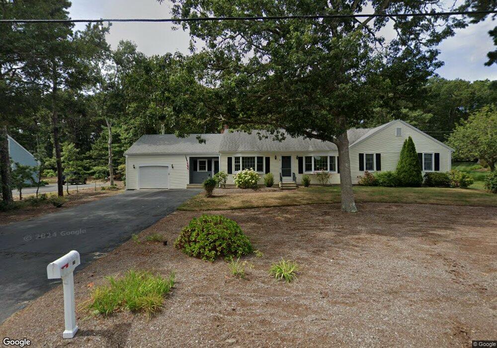
19 Captain Walsh Rd Dennis, MA 02638
East Dennis NeighborhoodEstimated Value: $1,006,000 - $3,187,471
5
Beds
4
Baths
3,630
Sq Ft
$667/Sq Ft
Est. Value
About This Home
This home is located at 19 Captain Walsh Rd, Dennis, MA 02638 and is currently estimated at $2,420,824, approximately $666 per square foot. 19 Captain Walsh Rd is a home located in Barnstable County with nearby schools including Dennis-Yarmouth Regional High School.
Ownership History
Date
Name
Owned For
Owner Type
Purchase Details
Closed on
Jul 25, 2022
Sold by
Carol F Simkin Irt
Bought by
Simkin-Berke Lauren
Current Estimated Value
Purchase Details
Closed on
Mar 25, 2011
Sold by
Lehrman Ronald J
Bought by
Simkin Carol F
Create a Home Valuation Report for This Property
The Home Valuation Report is an in-depth analysis detailing your home's value as well as a comparison with similar homes in the area
Home Values in the Area
Average Home Value in this Area
Purchase History
We collect this data history from publicly available records. To have your information removed, we recommend requesting removal directly through your county’s website.
| Date | Buyer | Sale Price | Title Company |
|---|---|---|---|
| Simkin-Berke Lauren | -- | None Available | |
| Simkin Carol F | -- | -- |
Source: Public Records
Tax History
| Year | Tax Paid | Tax Assessment Tax Assessment Total Assessment is a certain percentage of the fair market value that is determined by local assessors to be the total taxable value of land and additions on the property. | Land | Improvement |
|---|---|---|---|---|
| 2025 | $16,403 | $3,788,200 | $2,460,200 | $1,328,000 |
| 2024 | $16,069 | $3,660,300 | $2,366,000 | $1,294,300 |
| 2023 | $15,606 | $3,341,800 | $2,150,800 | $1,191,000 |
| 2022 | $15,828 | $2,826,400 | $1,937,500 | $888,900 |
| 2021 | $15,797 | $2,619,800 | $1,899,400 | $720,400 |
| 2020 | $18,675 | $3,061,500 | $2,374,300 | $687,200 |
| 2019 | $18,454 | $2,990,900 | $2,378,500 | $612,400 |
| 2018 | $18,867 | $2,975,900 | $2,384,600 | $591,300 |
| 2017 | $14,598 | $2,373,700 | $1,782,400 | $591,300 |
| 2016 | $12,489 | $1,912,600 | $1,409,100 | $503,500 |
| 2015 | $12,241 | $1,912,600 | $1,409,100 | $503,500 |
| 2014 | $12,044 | $1,896,700 | $1,409,100 | $487,600 |
Source: Public Records
Map
Nearby Homes
- 32 Captain Walsh Dr
- 53 Captain Walsh Dr
- 71 Grassy Pond Dr
- 61 Terrace Hill Dr
- 58 Terrace Hill Dr
- 15 Greenwood Rd
- 10 Danielle Dr
- 35 Terrace Hill Dr
- 16 Hazelwood Rd
- 12 Fairway
- 12 Fairway Dr
- 68 Sea Meadow Dr
- 5 Funn Pond Rd
- 39 Whittier Dr
- 34 Clearview Dr
- 15 Doctor Stanton Rd
- 154 Bayridge Dr
- 14 Prince Way
- 20 Longview Dr
- 4 Surrey Ln
- 19 Captain Walsh Rd
- 19 Captain Walsh Dr
- 13 Captain Walsh Rd
- 25 Captain Walsh Rd
- 13 Captain Walsh Dr
- 2 Blackberry Ln
- 8 Blackberry Ln
- 636 Old Bass River Rd
- 26 Captain Walsh Rd
- 20 Captain Walsh Rd
- 33 Captain Walsh Rd
- 32 Captain Walsh Rd
- 7 Captain Walsh Rd
- 7 Captain Walsh Rd
- 14 Blackberry Ln
- 15 Pavian Way
- 14 Captain Walsh Rd
- 14 Captain Walsh Rd
- 20 Blackberry Ln
- 0 Blackberry Ln Unit 9902880
Your Personal Tour Guide
Ask me questions while you tour the home.