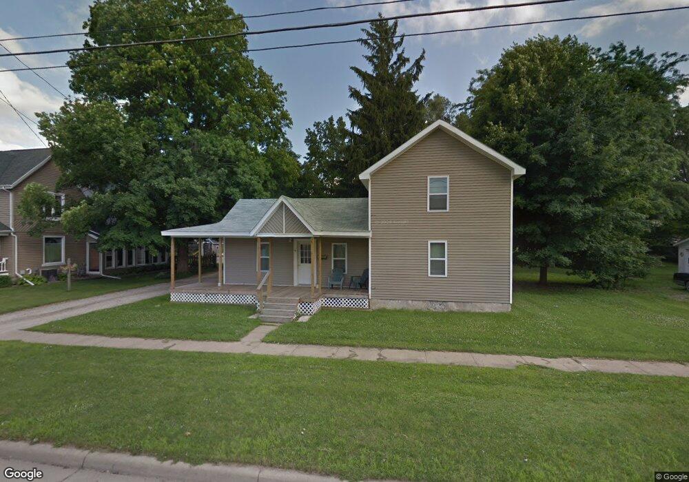
19 E Jefferson St Quincy, MI 49082
Estimated Value: $150,000 - $178,000
4
Beds
2
Baths
1,816
Sq Ft
$92/Sq Ft
Est. Value
About This Home
This home is located at 19 E Jefferson St, Quincy, MI 49082 and is currently estimated at $167,234, approximately $92 per square foot. 19 E Jefferson St is a home located in Branch County with nearby schools including Jennings Elementary School, Quincy Middle School, and Quincy High School.
Ownership History
Date
Name
Owned For
Owner Type
Purchase Details
Closed on
Mar 15, 2012
Sold by
Badders Danielle
Bought by
Hurley Natasha
Current Estimated Value
Home Financials for this Owner
Home Financials are based on the most recent Mortgage that was taken out on this home.
Original Mortgage
$66,326
Outstanding Balance
$45,540
Interest Rate
3.86%
Mortgage Type
New Conventional
Estimated Equity
$121,694
Purchase Details
Closed on
Nov 4, 2010
Sold by
Spaulding Charles A
Bought by
Federal Home Loan Mortgage Corp
Create a Home Valuation Report for This Property
The Home Valuation Report is an in-depth analysis detailing your home's value as well as a comparison with similar homes in the area
Purchase History
| Date | Buyer | Sale Price | Title Company |
|---|---|---|---|
| Hurley Natasha | $63,400 | Branch County Abstract & Tit | |
| Federal Home Loan Mortgage Corp | $28,036 | None Available |
Source: Public Records
Mortgage History
| Date | Status | Borrower | Loan Amount |
|---|---|---|---|
| Open | Hurley Natasha | $66,326 |
Source: Public Records
Tax History
| Year | Tax Paid | Tax Assessment Tax Assessment Total Assessment is a certain percentage of the fair market value that is determined by local assessors to be the total taxable value of land and additions on the property. | Land | Improvement |
|---|---|---|---|---|
| 2025 | $1,032 | $66,821 | $0 | $0 |
| 2024 | $8 | $58,958 | $0 | $0 |
| 2023 | $828 | $54,192 | $0 | $0 |
| 2022 | $828 | $51,505 | $0 | $0 |
| 2020 | -- | $50,091 | $0 | $0 |
| 2019 | -- | $39,841 | $0 | $0 |
| 2018 | -- | $38,219 | $0 | $0 |
| 2017 | -- | $34,421 | $0 | $0 |
| 2016 | -- | $28,299 | $0 | $0 |
| 2015 | -- | $28,961 | $0 | $0 |
| 2014 | -- | $27,531 | $0 | $0 |
| 2013 | -- | $27,836 | $0 | $0 |
Source: Public Records
Map
Nearby Homes
- 20 S Main St
- 46 W Chicago St
- 8 Hunting Trail Ave
- 29 Broughton St
- 437 Richard St
- 493 Richard St
- 0 Wildwood Rd
- 201 Wildwood Beach Rd
- 345 N Fremont Rd
- 981 Generic Dr
- 944 Lukesport Rd
- 0 Lott Rd
- 147 Dons Dr
- VL N Fiske Rd
- 410 N Fiske Rd
- 181 Dons Dr
- 202 Dons Dr
- 586 Schaeffer Dr
- 204 Dons Dr
- 88 Fawn Run Unit 38
- 15 E Jefferson St Unit A
- 23 E Jefferson St
- 18 E Jefferson St
- 11 E Jefferson St
- 27 E Jefferson St
- 14 E Jefferson St
- 28 E Jefferson St
- 23 Fulton St
- 30 E Jefferson St
- 25 Fulton St
- 7 E Jefferson St
- 31 E Jefferson St
- 6 E Jefferson St
- 31 Fulton St
- 31 Fulton St
- 17 Fulton St
- 24 Orange St
- 18 Orange St
- 14 Orange St
- 12 S Main St
Your Personal Tour Guide
Ask me questions while you tour the home.