Estimated Value: $700,000 - $889,000
3
Beds
3
Baths
1,806
Sq Ft
$418/Sq Ft
Est. Value
About This Home
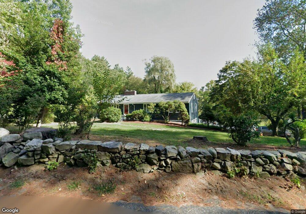
This home is located at 19 Garner Rd, Stow, MA 01775 and is currently estimated at $754,418, approximately $417 per square foot. 19 Garner Rd is a home located in Middlesex County with nearby schools including Center School, Hale Middle School, and Nashoba Regional High School.
Ownership History
Date
Name
Owned For
Owner Type
Purchase Details
Closed on
Jan 10, 1997
Sold by
Kennedy Stephen R
Bought by
Strauss Noelle E
Current Estimated Value
Home Financials for this Owner
Home Financials are based on the most recent Mortgage that was taken out on this home.
Original Mortgage
$140,000
Interest Rate
7.46%
Mortgage Type
Purchase Money Mortgage
Create a Home Valuation Report for This Property
The Home Valuation Report is an in-depth analysis detailing your home's value as well as a comparison with similar homes in the area
Home Values in the Area
Average Home Value in this Area
Purchase History
| Date | Buyer | Sale Price | Title Company |
|---|---|---|---|
| Strauss Noelle E | $240,000 | -- |
Source: Public Records
Mortgage History
| Date | Status | Borrower | Loan Amount |
|---|---|---|---|
| Open | Strauss Noelle E | $145,000 | |
| Closed | Strauss Noelle E | $72,000 | |
| Closed | Strauss Noelle E | $140,000 | |
| Previous Owner | Strauss Noelle E | $59,000 |
Source: Public Records
Tax History
| Year | Tax Paid | Tax Assessment Tax Assessment Total Assessment is a certain percentage of the fair market value that is determined by local assessors to be the total taxable value of land and additions on the property. | Land | Improvement |
|---|---|---|---|---|
| 2025 | $10,062 | $577,600 | $338,200 | $239,400 |
| 2024 | $11,480 | $676,500 | $371,800 | $304,700 |
| 2023 | $10,222 | $563,800 | $332,300 | $231,500 |
| 2022 | $9,848 | $503,500 | $255,900 | $247,600 |
| 2021 | $9,057 | $453,300 | $255,900 | $197,400 |
| 2020 | $8,895 | $431,600 | $236,200 | $195,400 |
| 2019 | $8,249 | $409,800 | $236,200 | $173,600 |
| 2018 | $8,170 | $389,400 | $236,200 | $153,200 |
| 2017 | $7,785 | $378,100 | $210,400 | $167,700 |
| 2016 | $7,600 | $380,400 | $210,400 | $170,000 |
| 2015 | $7,199 | $360,300 | $191,300 | $169,000 |
Source: Public Records
Map
Nearby Homes
- 103 Peabody Dr
- 352 Taylor Rd
- 308 Harvard Rd
- 555 Old Harvard Rd
- 21 Sylvan Dr
- 212 Taylor Rd
- 3 Pine Hill Way
- 14 Pine Hill Way
- 16 A Pine Hill Way Unit 16AA
- 18 B Pine Hill Way Unit BB
- 45 Hiley Brook Rd
- 40 Ridgewood Dr Unit 40
- 184 Old Bolton Rd
- 108 Harvard Rd
- 276 Codman Hill Rd Unit 36A
- 42 Trefry Ln
- 99 Corn Rd
- 28 Mcintosh Dr Unit 22
- 28 Mcintosh Dr
- 120 Maple St
- 31 Garner Rd
- 205 Kirkland Dr
- 195 Kirkland Dr
- 35 Garner Rd
- 189 Kirkland Dr
- 39 Garner Rd
- 204 Kirkland Dr
- 183 Kirkland Dr
- 1 No Name Rd
- 190 Kirkland Dr
- LOT 1 Bradley Ln
- LOT 6 Kettell Plain Rd
- Lot 44 Whispering Way
- LOT B Maple St
- LOT 2 Kettell Plain Rd
- LOT 3 Fox Ct
- LOT 1 Robinwood Ln
- Lot 45 Whispering Way
- LOT 6 Brandymeade Cir
- LOT 2 Brandymeade Cir
Your Personal Tour Guide
Ask me questions while you tour the home.