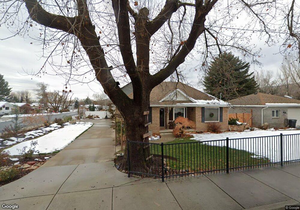
19 N 100 W Alpine, UT 84004
Estimated Value: $635,000 - $792,815
5
Beds
3
Baths
2,310
Sq Ft
$309/Sq Ft
Est. Value
About This Home
This home is located at 19 N 100 W, Alpine, UT 84004 and is currently estimated at $712,704, approximately $308 per square foot. 19 N 100 W is a home located in Utah County with nearby schools including Westfield School, Timberline Middle School, and Lone Peak High School.
Ownership History
Date
Name
Owned For
Owner Type
Purchase Details
Closed on
Dec 1, 2024
Sold by
Wardle Trenton and Wardle Daidreann
Bought by
19 North Llc
Current Estimated Value
Home Financials for this Owner
Home Financials are based on the most recent Mortgage that was taken out on this home.
Original Mortgage
$561,750
Interest Rate
6.2%
Mortgage Type
New Conventional
Purchase Details
Closed on
Oct 24, 2024
Sold by
Speed Deborah White
Bought by
Wardle Trenton and Wardle Daidreann
Home Financials for this Owner
Home Financials are based on the most recent Mortgage that was taken out on this home.
Original Mortgage
$561,750
Interest Rate
6.2%
Mortgage Type
New Conventional
Purchase Details
Closed on
Aug 15, 2017
Sold by
Mcdanile Rulon C and Mcdanile Marilyn C
Bought by
Speed Deborah White
Home Financials for this Owner
Home Financials are based on the most recent Mortgage that was taken out on this home.
Original Mortgage
$329,975
Interest Rate
3.75%
Mortgage Type
FHA
Purchase Details
Closed on
May 7, 2010
Sold by
Mcdaniel Rulon C and Mcdaniel Marilyn C
Bought by
Mcdaniel Rulon C and Mcdaniel Marilyn C
Create a Home Valuation Report for This Property
The Home Valuation Report is an in-depth analysis detailing your home's value as well as a comparison with similar homes in the area
Home Values in the Area
Average Home Value in this Area
Purchase History
| Date | Buyer | Sale Price | Title Company |
|---|---|---|---|
| 19 North Llc | -- | None Listed On Document | |
| Wardle Trenton | -- | Inwest Title | |
| Speed Deborah White | -- | Eagle Gate Title Ins Agency | |
| Mcdaniel Rulon C | -- | None Available |
Source: Public Records
Mortgage History
| Date | Status | Borrower | Loan Amount |
|---|---|---|---|
| Previous Owner | Wardle Trenton | $561,750 | |
| Previous Owner | Speed Deborah White | $329,975 |
Source: Public Records
Tax History
| Year | Tax Paid | Tax Assessment Tax Assessment Total Assessment is a certain percentage of the fair market value that is determined by local assessors to be the total taxable value of land and additions on the property. | Land | Improvement |
|---|---|---|---|---|
| 2025 | $2,854 | $345,730 | -- | -- |
| 2024 | $2,854 | $332,585 | $0 | $0 |
| 2023 | $2,626 | $328,625 | $0 | $0 |
| 2022 | $2,583 | $313,940 | $0 | $0 |
| 2021 | $2,007 | $378,800 | $223,200 | $155,600 |
| 2020 | $1,853 | $342,300 | $194,100 | $148,200 |
| 2019 | $1,675 | $323,000 | $194,100 | $128,900 |
| 2018 | $1,654 | $315,200 | $186,300 | $128,900 |
| 2017 | $1,655 | $167,805 | $0 | $0 |
| 2016 | $1,631 | $154,165 | $0 | $0 |
| 2015 | -- | $139,150 | $0 | $0 |
| 2014 | $1,428 | $126,335 | $0 | $0 |
Source: Public Records
Map
Nearby Homes
- 30 S Main St
- 48 N 100 E
- 248 Deerfield Dr
- 250 S Main St Unit 25
- 250 S Main St Unit 9
- 250 S Main St Unit 7
- 151 Glacier Lily Dr
- 259 Twin River Loop
- 366 River Rd
- 501 W Devey Dr
- 475 Grove Dr
- 499 E 300 N
- 596 S Cascade Ct
- 353 International Way
- 684 N Summit Way
- 820 Eagleview Dr
- 243 W Conrad Ct
- 202 E Alpine Dr
- 512 Eastridge Cir
- 184 S Pfeifferhorn Dr
Your Personal Tour Guide
Ask me questions while you tour the home.