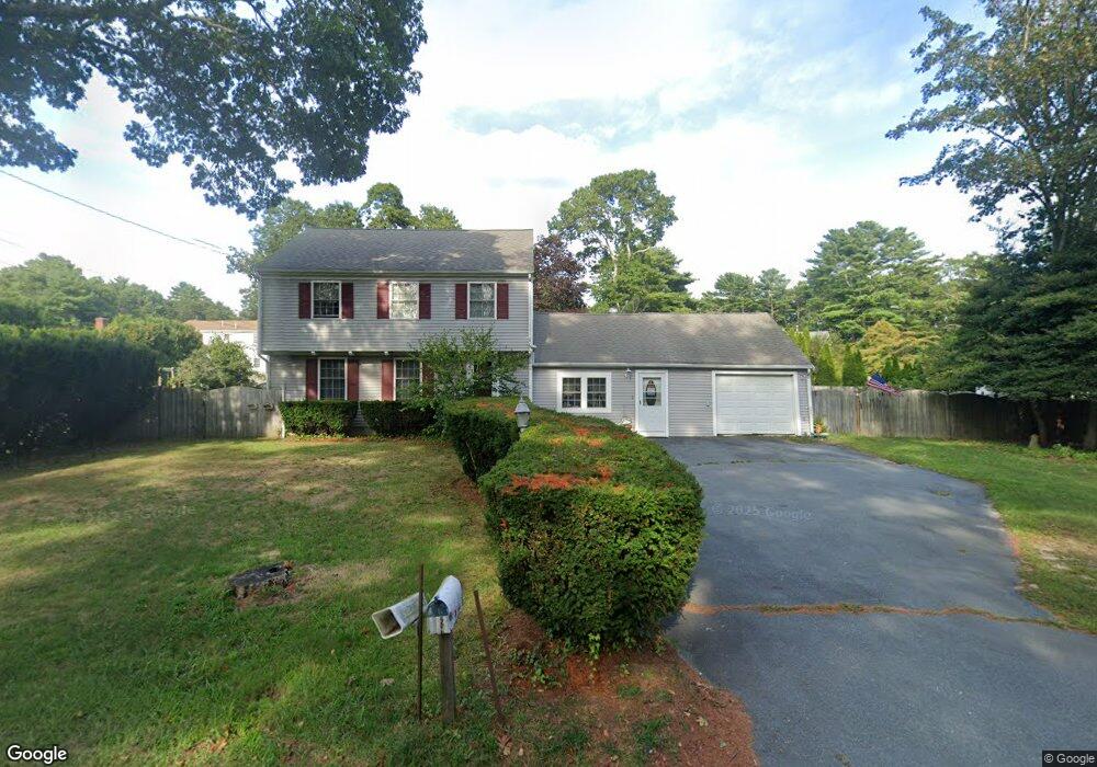
19 Stillman Memorial Dr Wareham, MA 02571
Wareham AreaEstimated Value: $534,000 - $575,000
3
Beds
1
Bath
1,880
Sq Ft
$293/Sq Ft
Est. Value
About This Home
This home is located at 19 Stillman Memorial Dr, Wareham, MA 02571 and is currently estimated at $551,590, approximately $293 per square foot. 19 Stillman Memorial Dr is a home located in Plymouth County.
Create a Home Valuation Report for This Property
The Home Valuation Report is an in-depth analysis detailing your home's value as well as a comparison with similar homes in the area
Tax History
We collect this data history from publicly available records. To have your information removed, we recommend requesting removal directly through your county’s website.
| Year | Tax Paid | Tax Assessment Tax Assessment Total Assessment is a certain percentage of the fair market value that is determined by local assessors to be the total taxable value of land and additions on the property. | Land | Improvement |
|---|---|---|---|---|
| 2025 | $4,518 | $433,600 | $121,800 | $311,800 |
| 2024 | $4,499 | $400,600 | $95,400 | $305,200 |
| 2023 | $4,267 | $354,700 | $86,700 | $268,000 |
| 2022 | $3,970 | $301,200 | $86,700 | $214,500 |
| 2021 | $32,626 | $290,200 | $86,700 | $203,500 |
| 2020 | $3,652 | $275,400 | $86,700 | $188,700 |
| 2019 | $3,433 | $258,300 | $84,500 | $173,800 |
| 2018 | $6,528 | $240,600 | $84,500 | $156,100 |
| 2017 | $34,650 | $235,600 | $84,500 | $151,100 |
| 2016 | $2,867 | $211,900 | $82,900 | $129,000 |
| 2015 | $2,770 | $211,900 | $82,900 | $129,000 |
| 2014 | $2,907 | $226,200 | $82,900 | $143,300 |
Source: Public Records
Map
Nearby Homes
- 8 Peter Cooper Dr
- 71 Great Neck Rd
- 33 Kingwood St
- 1 Arlington Rd
- 6 Birch St
- 30 Minot Ave
- 49 Edgewater Way
- Lot A Great Neck Rd
- 63 Edgewater Dr
- 10 Oak St
- 66 Squaw's Path
- 28 Arlington Rd
- 66 Squaws Path
- 79 Edgewater Dr
- 27 Alden Rd
- 94 Edgewater Dr
- 6 Pinehurst Dr
- 391 Onset Ave
- 8 Cottage St
- 45 Main St Unit 112
- 21 Stillman Memorial Dr
- 17 Stillman Memorial Dr
- 10 Frank Cutler Dr
- 8 Frank Cutler Dr
- 12 Frank Cutler Dr
- 15 Stillman Memorial Dr
- 23 Stillman Memorial Dr
- 6 Frank Cutler Dr
- 4 Frank Cutler Dr
- 13 Stillman Memorial Dr
- 14 Frank Cutler Dr
- 11 Frank Cutler Dr
- 9 Frank Cutler Dr
- 7 Frank Cutler Dr
- 22 Frank Cutler Dr
- 11 Stillman Memorial Dr
- 5 Frank Cutler Dr
- 16 Frank Cutler Dr
- 21 Frank Cutler Dr
- 1 Peter Cooper Dr
Your Personal Tour Guide
Ask me questions while you tour the home.