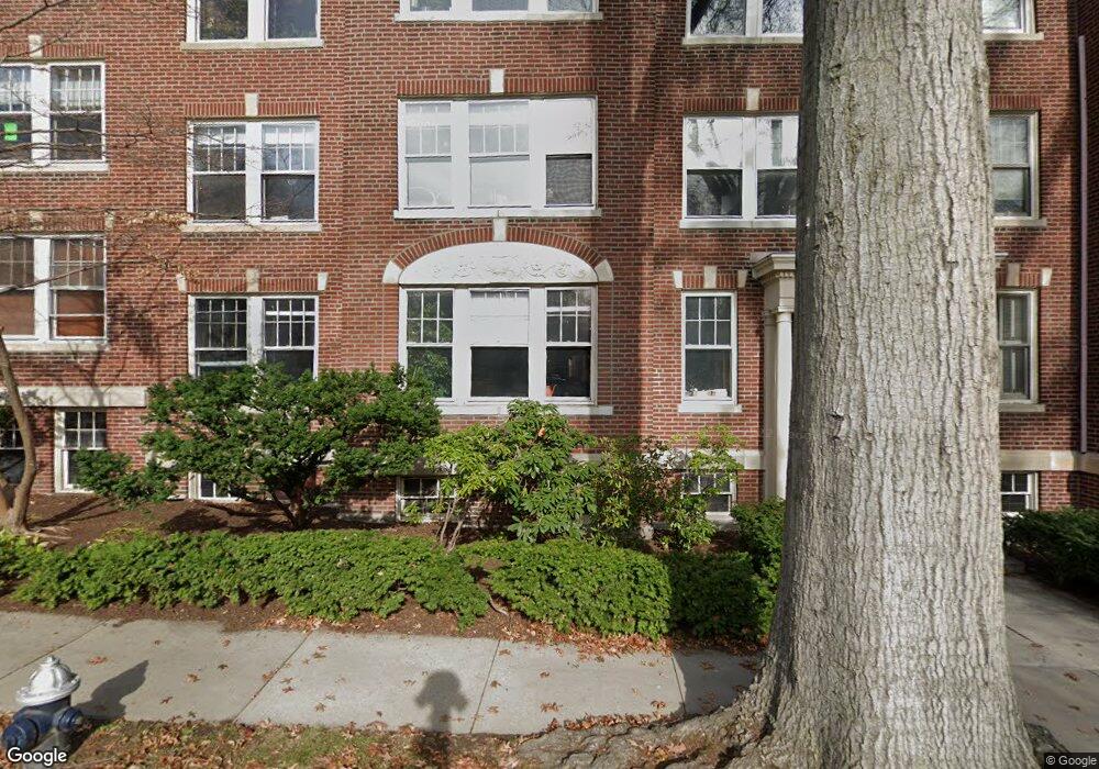
19 Thatcher St Unit E22 Brookline, MA 02446
Coolidge Corner NeighborhoodEstimated Value: $1,468,000 - $1,553,000
3
Beds
2
Baths
1,885
Sq Ft
$806/Sq Ft
Est. Value
About This Home
This home is located at 19 Thatcher St Unit E22, Brookline, MA 02446 and is currently estimated at $1,518,682, approximately $805 per square foot. 19 Thatcher St Unit E22 is a home located in Norfolk County with nearby schools including Amos A. Lawrence School, Brookline High School, and Match Charter Public School.
Ownership History
Date
Name
Owned For
Owner Type
Purchase Details
Closed on
Jul 30, 1997
Sold by
Goldwyn Tatyana
Bought by
Herrmann William A L and Herrmann Sarah L
Current Estimated Value
Home Financials for this Owner
Home Financials are based on the most recent Mortgage that was taken out on this home.
Original Mortgage
$285,360
Outstanding Balance
$42,810
Interest Rate
7.55%
Mortgage Type
Purchase Money Mortgage
Estimated Equity
$1,475,872
Create a Home Valuation Report for This Property
The Home Valuation Report is an in-depth analysis detailing your home's value as well as a comparison with similar homes in the area
Home Values in the Area
Average Home Value in this Area
Purchase History
| Date | Buyer | Sale Price | Title Company |
|---|---|---|---|
| Herrmann William A L | $356,700 | -- |
Source: Public Records
Mortgage History
| Date | Status | Borrower | Loan Amount |
|---|---|---|---|
| Open | Herrmann William A L | $285,360 | |
| Previous Owner | Herrmann William A L | $135,000 |
Source: Public Records
Tax History
| Year | Tax Paid | Tax Assessment Tax Assessment Total Assessment is a certain percentage of the fair market value that is determined by local assessors to be the total taxable value of land and additions on the property. | Land | Improvement |
|---|---|---|---|---|
| 2025 | $12,645 | $1,281,200 | $0 | $1,281,200 |
| 2024 | $12,272 | $1,256,100 | $0 | $1,256,100 |
| 2023 | $12,053 | $1,208,900 | $0 | $1,208,900 |
| 2022 | $12,077 | $1,185,200 | $0 | $1,185,200 |
| 2021 | $11,500 | $1,173,500 | $0 | $1,173,500 |
| 2020 | $10,981 | $1,162,000 | $0 | $1,162,000 |
| 2019 | $10,369 | $1,106,600 | $0 | $1,106,600 |
| 2018 | $9,580 | $1,012,700 | $0 | $1,012,700 |
| 2017 | $9,431 | $954,600 | $0 | $954,600 |
| 2016 | $9,042 | $867,800 | $0 | $867,800 |
| 2015 | $8,425 | $788,900 | $0 | $788,900 |
| 2014 | $8,121 | $713,000 | $0 | $713,000 |
Source: Public Records
Map
Nearby Homes
- 180 Ivy St
- 99 Crowninshield Rd Unit 99
- 178 Ivy St
- 7 Parkman St Unit 1
- 221 Saint Paul St
- 79 Pleasant St Unit 4
- 21 Crowninshield Rd Unit 21
- 105 Babcock St
- 36 Osborne Rd Unit 1
- 36 Osborne Rd
- 53 Winslow Rd
- 63-65 Green St Unit PH-3
- 95 Stedman St Unit 1
- 14 James St Unit 3
- 95 Beals St Unit 2
- 8 Euston St Unit 5
- 1243 Beacon St Unit 5A
- 100 Sewall Ave Unit 5
- 1002 Beacon St
- 52 Babcock St Unit 5
- 19 Thatcher St Unit E13
- 19 Thatcher St Unit E12
- 19 Thatcher St Unit E11
- 15 Thatcher St Unit F13
- 15 Thatcher St Unit F12
- 15 Thatcher St Unit F11
- 19 Thatcher St Unit E23
- 19 Thatcher St Unit E21
- 15 Thatcher St Unit F23
- 15 Thatcher St Unit F21
- 19 Thatcher St Unit 66-2
- 19 Thatcher St Unit 64-2
- 19 Thatcher St Unit 66-5
- 19 Thatcher St Unit 3
- 19 Thatcher St Unit 6
- 15 Thatcher St
- 19 Thatcher St
- 15 Thatcher St Unit 5
- 15 Thatcher St Unit 3,15
- 19 Thatcher St Unit e2-2,19
Your Personal Tour Guide
Ask me questions while you tour the home.