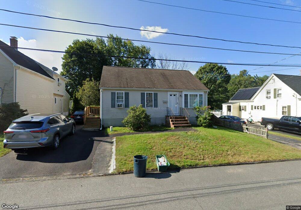
190 Perry St Stoughton, MA 02072
Estimated Value: $463,000 - $550,959
3
Beds
2
Baths
1,258
Sq Ft
$414/Sq Ft
Est. Value
About This Home
This home is located at 190 Perry St, Stoughton, MA 02072 and is currently estimated at $520,740, approximately $413 per square foot. 190 Perry St is a home located in Norfolk County with nearby schools including Joseph H. Gibbons Elementary School, O'Donnell Middle School, and Stoughton High School.
Ownership History
Date
Name
Owned For
Owner Type
Purchase Details
Closed on
Dec 24, 1999
Sold by
Briarwood Constr Corp
Bought by
Perrin Todd
Current Estimated Value
Home Financials for this Owner
Home Financials are based on the most recent Mortgage that was taken out on this home.
Original Mortgage
$143,600
Interest Rate
7.61%
Mortgage Type
Purchase Money Mortgage
Purchase Details
Closed on
May 21, 1999
Sold by
Starr Ann R
Bought by
Briarwood Const Corp
Create a Home Valuation Report for This Property
The Home Valuation Report is an in-depth analysis detailing your home's value as well as a comparison with similar homes in the area
Home Values in the Area
Average Home Value in this Area
Purchase History
| Date | Buyer | Sale Price | Title Company |
|---|---|---|---|
| Perrin Todd | $179,500 | -- | |
| Briarwood Const Corp | $38,000 | -- |
Source: Public Records
Mortgage History
| Date | Status | Borrower | Loan Amount |
|---|---|---|---|
| Open | Briarwood Const Corp | $155,000 | |
| Closed | Briarwood Const Corp | $143,600 | |
| Closed | Briarwood Const Corp | $9,975 |
Source: Public Records
Tax History
| Year | Tax Paid | Tax Assessment Tax Assessment Total Assessment is a certain percentage of the fair market value that is determined by local assessors to be the total taxable value of land and additions on the property. | Land | Improvement |
|---|---|---|---|---|
| 2025 | $5,994 | $484,200 | $206,500 | $277,700 |
| 2024 | $5,807 | $456,200 | $188,200 | $268,000 |
| 2023 | $5,644 | $416,500 | $174,900 | $241,600 |
| 2022 | $5,440 | $377,500 | $159,900 | $217,600 |
| 2021 | $5,380 | $356,300 | $144,900 | $211,400 |
| 2020 | $5,231 | $351,300 | $139,900 | $211,400 |
| 2019 | $5,105 | $332,800 | $139,900 | $192,900 |
| 2018 | $4,578 | $309,100 | $133,200 | $175,900 |
| 2017 | $4,217 | $291,000 | $126,600 | $164,400 |
| 2016 | $4,171 | $278,600 | $116,600 | $162,000 |
| 2015 | $3,893 | $257,300 | $109,900 | $147,400 |
| 2014 | $3,752 | $238,400 | $99,900 | $138,500 |
Source: Public Records
Map
Nearby Homes
- 92 French St
- 138 Water St
- 100 Water St
- 438 School St
- 88 Pearl St
- 22 Legaski Ave
- 31 Hunt Dr
- 1345 Central St
- 31 Jones Terrace Unit 22
- 75 Whitten Ave
- 65 Mccormick Terrace Unit 10
- 103 Columbus Ave
- 30 Whitten Ave
- 29 Keith Terrace
- 62 Duncan Rd
- 715 Central St
- 475 Pleasant St
- 84 Kim Terrace
- 434 Sumner St
- 72 Kim Terrace Unit C
- 192 Perry St
- 184 Perry St
- 196 Perry St
- 196 Perry St Unit 196
- 194 Perry St
- 299 School St
- 289 School St Unit 293
- 293 School St Unit 1L
- 293 School St Unit 2L
- 293 School St Unit 3R
- 293 School St Unit 1R
- 202 Perry St
- 307 School St
- 319 School St
- 189 Perry St
- 185 Perry St
- 206 Perry St
- 195 Perry St
- 177 Perry St
- 171 Perry St
Your Personal Tour Guide
Ask me questions while you tour the home.