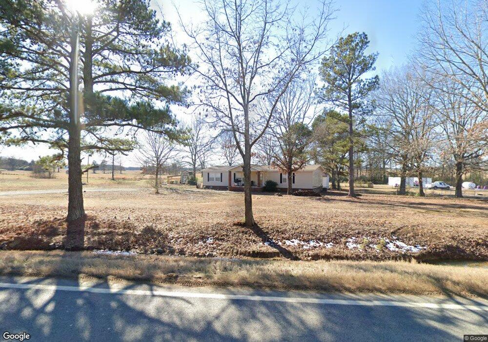
1900 Highway 31 N Beebe, AR 72012
Beebe AreaEstimated Value: $162,000 - $230,000
About This Home
This home is located at 1900 Highway 31 N, Beebe, AR 72012 and is currently estimated at $196,000, approximately $87 per square foot. 1900 Highway 31 N is a home with nearby schools including Beebe Elementary School, Beebe Middle School, and Beebe Junior High School.
Ownership History
We collect this data history from publicly available records. To have your information removed, we recommend requesting removal directly through your county’s website.
Purchase Details
Home Financials for this Owner
Home Financials are based on the most recent Mortgage that was taken out on this home.Purchase Details
Purchase History
We collect this data history from publicly available records. To have your information removed, we recommend requesting removal directly through your county’s website.
| Date | Buyer | Sale Price | Title Company |
|---|---|---|---|
| -- | None Listed On Document | ||
| $10,000 | -- |
Mortgage History
We collect this data history from publicly available records. To have your information removed, we recommend requesting removal directly through your county’s website.
| Date | Status | Borrower | Loan Amount |
|---|---|---|---|
| Open | $256,000 | ||
| Previous Owner | $25,000 | ||
| Previous Owner | $59,264 | ||
| Previous Owner | $28,532 | ||
| Previous Owner | $35,506 | ||
| Previous Owner | $81,500 | ||
| Previous Owner | $79,088 |
Tax History
We collect this data history from publicly available records. To have your information removed, we recommend requesting removal directly through your county’s website.
| Year | Tax Paid | Tax Assessment Tax Assessment Total Assessment is a certain percentage of the fair market value that is determined by local assessors to be the total taxable value of land and additions on the property. | Land | Improvement |
|---|---|---|---|---|
| 2025 | $120 | $2,960 | $2,260 | $700 |
| 2024 | $120 | $2,960 | $2,260 | $700 |
| 2023 | $120 | $2,960 | $2,260 | $700 |
| 2022 | $120 | $2,960 | $2,260 | $700 |
| 2021 | $110 | $2,960 | $2,260 | $700 |
| 2020 | $100 | $2,960 | $2,260 | $700 |
| 2019 | $67 | $2,260 | $2,260 | $0 |
| 2018 | $62 | $2,260 | $2,260 | $0 |
| 2017 | $52 | $2,260 | $2,260 | $0 |
| 2016 | $52 | $1,280 | $2,260 | $0 |
| 2015 | $47 | $1,160 | $1,160 | $0 |
| 2014 | $626 | $15,380 | $1,940 | $13,440 |
Map
- 104 Bob White Cove
- 202 W Blake H Ln
- 2235 Highway 31 N
- 50 Rosewood Dr
- Tract 1 Sandy Ford Rd
- Tract 3 Sandy Ford Rd
- 40 Rosewood Dr
- 608 Webb Hill Rd
- 260 Hwy 321
- 120 Poindexter Ln
- 106 W End St
- 212 Byars Rd
- 592 Shiloh Rd
- Tract 11 Black Rock Rd
- 2472 Highway 31 N
- 000 Shiloh Rd
- 108 Brandi Ln
- 356 Shiloh Rd
- 244 Artesia Ln
- 167 Turkey Mountain Rd
- 1906 Highway 31 N
- 1906 Highway 31 N
- 1897 Highway 31 N
- 1914 Highway 31 N
- 117 Pruitt Ln
- 115 Pruitt Ln
- 1915 Highway 31 N
- 1922 Highway 31 N
- 121 Ashley Horton Ln
- 160 Schmitz Ln
- LOT 8 S Ashley Horton Ln
- LOT 6 S Ashley Horton Ln
- 1940 Highway 31 N
- 1939 Highway 31 N
- 145 Ashley Horton Ln
- 116 Reese Kincaid Dr N
- 1948 Highway 31 N
- 126 Reese Kincaide Dr
- 1948 Highway 31 N
- 1945 Highway 31 N
Ask me questions while you tour the home.