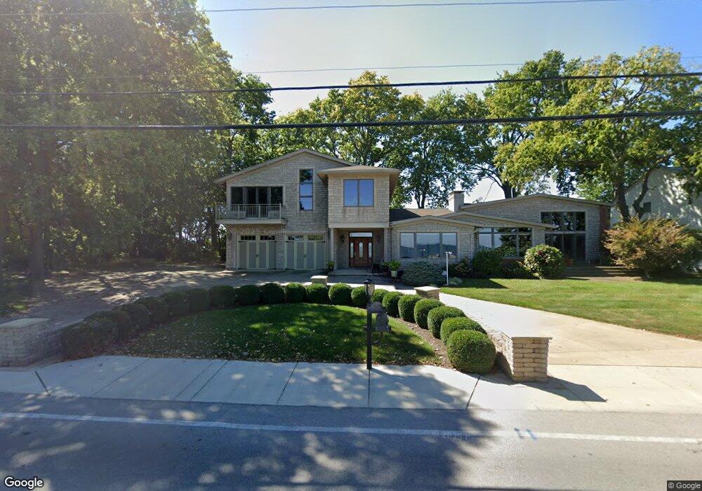
1907 Cedar Point Rd Sandusky, OH 44870
Estimated Value: $1,221,979 - $1,386,000
About This Home
This home is located at 1907 Cedar Point Rd, Sandusky, OH 44870 and is currently estimated at $1,292,660, approximately $258 per square foot. 1907 Cedar Point Rd is a home located in Erie County with nearby schools including Sandusky High School and Monroe Preparatory Academy.
Ownership History
We collect this data history from publicly available records. To have your information removed, we recommend requesting removal directly through your county’s website.
Purchase Details
Home Financials for this Owner
Home Financials are based on the most recent Mortgage that was taken out on this home.Purchase Details
Purchase Details
Home Financials for this Owner
Home Financials are based on the most recent Mortgage that was taken out on this home.Purchase History
We collect this data history from publicly available records. To have your information removed, we recommend requesting removal directly through your county’s website.
| Date | Buyer | Sale Price | Title Company |
|---|---|---|---|
| -- | Hartung Title | ||
| -- | Hartung Title | ||
| $675,000 | Lawyers Title Ins Corp | ||
| $975,000 | -- |
Mortgage History
We collect this data history from publicly available records. To have your information removed, we recommend requesting removal directly through your county’s website.
| Date | Status | Borrower | Loan Amount |
|---|---|---|---|
| Open | $700,000 | ||
| Previous Owner | $540,000 |
Tax History
We collect this data history from publicly available records. To have your information removed, we recommend requesting removal directly through your county’s website.
| Year | Tax Paid | Tax Assessment Tax Assessment Total Assessment is a certain percentage of the fair market value that is determined by local assessors to be the total taxable value of land and additions on the property. | Land | Improvement |
|---|---|---|---|---|
| 2025 | $11,898 | $319,637 | $145,656 | $173,981 |
| 2024 | $11,898 | $319,637 | $145,656 | $173,981 |
| 2023 | $12,302 | $252,101 | $128,520 | $123,581 |
| 2022 | $12,478 | $252,112 | $128,520 | $123,592 |
| 2021 | $12,594 | $252,110 | $128,520 | $123,590 |
| 2020 | $12,835 | $236,250 | $128,520 | $107,730 |
| 2019 | $13,204 | $236,250 | $128,520 | $107,730 |
| 2018 | $13,218 | $236,250 | $128,520 | $107,730 |
| 2017 | $14,411 | $256,780 | $132,800 | $123,980 |
| 2016 | $14,404 | $256,780 | $132,800 | $123,980 |
| 2015 | $13,000 | $256,780 | $132,800 | $123,980 |
| 2014 | $11,969 | $237,910 | $119,950 | $117,960 |
| 2013 | $11,846 | $237,910 | $119,950 | $117,960 |
Map
- 1711 Willow Dr
- 174 Sunset Dr
- 1431 Cedar Point Rd
- 571 Bimini Dr
- 412 Anderson St
- 444 Hasting Dr
- 179 Marina Point Dr
- 4 Curran St
- 3 Curran St
- 1035 1st St
- 30 Marina Point Dr
- 57 Marina Point Dr
- 31 Marina Point Dr Unit 31
- 32 Marina Point Dr
- 1215 E Farwell St
- 908 Ontario St
- 1005 1st St
- 1327 5th St
- 1310 E Larchmont Dr
- 907 Ontario St
- 1909 Cedar Point
- 1907 Cedar Point
- 1909 Cedar Point Rd
- 1915 Cedar Point Rd
- 1919 Cedar Point Rd
- 1837 Cedar Point Rd
- 1923 Cedar Point Rd
- 1835 Cedar Point Rd
- 1831 Cedar Point Rd
- 1929 Cedar Point Rd
- 1827 Cedar Point Rd
- 1937 Cedar Point Rd
- 1825 Cedar Point Rd
- 1939 Cedar Point Rd
- 1821 Cedar Point Rd
- 1939 Cedar Point
- 1817 Cedar Point Rd
- 1813 Cedar Point Rd
- 1809 Cedar Point Rd
- 2007 Cedar Point Rd
Ask me questions while you tour the home.