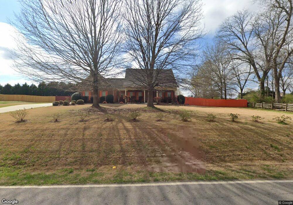
1908 Stroud Rd Unit 1 McDonough, GA 30252
Estimated Value: $329,532 - $374,000
About This Home
This home is located at 1908 Stroud Rd Unit 1, McDonough, GA 30252 and is currently estimated at $352,133, approximately $163 per square foot. 1908 Stroud Rd Unit 1 is a home located in Henry County with nearby schools including Rock Spring Elementary School, Ola Middle School, and Ola High School.
Ownership History
We collect this data history from publicly available records. To have your information removed, we recommend requesting removal directly through your county’s website.
Purchase Details
Purchase Details
Home Financials for this Owner
Home Financials are based on the most recent Mortgage that was taken out on this home.Purchase Details
Purchase Details
Purchase Details
Home Financials for this Owner
Home Financials are based on the most recent Mortgage that was taken out on this home.Home Values in the Area
Average Home Value in this Area
Purchase History
We collect this data history from publicly available records. To have your information removed, we recommend requesting removal directly through your county’s website.
| Date | Buyer | Sale Price | Title Company |
|---|---|---|---|
| $225,000 | -- | ||
| $149,000 | -- | ||
| $209,000 | -- | ||
| -- | -- | ||
| $100,000 | -- |
Mortgage History
We collect this data history from publicly available records. To have your information removed, we recommend requesting removal directly through your county’s website.
| Date | Status | Borrower | Loan Amount |
|---|---|---|---|
| Previous Owner | $152,040 | ||
| Previous Owner | $357,000 |
Tax History
We collect this data history from publicly available records. To have your information removed, we recommend requesting removal directly through your county’s website.
| Year | Tax Paid | Tax Assessment Tax Assessment Total Assessment is a certain percentage of the fair market value that is determined by local assessors to be the total taxable value of land and additions on the property. | Land | Improvement |
|---|---|---|---|---|
| 2025 | $2,752 | $142,120 | $18,000 | $124,120 |
| 2024 | $2,752 | $153,680 | $18,000 | $135,680 |
| 2023 | $2,319 | $150,080 | $14,800 | $135,280 |
| 2022 | $2,871 | $120,800 | $14,800 | $106,000 |
| 2021 | $2,374 | $99,760 | $14,800 | $84,960 |
| 2020 | $2,929 | $93,240 | $12,000 | $81,240 |
| 2019 | $3,492 | $90,000 | $11,790 | $78,210 |
| 2018 | $0 | $86,520 | $12,000 | $74,520 |
| 2016 | $2,637 | $74,760 | $10,000 | $64,760 |
| 2015 | $2,345 | $65,560 | $10,000 | $55,560 |
| 2014 | $2,193 | $61,160 | $10,000 | $51,160 |
Map
- 227 Aves Ct
- 1959 Stroud Rd
- 1801 Stroud Rd
- 1703 Keys Ferry Rd
- 527 Gallantry Trail
- 423 Serenity Walk
- 400 Kissee Ct
- 0 Fincherville Rd Unit TRACT 3
- 0 Fincherville Rd Unit TRACT 2
- 133 Gambier Cove
- 214 Millie Ct
- 0 Hyannis Dr Unit 26428085
- 125 Ashby Dr
- 156 Meadow View Dr
- 162 Loam Dr
- 306 Ponderosa Trail
- 320 Ponderosa Trail
- 204 Clear Springs Ct
- 0 Belford Way Unit 7760561
- 1215 Mount Bethel Rd
- 1908 Stroud Rd
- 1910 Stroud Rd Unit N/a
- 1910 Stroud Rd Unit .
- 1910 Stroud Rd
- 1844 Keys Ferry Rd
- 2248 Stroud Rd
- 1824 Keys Ferry Rd
- 215 Aves Ct
- 1912 Stroud Rd
- 219 Aves Ct
- 219 Aves Ct Unit 25
- 1808 Keys Ferry Rd
- 211 Aves Ct
- 223 Aves Ct
- 223 Aves Ct Unit 203
- 1825 Keys Ferry Rd
- 1914 Stroud Rd Unit 4
- 1914 Stroud Rd
- 209 Aves Ct
- 212 Aves Ct
Ask me questions while you tour the home.