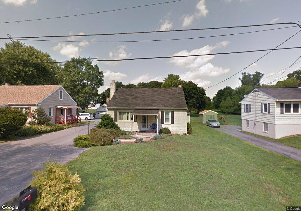
1909 Barton Dr Lancaster, PA 17603
Meadia Heights NeighborhoodEstimated Value: $252,000 - $296,000
2
Beds
1
Bath
1,484
Sq Ft
$189/Sq Ft
Est. Value
About This Home
This home is located at 1909 Barton Dr, Lancaster, PA 17603 and is currently estimated at $280,087, approximately $188 per square foot. 1909 Barton Dr is a home located in Lancaster County with nearby schools including Elizabeth R Martin Elementary School, Wheatland Middle School, and McCaskey High School.
Ownership History
Date
Name
Owned For
Owner Type
Purchase Details
Closed on
Apr 24, 2006
Sold by
Flowers Cathy L
Bought by
Helm Ryan E and Helm Kyle N
Current Estimated Value
Home Financials for this Owner
Home Financials are based on the most recent Mortgage that was taken out on this home.
Original Mortgage
$104,000
Outstanding Balance
$57,205
Interest Rate
6.4%
Mortgage Type
Purchase Money Mortgage
Estimated Equity
$222,882
Create a Home Valuation Report for This Property
The Home Valuation Report is an in-depth analysis detailing your home's value as well as a comparison with similar homes in the area
Home Values in the Area
Average Home Value in this Area
Purchase History
We collect this data history from publicly available records. To have your information removed, we recommend requesting removal directly through your county’s website.
| Date | Buyer | Sale Price | Title Company |
|---|---|---|---|
| Helm Ryan E | $130,000 | None Available |
Source: Public Records
Mortgage History
We collect this data history from publicly available records. To have your information removed, we recommend requesting removal directly through your county’s website.
| Date | Status | Borrower | Loan Amount |
|---|---|---|---|
| Open | Helm Ryan E | $104,000 |
Source: Public Records
Tax History
| Year | Tax Paid | Tax Assessment Tax Assessment Total Assessment is a certain percentage of the fair market value that is determined by local assessors to be the total taxable value of land and additions on the property. | Land | Improvement |
|---|---|---|---|---|
| 2025 | $4,213 | $146,100 | $50,800 | $95,300 |
| 2024 | $4,213 | $146,100 | $50,800 | $95,300 |
| 2023 | $4,116 | $146,100 | $50,800 | $95,300 |
| 2022 | $3,871 | $146,100 | $50,800 | $95,300 |
| 2021 | $3,754 | $146,100 | $50,800 | $95,300 |
| 2020 | $3,754 | $146,100 | $50,800 | $95,300 |
| 2019 | $3,674 | $146,100 | $50,800 | $95,300 |
| 2018 | $2,679 | $146,100 | $50,800 | $95,300 |
| 2017 | $3,518 | $107,600 | $37,200 | $70,400 |
| 2016 | $3,453 | $107,600 | $37,200 | $70,400 |
| 2015 | $466 | $107,600 | $37,200 | $70,400 |
| 2014 | $2,443 | $107,600 | $37,200 | $70,400 |
Source: Public Records
Map
Nearby Homes
- 2460 Honeysuckle Ln
- 10 Hull Ct
- 256 Pilgrim Dr
- 236 Pilgrim Dr
- 232 Pilgrim Dr
- 233 Pilgrim Dr
- 131 Hillard Field
- 125 Hillard Field
- 231 Pilgrim Dr
- 129 Hillard Field
- 229 Pilgrim Dr
- 124 Hillard Field
- 112 Hillard Field
- 109 Waypoint Dr
- 227 Pilgrim Dr
- 225 Pilgrim Dr
- 120 Hillard Field
- 127 Hillard Field
- 219 Pilgrim Dr
- 122 Hillard Field
- 1905 Barton Dr
- 1911 Barton Dr
- 1901 Barton Dr
- 1919 Barton Dr
- 1906 Barton Dr
- 1910 Barton Dr
- 2480 Honeysuckle Ln
- 1914 Barton Dr
- 2504 Honeysuckle Ln
- 1923 Barton Dr
- 1916 Barton Dr
- 2506 Honeysuckle Ln
- 1924 Barton Dr
- 2508 Honeysuckle Ln
- 1950 Barton Dr
- 2520 Honeysuckle Ln
- 2530 Honeysuckle Ln
- 2540 Honeysuckle Ln
- 2450 Honeysuckle Ln
- 2550 Honeysuckle Ln
Your Personal Tour Guide
Ask me questions while you tour the home.