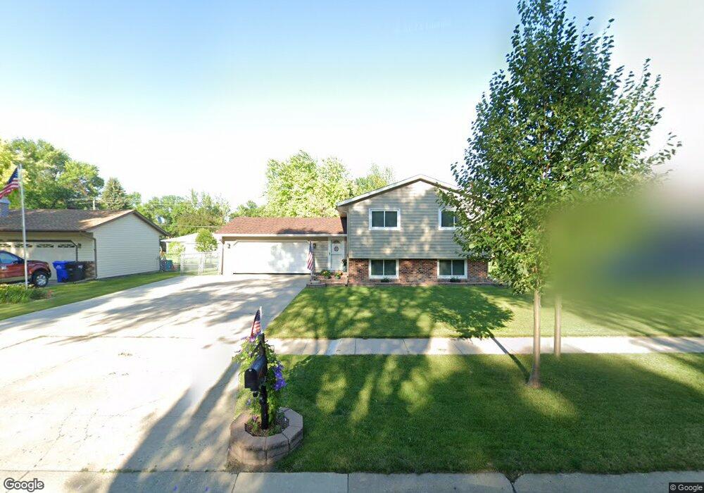
1910 18th St S Fargo, ND 58103
South High NeighborhoodEstimated Value: $283,415 - $324,000
5
Beds
2
Baths
1,934
Sq Ft
$161/Sq Ft
Est. Value
About This Home
This home is located at 1910 18th St S, Fargo, ND 58103 and is currently estimated at $311,604, approximately $161 per square foot. 1910 18th St S is a home located in Cass County with nearby schools including Lewis & Clark Elementary School, Carl Ben Eielson Middle School, and South High School.
Ownership History
Date
Name
Owned For
Owner Type
Purchase Details
Closed on
Oct 4, 2019
Sold by
Johnston Diane J and Johnston David E
Bought by
Svenningsen Austin P
Current Estimated Value
Home Financials for this Owner
Home Financials are based on the most recent Mortgage that was taken out on this home.
Original Mortgage
$206,910
Outstanding Balance
$180,891
Interest Rate
3.4%
Mortgage Type
New Conventional
Estimated Equity
$130,713
Purchase Details
Closed on
Nov 12, 2010
Sold by
Brasel Leroy W and Brasel Connie S
Bought by
Johnston Diane J and Johnston David E
Home Financials for this Owner
Home Financials are based on the most recent Mortgage that was taken out on this home.
Original Mortgage
$134,300
Interest Rate
4.31%
Mortgage Type
New Conventional
Create a Home Valuation Report for This Property
The Home Valuation Report is an in-depth analysis detailing your home's value as well as a comparison with similar homes in the area
Home Values in the Area
Average Home Value in this Area
Purchase History
| Date | Buyer | Sale Price | Title Company |
|---|---|---|---|
| Svenningsen Austin P | $229,900 | Regency Title Inc | |
| Johnston Diane J | -- | -- |
Source: Public Records
Mortgage History
| Date | Status | Borrower | Loan Amount |
|---|---|---|---|
| Open | Svenningsen Austin P | $206,910 | |
| Previous Owner | Johnston Diane J | $134,300 |
Source: Public Records
Tax History
| Year | Tax Paid | Tax Assessment Tax Assessment Total Assessment is a certain percentage of the fair market value that is determined by local assessors to be the total taxable value of land and additions on the property. | Land | Improvement |
|---|---|---|---|---|
| 2024 | $3,134 | $135,400 | $27,700 | $107,700 |
| 2023 | $3,410 | $127,750 | $27,700 | $100,050 |
| 2022 | $3,240 | $119,400 | $27,700 | $91,700 |
| 2021 | $3,057 | $114,750 | $29,800 | $84,950 |
| 2020 | $2,765 | $104,300 | $29,800 | $74,500 |
| 2019 | $2,590 | $98,400 | $16,550 | $81,850 |
| 2018 | $2,556 | $98,400 | $16,550 | $81,850 |
| 2017 | $2,455 | $95,550 | $16,550 | $79,000 |
| 2016 | $2,186 | $92,750 | $16,550 | $76,200 |
| 2015 | $2,181 | $86,800 | $12,400 | $74,400 |
| 2014 | $2,034 | $78,900 | $12,400 | $66,500 |
| 2013 | $2,035 | $78,900 | $12,400 | $66,500 |
Source: Public Records
Map
Nearby Homes
- 1901 18th St S
- 2320 20th Ave S Unit 7
- 2326 20th Ave S Unit 9
- 1809 15th St S
- 1721 17th St S
- 1810 15th St S
- 2366 20th Ave S
- 2201 15th St S
- 2012 Park Blvd S Unit B4
- 2379 20 1 2 Ave S Unit 2379-2
- 1722 15th St S
- 1718 15th St S
- 2402 18th St S Unit 3
- 2308 18th St S Unit H
- 2440 15th St S Unit 104
- 1840 15th Ave S
- 1502 16th Ave S
- 2301 23rd Ave S
- 2102 23rd Ave S
- 1630 14th St S
Your Personal Tour Guide
Ask me questions while you tour the home.