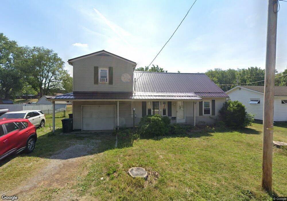
1910 Root Ave NE Canton, OH 44705
Fairmount NeighborhoodEstimated Value: $109,000 - $160,000
About This Home
This home is located at 1910 Root Ave NE, Canton, OH 44705 and is currently estimated at $129,777, approximately $79 per square foot. 1910 Root Ave NE is a home located in Stark County with nearby schools including Belle Stone Elementary School, Early Learning Center @ Schreiber, and Youtz Intermediate School.
Ownership History
We collect this data history from publicly available records. To have your information removed, we recommend requesting removal directly through your county’s website.
Purchase Details
Home Financials for this Owner
Home Financials are based on the most recent Mortgage that was taken out on this home.Purchase Details
Purchase Details
Home Values in the Area
Average Home Value in this Area
Purchase History
We collect this data history from publicly available records. To have your information removed, we recommend requesting removal directly through your county’s website.
| Date | Buyer | Sale Price | Title Company |
|---|---|---|---|
| $81,000 | Insignia Title Agency Ltd | ||
| -- | -- | ||
| $37,500 | -- |
Mortgage History
We collect this data history from publicly available records. To have your information removed, we recommend requesting removal directly through your county’s website.
| Date | Status | Borrower | Loan Amount |
|---|---|---|---|
| Open | $79,677 |
Tax History
We collect this data history from publicly available records. To have your information removed, we recommend requesting removal directly through your county’s website.
| Year | Tax Paid | Tax Assessment Tax Assessment Total Assessment is a certain percentage of the fair market value that is determined by local assessors to be the total taxable value of land and additions on the property. | Land | Improvement |
|---|---|---|---|---|
| 2025 | -- | $29,890 | $4,970 | $24,920 |
| 2024 | -- | $29,890 | $4,970 | $24,920 |
| 2023 | $1,258 | $21,040 | $3,680 | $17,360 |
| 2022 | $1,223 | $21,040 | $3,680 | $17,360 |
| 2021 | $1,236 | $21,040 | $3,680 | $17,360 |
| 2020 | $1,208 | $18,410 | $3,080 | $15,330 |
| 2019 | $1,055 | $18,410 | $3,080 | $15,330 |
| 2018 | $1,061 | $18,410 | $3,080 | $15,330 |
| 2017 | $1,173 | $18,550 | $3,290 | $15,260 |
| 2016 | $1,177 | $18,550 | $3,290 | $15,260 |
| 2015 | $1,184 | $18,550 | $3,290 | $15,260 |
| 2014 | $1,329 | $19,570 | $3,470 | $16,100 |
| 2013 | $640 | $19,570 | $3,470 | $16,100 |
Map
- 1824 Root Ave NE
- 1811 Grace Ave NE
- 1713 Regal Ave NE
- 1646 Royal Ave NE
- 2211 17th St NE
- 1815 Roosevelt Ave NE
- 2216 17th St NE
- 2314 Indiana Way NE
- 2708 19th St NE
- 2201 23rd St NE
- 2321 15th St NE
- 2010 18th St NE
- 2106 Indiana Way NE
- 2334 15th St NE
- 2329 Winfield Way NE
- 1939 Midway Ave NE
- 2221 Maxine Ave NE
- 2235 Winfield Way NE
- 2200 15th St NE
- 2014 25th St NE
- 1828 Root Ave NE
- 1816 Root Ave NE
- 1832 Root Ave NE
- 2438 19th St NE
- 1819 Royal Ave NE
- 1821 Root Ave NE
- 1817 Root Ave NE
- 1829 Root Ave NE
- 1806 Root Ave NE
- 1833 Root Ave NE
- 1809 Royal Ave NE
- 1902 Root Ave NE
- 1909 Royal Ave NE
- 1804 Root Ave NE
- 1901 Root Ave NE
- 1803 Root Ave NE
- 1905 Root Ave NE
- 1907 Royal Ave NE
- 1828 Superior Ave NE
- 1820 Superior Ave NE
Ask me questions while you tour the home.