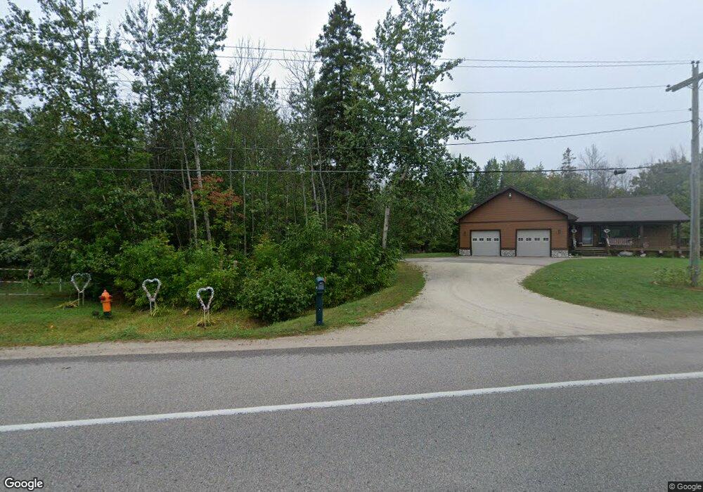
1916 Riverside Dr Sault Sainte Marie, MI 49783
Estimated Value: $378,000 - $587,000
4
Beds
3
Baths
1,800
Sq Ft
$278/Sq Ft
Est. Value
About This Home
This home is located at 1916 Riverside Dr, Sault Sainte Marie, MI 49783 and is currently estimated at $500,600, approximately $278 per square foot. 1916 Riverside Dr is a home located in Chippewa County with nearby schools including Sault Area Middle School, Sault Area High School, and Joseph K. Lumsden Bahweting Anishnabe Academy.
Ownership History
Date
Name
Owned For
Owner Type
Purchase Details
Closed on
Jun 12, 2008
Sold by
Cardinal Norman J and Cardinal Peggy J
Bought by
Nixon Dennis E and Nixon Debra J
Current Estimated Value
Home Financials for this Owner
Home Financials are based on the most recent Mortgage that was taken out on this home.
Original Mortgage
$50,300
Interest Rate
6.05%
Create a Home Valuation Report for This Property
The Home Valuation Report is an in-depth analysis detailing your home's value as well as a comparison with similar homes in the area
Home Values in the Area
Average Home Value in this Area
Purchase History
We collect this data history from publicly available records. To have your information removed, we recommend requesting removal directly through your county’s website.
| Date | Buyer | Sale Price | Title Company |
|---|---|---|---|
| Nixon Dennis E | $250,000 | -- |
Source: Public Records
Mortgage History
We collect this data history from publicly available records. To have your information removed, we recommend requesting removal directly through your county’s website.
| Date | Status | Borrower | Loan Amount |
|---|---|---|---|
| Closed | Nixon Dennis E | $50,300 |
Source: Public Records
Tax History
| Year | Tax Paid | Tax Assessment Tax Assessment Total Assessment is a certain percentage of the fair market value that is determined by local assessors to be the total taxable value of land and additions on the property. | Land | Improvement |
|---|---|---|---|---|
| 2025 | $9,261 | $229,600 | $0 | $0 |
| 2024 | $5,555 | $182,700 | $0 | $0 |
| 2023 | $6,093 | $169,700 | $0 | $0 |
| 2022 | $6,093 | $160,800 | $0 | $0 |
| 2021 | $5,827 | $155,500 | $0 | $0 |
| 2020 | $5,720 | $150,400 | $0 | $0 |
| 2019 | $5,608 | $164,400 | $0 | $0 |
| 2018 | $5,457 | $143,400 | $0 | $0 |
| 2017 | $4,471 | $144,800 | $0 | $0 |
| 2016 | $4,417 | $150,600 | $0 | $0 |
Source: Public Records
Map
Nearby Homes
- 2039 Riverside Dr
- 3032 S Frances Ave
- 2039 S Riverside Dr
- 00 S Riverside Dr
- 111 Waterfront Apt 10 Place
- 1002 Superior St
- 0 E 5th Ave
- 309 Johnston St
- 715 E Easterday Ave
- 418 Dawson St
- 418 Cedar St
- 1303 John St
- 1105 John St
- 1004 John St
- 2901 I 75 Business Spur
- 1400 Ashmun St
- 1309 Davitt St
- 227 Arlington St
- 427 W Portage Ave
- 0 Ridge St
- 1920 Riverside Dr
- 1912 Riverside Dr
- 1912 Riverside Dr
- 1914 Riverside Dr
- 1914 Riverside Dr
- 1911 Riverside Dr
- 1910 Riverside Dr
- 1910 Riverside Dr
- 1923 Riverside Dr
- 1915 Riverside Dr
- 1925 Riverside Dr
- 1925 Riverside Dr
- 1931 Riverside Dr
- 1937 Riverside Dr
- 1821 Riverside Dr
- 1939 Riverside Dr
- 2700 BLK(3 Riverside Dr
- 2700 BLK(1 Riverside Dr
- 2700 BLK(2 Riverside Dr
- 40 Acres Riverside Dr
Your Personal Tour Guide
Ask me questions while you tour the home.