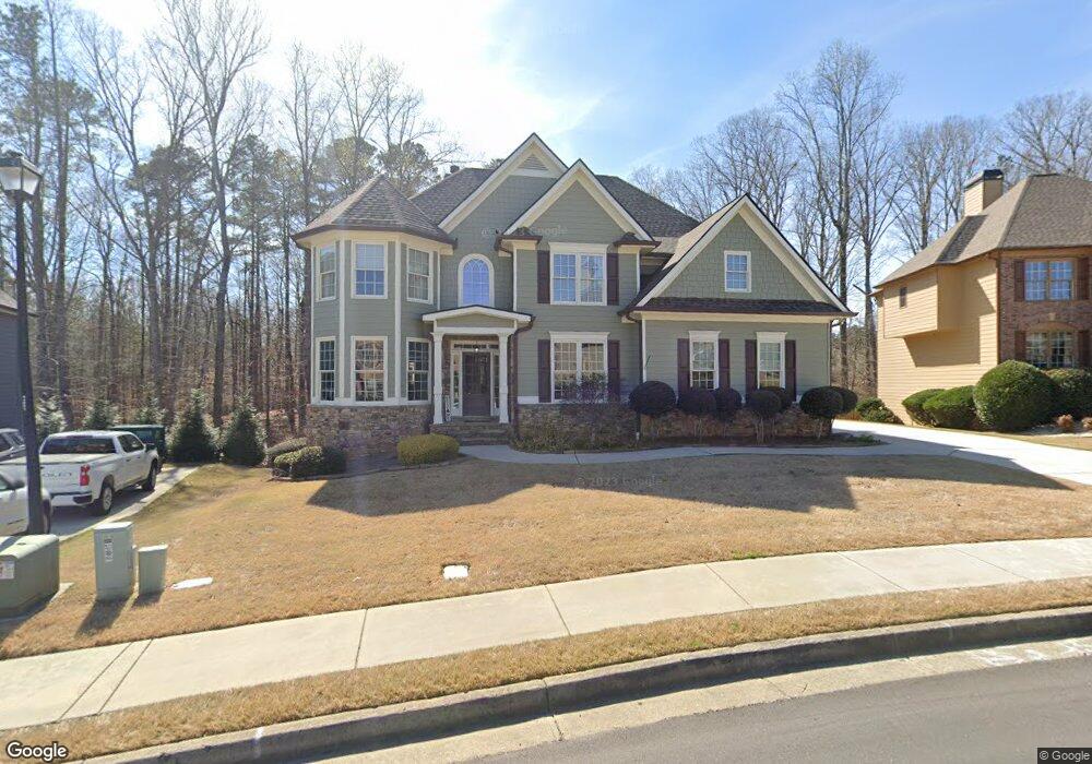
1918 Mapmaker Dr Unit 3 Dacula, GA 30019
Estimated Value: $590,521 - $661,000
5
Beds
4
Baths
3,803
Sq Ft
$162/Sq Ft
Est. Value
About This Home
This home is located at 1918 Mapmaker Dr Unit 3, Dacula, GA 30019 and is currently estimated at $616,380, approximately $162 per square foot. 1918 Mapmaker Dr Unit 3 is a home located in Gwinnett County with nearby schools including Fort Daniel Elementary School, Frank N. Osborne Middle School, and Mill Creek High School.
Ownership History
Date
Name
Owned For
Owner Type
Purchase Details
Closed on
Mar 31, 2022
Sold by
Hood Roland Foster
Bought by
Hood Sari Marie
Current Estimated Value
Home Financials for this Owner
Home Financials are based on the most recent Mortgage that was taken out on this home.
Original Mortgage
$245,000
Outstanding Balance
$228,072
Interest Rate
3.76%
Mortgage Type
New Conventional
Estimated Equity
$388,308
Purchase Details
Closed on
Sep 30, 2004
Sold by
Bryce Homes Inc
Bought by
Hood Roland F and Hood Sari
Home Financials for this Owner
Home Financials are based on the most recent Mortgage that was taken out on this home.
Original Mortgage
$30,349
Interest Rate
5.73%
Mortgage Type
New Conventional
Create a Home Valuation Report for This Property
The Home Valuation Report is an in-depth analysis detailing your home's value as well as a comparison with similar homes in the area
Home Values in the Area
Average Home Value in this Area
Purchase History
| Date | Buyer | Sale Price | Title Company |
|---|---|---|---|
| Hood Sari Marie | -- | -- | |
| Hood Roland F | $303,500 | -- |
Source: Public Records
Mortgage History
| Date | Status | Borrower | Loan Amount |
|---|---|---|---|
| Open | Hood Sari Marie | $245,000 | |
| Previous Owner | Hood Roland F | $30,349 | |
| Previous Owner | Hood Roland F | $242,792 |
Source: Public Records
Tax History
| Year | Tax Paid | Tax Assessment Tax Assessment Total Assessment is a certain percentage of the fair market value that is determined by local assessors to be the total taxable value of land and additions on the property. | Land | Improvement |
|---|---|---|---|---|
| 2025 | $8,398 | $250,000 | $47,200 | $202,800 |
| 2024 | $7,964 | $258,280 | $47,200 | $211,080 |
| 2023 | $7,964 | $238,160 | $47,200 | $190,960 |
| 2022 | $5,707 | $210,040 | $41,200 | $168,840 |
| 2021 | $5,793 | $156,520 | $29,400 | $127,120 |
| 2020 | $5,829 | $156,520 | $29,400 | $127,120 |
| 2019 | $5,619 | $156,520 | $29,400 | $127,120 |
| 2018 | $4,350 | $120,000 | $21,600 | $98,400 |
| 2016 | $4,369 | $120,000 | $21,600 | $98,400 |
| 2015 | $4,275 | $116,000 | $20,000 | $96,000 |
| 2014 | -- | $112,800 | $20,000 | $92,800 |
Source: Public Records
Map
Nearby Homes
- 1958 Mapmaker Dr
- 1838 Mapmaker Dr
- 1515 Brisbane Dr
- 1720 Fort Daniels Trail
- 1728 Scouts Walk NE
- 2727 Captain Ct
- 1714 Fort Shawnee Trace Unit 6
- 2628 Adair Trail
- 2755 Fort Daniels Dr
- 2461 Lance Ridge Way
- 2678 Adair Trail
- 1458 Whitaker Park Place
- 1405 La Maison Dr Unit I
- 1540 La Maison Dr
- 2159 Shin Ct
- 1608 School House Run
- 1521 Rocky Knoll Ln
- 1418 Wilkes Ive Dr
- 1455 Wilkes Crest Dr
- 2340 Heatherton Cir
- 1928 Mapmaker Dr
- 1908 Mapmaker Dr Unit 3
- 1938 Mapmaker Dr Unit 3
- 1909 Mapmaker Dr
- 1898 Mapmaker Dr Unit 3
- 2505 Hidden Path Trace
- 1948 Mapmaker Dr
- 1888 Mapmaker Dr NE
- 1889 Mapmaker Dr Unit 3
- 1888 Mapmaker Dr
- 1717 Fort River Way
- 1958 Mapmaker Dr Unit 208
- 1727 Fort River Way Unit 3B
- 2502 Hidden Path Trace
- 2515 Hidden Path Trace
- 1869 Mapmaker Dr
- 1878 Mapmaker Dr
- 2525 Hidden Path Trace Unit 3
- 1737 Fort River Way
- 1859 Mapmaker Dr NE
Your Personal Tour Guide
Ask me questions while you tour the home.