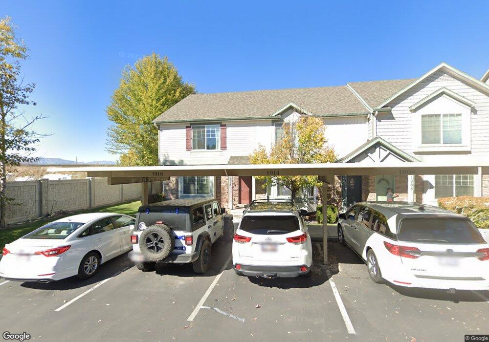
1918 W 1020 N Provo, UT 84604
Rivergrove NeighborhoodEstimated Value: $389,000 - $393,000
3
Beds
2
Baths
1,414
Sq Ft
$276/Sq Ft
Est. Value
About This Home
This home is located at 1918 W 1020 N, Provo, UT 84604 and is currently estimated at $390,391, approximately $276 per square foot. 1918 W 1020 N is a home located in Utah County with nearby schools including Westridge Elementary School, Dixon Middle School, and Provo High School.
Ownership History
Date
Name
Owned For
Owner Type
Purchase Details
Closed on
May 13, 2010
Sold by
Independence Avenue Llc
Bought by
Razo Alberto and Martinez Adriana Abigail
Current Estimated Value
Home Financials for this Owner
Home Financials are based on the most recent Mortgage that was taken out on this home.
Original Mortgage
$167,741
Outstanding Balance
$114,879
Interest Rate
5.5%
Mortgage Type
FHA
Estimated Equity
$275,512
Create a Home Valuation Report for This Property
The Home Valuation Report is an in-depth analysis detailing your home's value as well as a comparison with similar homes in the area
Home Values in the Area
Average Home Value in this Area
Purchase History
| Date | Buyer | Sale Price | Title Company |
|---|---|---|---|
| Razo Alberto | -- | First American Orem |
Source: Public Records
Mortgage History
| Date | Status | Borrower | Loan Amount |
|---|---|---|---|
| Open | Razo Alberto | $167,741 |
Source: Public Records
Tax History
| Year | Tax Paid | Tax Assessment Tax Assessment Total Assessment is a certain percentage of the fair market value that is determined by local assessors to be the total taxable value of land and additions on the property. | Land | Improvement |
|---|---|---|---|---|
| 2025 | $2,089 | $201,905 | -- | -- |
| 2024 | $2,089 | $205,645 | $0 | $0 |
| 2023 | $2,017 | $195,745 | $0 | $0 |
| 2022 | $1,962 | $191,950 | $0 | $0 |
| 2021 | $1,538 | $262,400 | $39,400 | $223,000 |
| 2020 | $1,550 | $248,000 | $32,300 | $215,700 |
| 2019 | $1,491 | $248,000 | $32,300 | $215,700 |
| 2018 | $1,345 | $226,900 | $29,000 | $197,900 |
| 2017 | $1,214 | $112,530 | $0 | $0 |
| 2016 | $1,184 | $102,300 | $0 | $0 |
| 2015 | $1,114 | $97,350 | $0 | $0 |
| 2014 | $972 | $88,550 | $0 | $0 |
Source: Public Records
Map
Nearby Homes
- 986 Independence Ave
- 1107 Independence Ave
- 927 Independence Ave
- 962 Independence Ave
- 1903 W 890 N
- 932 N 1760 W
- 1580 W 900 N
- 579 N Geneva Rd
- 1524 Merlin Dr
- 1441 Arthur Dr
- 1415 Arthur Dr
- 407 N 2150 W
- 1407 Arthur Dr
- 2507 W 520 N
- 1432 Lancelot Dr
- 1616 N 2100 W
- 1682 N 2250 W
- 255 N 1600 W Unit 148
- 255 N 1600 W Unit 52
- 255 N 1600 W Unit 60
- 1918 W 1020 N Unit 32
- 1914 W 1020 N Unit 33
- 1908 W 1020 N Unit 34
- 1913 W 1020 N Unit 31
- 1913 W 1020 N
- 1902 W 1020 N
- 1902 W 1020 N Unit 35
- 1898 W 1020 N
- 1898 W 1020 N Unit 36
- 1894 W 1020 N Unit 37
- 1888 W 1020 N
- 1888 W 1020 N Unit 38
- 1909 W 1020 N Unit 30
- 1049 N 1880 W
- 1049 N 1880 W Unit 40
- 1905 W 1020 N Unit 29
- 1905 W 1020 N
- 1055 N 1880 W Unit 41
- 1055 N 1880 W
- 1884 W 1020 N Unit 39
Your Personal Tour Guide
Ask me questions while you tour the home.