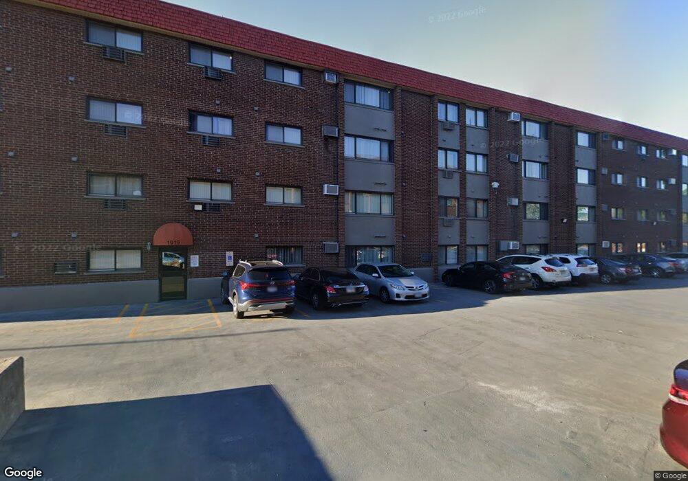
1919 S Wolf Rd Unit 1313 Hillside, IL 60162
Estimated Value: $113,000 - $148,000
Studio
1
Bath
475
Sq Ft
$265/Sq Ft
Est. Value
About This Home
This home is located at 1919 S Wolf Rd Unit 1313, Hillside, IL 60162 and is currently estimated at $125,735, approximately $264 per square foot. 1919 S Wolf Rd Unit 1313 is a home located in Cook County with nearby schools including Hillside Elementary School, Proviso West High School, and Immanuel Christian Academy.
Ownership History
Date
Name
Owned For
Owner Type
Purchase Details
Closed on
Jul 3, 2007
Sold by
Westbrook Development Llc
Bought by
Yee James and Yee Cheryl
Current Estimated Value
Home Financials for this Owner
Home Financials are based on the most recent Mortgage that was taken out on this home.
Original Mortgage
$82,049
Outstanding Balance
$50,207
Interest Rate
6.37%
Mortgage Type
Unknown
Estimated Equity
$75,528
Create a Home Valuation Report for This Property
The Home Valuation Report is an in-depth analysis detailing your home's value as well as a comparison with similar homes in the area
Home Values in the Area
Average Home Value in this Area
Purchase History
| Date | Buyer | Sale Price | Title Company |
|---|---|---|---|
| Yee James | $103,000 | Multiple |
Source: Public Records
Mortgage History
| Date | Status | Borrower | Loan Amount |
|---|---|---|---|
| Open | Yee James | $82,049 |
Source: Public Records
Tax History
| Year | Tax Paid | Tax Assessment Tax Assessment Total Assessment is a certain percentage of the fair market value that is determined by local assessors to be the total taxable value of land and additions on the property. | Land | Improvement |
|---|---|---|---|---|
| 2025 | $2,844 | $8,325 | $436 | $7,889 |
| 2024 | $2,844 | $8,325 | $436 | $7,889 |
| 2023 | $2,258 | $8,324 | $435 | $7,889 |
| 2022 | $2,258 | $6,020 | $653 | $5,367 |
| 2021 | $2,213 | $6,019 | $653 | $5,366 |
| 2020 | $2,154 | $6,019 | $653 | $5,366 |
| 2019 | $1,737 | $4,555 | $590 | $3,965 |
| 2018 | $1,688 | $4,555 | $590 | $3,965 |
| 2017 | $1,623 | $4,555 | $590 | $3,965 |
| 2016 | $1,676 | $4,609 | $544 | $4,065 |
| 2015 | $1,622 | $4,609 | $544 | $4,065 |
| 2014 | $1,580 | $4,609 | $544 | $4,065 |
| 2013 | $2,507 | $7,995 | $544 | $7,451 |
Source: Public Records
Map
Nearby Homes
- 11138 Shaw St
- 11053 Mandel Ave
- 10850 Claridge Ave Unit 2
- 10842 Claridge Ave
- 10845 Claridge Ave
- 1943 Mayfair Ave
- 2345 Boeger Ave
- 11460 Prescott Ln
- 1850 Kensington Ave
- 10909 Martindale Dr
- 1430 Evers Ave
- 2556 Camberley Cir Unit 2-813
- 10630 W Cermak Rd Unit 2E
- 2601 Burton Dr
- 1821 Buckingham Ave
- 11438 Ashley Woods Dr
- 11466 Ashley Woods Dr
- 2612 Ashley Woods Dr
- 1249 Highridge Pkwy
- 28 Queens Ct Unit Q28
- 1919 S Wolf Rd Unit 207
- 1919 S Wolf Rd Unit 323
- 1919 S Wolf Rd Unit 407
- 1919 S Wolf Rd Unit 403
- 1919 S Wolf Rd Unit 419
- 1919 S Wolf Rd Unit 222
- 1919 S Wolf Rd Unit 1312
- 1919 S Wolf Rd Unit 1421
- 1919 S Wolf Rd Unit 1420
- 1919 S Wolf Rd Unit 1418
- 1919 S Wolf Rd Unit 1417
- 1919 S Wolf Rd Unit 1413
- 1919 S Wolf Rd Unit 1412
- 1919 S Wolf Rd Unit 1411
- 1919 S Wolf Rd Unit 1213
- 1919 S Wolf Rd Unit 1212
- 1919 S Wolf Rd Unit 1211
- 1919 S Wolf Rd Unit 1408
- 1919 S Wolf Rd Unit 1407
- 1919 S Wolf Rd Unit 1405
Your Personal Tour Guide
Ask me questions while you tour the home.