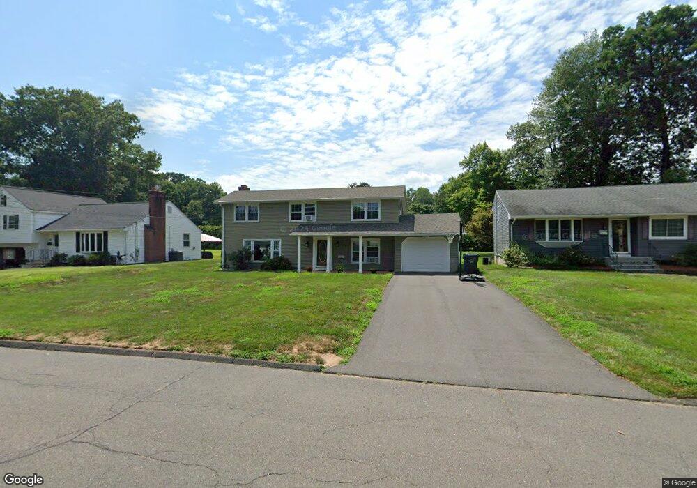
192 Brookside Rd Newington, CT 06111
Estimated Value: $370,000 - $430,000
3
Beds
2
Baths
1,176
Sq Ft
$337/Sq Ft
Est. Value
About This Home
This home is located at 192 Brookside Rd, Newington, CT 06111 and is currently estimated at $396,445, approximately $337 per square foot. 192 Brookside Rd is a home located in Hartford County with nearby schools including Elizabeth Green School, Martin Kellogg Middle School, and Newington High School.
Ownership History
Date
Name
Owned For
Owner Type
Purchase Details
Closed on
Jul 8, 2005
Sold by
Karas Mary E and Polchaninoff Michael
Bought by
Dave Parth A and Dave Smita
Current Estimated Value
Home Financials for this Owner
Home Financials are based on the most recent Mortgage that was taken out on this home.
Original Mortgage
$165,000
Outstanding Balance
$85,863
Interest Rate
5.71%
Estimated Equity
$310,583
Purchase Details
Closed on
Aug 21, 1997
Sold by
Luddy Sheila P
Bought by
Marshall Peter and Marshall Mary Kara S
Create a Home Valuation Report for This Property
The Home Valuation Report is an in-depth analysis detailing your home's value as well as a comparison with similar homes in the area
Home Values in the Area
Average Home Value in this Area
Purchase History
| Date | Buyer | Sale Price | Title Company |
|---|---|---|---|
| Dave Parth A | $245,000 | -- | |
| Marshall Peter | $145,500 | -- |
Source: Public Records
Mortgage History
| Date | Status | Borrower | Loan Amount |
|---|---|---|---|
| Closed | Marshall Peter | $25,000 | |
| Open | Marshall Peter | $165,000 | |
| Previous Owner | Marshall Peter | $146,450 | |
| Previous Owner | Marshall Peter | $60,000 |
Source: Public Records
Tax History
| Year | Tax Paid | Tax Assessment Tax Assessment Total Assessment is a certain percentage of the fair market value that is determined by local assessors to be the total taxable value of land and additions on the property. | Land | Improvement |
|---|---|---|---|---|
| 2025 | $6,784 | $169,690 | $54,880 | $114,810 |
| 2024 | $6,732 | $169,690 | $54,880 | $114,810 |
| 2023 | $6,184 | $161,210 | $54,880 | $106,330 |
| 2022 | $6,205 | $161,210 | $54,880 | $106,330 |
| 2021 | $6,257 | $161,210 | $54,880 | $106,330 |
| 2020 | $6,462 | $164,500 | $51,450 | $113,050 |
| 2019 | $6,490 | $164,500 | $51,450 | $113,050 |
| 2018 | $6,333 | $164,500 | $51,450 | $113,050 |
| 2017 | $6,019 | $164,500 | $51,450 | $113,050 |
| 2016 | $5,881 | $164,500 | $51,450 | $113,050 |
| 2014 | $5,153 | $148,210 | $51,920 | $96,290 |
Source: Public Records
Map
Nearby Homes
- 76 Main St
- 161 Abbotsford Ave
- 138 Williamstown Ct Unit 138
- 134 Williamstown Ct Unit 134
- 32 Garvan St
- 46 Piper Brook Ave
- 50 Hillcrest Ave
- 43 Marion St
- 79 Piper Brook Ave
- 149 Moylan Ct
- 104 Hollywood Ave
- 20 Brook St
- 22 Stafford St
- 24 Millbrook Ct Unit 24 Millbrook Ct Newi
- 14 Coolidge Ave
- 27 Burgoyne St Unit E
- 140 Camp Ave
- 5 Brinley Ave
- 25 Lewis Ln
- 26 Schoolhouse Dr Unit 308
- 198 Brookside Rd
- 186 Brookside Rd
- 95 Brace Rd
- 178 Brookside Rd
- 210 Brookside Rd
- 91 Brace Rd
- 101 Brace Rd
- 85 Woodmere Rd
- 168 Brookside Rd
- 87 Brace Rd
- 205 Brookside Rd
- 185 Brookside Rd
- 191 Brookside Rd
- 195 Brookside Rd
- 209 Brookside Rd
- 175 Brookside Rd
- 81 Brace Rd
- 217 Brookside Rd
- 213 Brookside Rd
- 88 Woodmere Rd
Your Personal Tour Guide
Ask me questions while you tour the home.