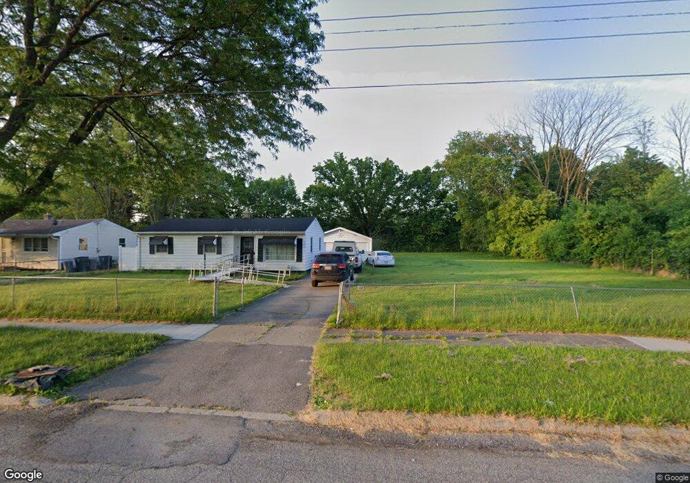
1920 Joseph St Flint, MI 48505
Northeast Village NeighborhoodEstimated Value: $51,000 - $123,000
3
Beds
1
Bath
1,480
Sq Ft
$59/Sq Ft
Est. Value
About This Home
This home is located at 1920 Joseph St, Flint, MI 48505 and is currently estimated at $87,000, approximately $58 per square foot. 1920 Joseph St is a home located in Genesee County with nearby schools including Brownell STEM Academy, The New Standard Academy, and Richfield Public School Academy.
Ownership History
Date
Name
Owned For
Owner Type
Purchase Details
Closed on
Oct 18, 2021
Sold by
Baker Curtis P
Bought by
Alford Shamell
Current Estimated Value
Purchase Details
Closed on
Apr 4, 2012
Sold by
Genesee County Land Bank Authority
Bought by
Baker Curtis P
Purchase Details
Closed on
Dec 21, 2007
Sold by
Kildee Daniel T
Bought by
Genesee County Land Bank Authority
Purchase Details
Closed on
Sep 14, 2001
Sold by
Harris Trust & Svgs Bank
Bought by
Bey Woodson Jnairo and Bates Tolerun E
Purchase Details
Closed on
Aug 16, 2000
Sold by
Baker Curtis
Bought by
Harris Trust & Svgs Bank
Create a Home Valuation Report for This Property
The Home Valuation Report is an in-depth analysis detailing your home's value as well as a comparison with similar homes in the area
Home Values in the Area
Average Home Value in this Area
Purchase History
| Date | Buyer | Sale Price | Title Company |
|---|---|---|---|
| Alford Shamell | -- | None Listed On Document | |
| Baker Curtis P | -- | None Available | |
| Genesee County Land Bank Authority | -- | None Available | |
| Bey Woodson Jnairo | $6,500 | First American Title Ins Co | |
| Harris Trust & Svgs Bank | $25,041 | -- |
Source: Public Records
Tax History
| Year | Tax Paid | Tax Assessment Tax Assessment Total Assessment is a certain percentage of the fair market value that is determined by local assessors to be the total taxable value of land and additions on the property. | Land | Improvement |
|---|---|---|---|---|
| 2025 | $196 | $2,900 | $0 | $0 |
| 2024 | $183 | $2,100 | $0 | $0 |
| 2023 | $188 | $2,300 | $0 | $0 |
| 2022 | $0 | $1,700 | $0 | $0 |
| 2021 | $140 | $1,900 | $0 | $0 |
| 2020 | $135 | $1,200 | $0 | $0 |
| 2019 | $143 | $1,200 | $0 | $0 |
| 2018 | $97 | $1,200 | $0 | $0 |
| 2017 | $25 | $0 | $0 | $0 |
| 2016 | $25 | $0 | $0 | $0 |
| 2015 | -- | $0 | $0 | $0 |
| 2014 | -- | $0 | $0 | $0 |
| 2012 | -- | $0 | $0 | $0 |
Source: Public Records
Map
Nearby Homes
- 1704 E Webster Rd
- 5910 N Dort Hwy
- 5919 Western Rd
- 3013 Hampstead Dr
- 5825 Branch Rd
- 2727 Eaton Place
- E E Carpenter Rd
- 1218 E Piper Ave
- 1206 E Home Ave
- 6101 Selby St
- 2212 E Coldwater Rd
- 2806 Epsilon Trail
- 5206 Branch Rd
- 3293 E Pierson Rd
- 1258 E Cornell Ave
- 5522 N Dort Hwy
- 802 E Russell Ave
- 3499 E Carpenter Rd
- 418 E Foss Ave
- 1023 E Princeton Ave
- 1926 Joseph St
- 1932 Joseph St
- 6708 N Webster Rd
- 1936 Joseph St
- 2002 Joseph St
- 6726 N Webster Rd
- 6701 Roseanna Dr
- 6732 N Webster Rd
- 6707 Roseanna Dr
- 2008 Joseph St
- 6702 Roseanna Dr
- 6738 N Webster Rd
- 6713 Roseanna Dr
- 2014 Joseph St
- 6681 N Webster Rd
- 6707 N Webster Rd
- 6802 N Webster Rd
- 6801 Roseanna Dr
- 6714 Roseanna Dr
- 6815 Touraine Dr
Your Personal Tour Guide
Ask me questions while you tour the home.