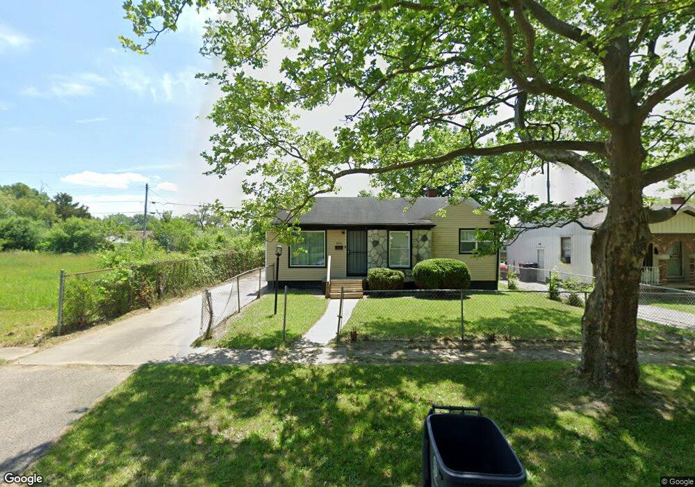
1921 Canniff St Flint, MI 48504
Bel-Aire Woods NeighborhoodEstimated Value: $22,000 - $51,163
3
Beds
1
Bath
878
Sq Ft
$45/Sq Ft
Est. Value
About This Home
This home is located at 1921 Canniff St, Flint, MI 48504 and is currently estimated at $39,291, approximately $44 per square foot. 1921 Canniff St is a home located in Genesee County with nearby schools including Brownell STEM Academy, Eagle's Nest Academy, and Greater Heights Academy.
Ownership History
Date
Name
Owned For
Owner Type
Purchase Details
Closed on
Apr 5, 2022
Sold by
Brandy Skelton
Bought by
Mahan Bryant
Current Estimated Value
Purchase Details
Closed on
Mar 1, 2022
Sold by
Genesee County Land Bank Authority
Bought by
Skelton Brandy Nicole
Purchase Details
Closed on
Sep 23, 2002
Sold by
Memorial Garden Sales Inc
Bought by
Hickmon Jamila J
Purchase Details
Closed on
Mar 7, 2002
Sold by
Continental Bank National Assn
Bought by
Memorial Gardens Sales Inc
Purchase Details
Closed on
Jun 28, 2000
Sold by
Murdock Leroy and Williams Joann M
Bought by
Continental Bank National Assn
Purchase Details
Closed on
May 9, 2000
Sold by
Flint Bonding Service
Bought by
Randle Joann M
Create a Home Valuation Report for This Property
The Home Valuation Report is an in-depth analysis detailing your home's value as well as a comparison with similar homes in the area
Home Values in the Area
Average Home Value in this Area
Purchase History
| Date | Buyer | Sale Price | Title Company |
|---|---|---|---|
| Mahan Bryant | -- | None Listed On Document | |
| Skelton Brandy Nicole | $7,000 | None Listed On Document | |
| Skelton Brandy Nicole | $7,000 | None Listed On Document | |
| Hickmon Jamila J | $57,000 | -- | |
| Memorial Gardens Sales Inc | $15,669 | First American Title Ins Co | |
| Continental Bank National Assn | $16,900 | -- | |
| Randle Joann M | -- | Cislo Title Company |
Source: Public Records
Tax History
| Year | Tax Paid | Tax Assessment Tax Assessment Total Assessment is a certain percentage of the fair market value that is determined by local assessors to be the total taxable value of land and additions on the property. | Land | Improvement |
|---|---|---|---|---|
| 2025 | $1,074 | $14,900 | $0 | $0 |
| 2024 | $996 | $12,400 | $0 | $0 |
| 2023 | $539 | $8,300 | $0 | $0 |
| 2022 | $0 | $0 | $0 | $0 |
| 2021 | $0 | $0 | $0 | $0 |
| 2020 | $0 | $0 | $0 | $0 |
| 2019 | $860 | $0 | $0 | $0 |
| 2018 | $710 | $7,000 | $0 | $0 |
| 2017 | $717 | $0 | $0 | $0 |
| 2016 | $860 | $0 | $0 | $0 |
| 2015 | -- | $0 | $0 | $0 |
| 2014 | -- | $0 | $0 | $0 |
| 2012 | -- | $12,500 | $0 | $0 |
Source: Public Records
Map
Nearby Homes
- 2013 Canniff St
- 1909 Cherrylawn Dr
- 2210 Canniff St
- 4539 Trumbull Dr
- 2320 Canniff St
- 5106 Cloverlawn Dr
- 4110 Leerda St
- 4008 Winona St
- 4306 Berger Dr
- 4310 Berger Dr
- 1720 Marlowe Dr
- 5413 Fleming Rd
- 3918 Trumbull Ave
- 4013 Sterling St
- 3808 Comstock Ave
- 5616 Griggs Dr
- 4816 Glenn Ave
- 5620 Marlowe Dr
- 3710 Kellar Ave
- 1518 Randy Ct
- 2001 Canniff St
- 2005 Canniff St
- 1913 Canniff St
- 2006 Santa Barbara Dr
- 2010 Santa Barbara Dr
- 2002 Santa Barbara Dr
- 1917 Canniff St
- 2014 Santa Barbara Dr
- 1907 Canniff St
- 2009 Canniff St
- 1922 Santa Barbara Dr
- 1920 Canniff St
- 1916 Canniff St
- 2002 Canniff St
- 2018 Santa Barbara Dr
- 1912 Canniff St
- 1918 Santa Barbara Dr
- 1901 Canniff St
- 2006 Canniff St
- 1908 Canniff St
Your Personal Tour Guide
Ask me questions while you tour the home.