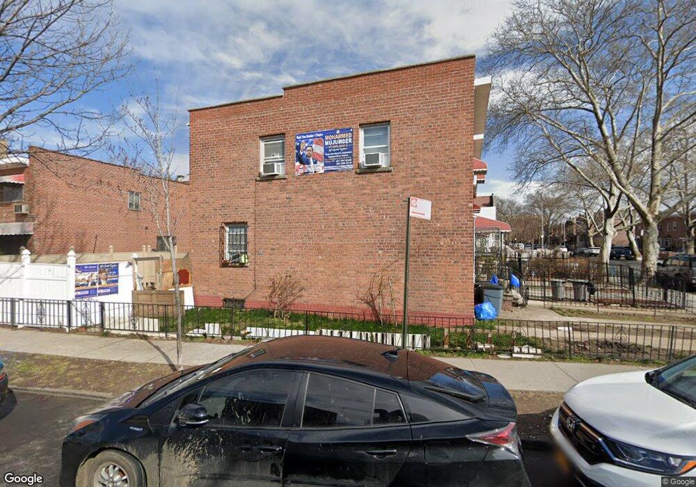
1923 Powell Ave Bronx, NY 10472
Unionport NeighborhoodEstimated Value: $572,037 - $769,000
Studio
--
Bath
1,080
Sq Ft
$606/Sq Ft
Est. Value
About This Home
This home is located at 1923 Powell Ave, Bronx, NY 10472 and is currently estimated at $655,009, approximately $606 per square foot. 1923 Powell Ave is a home located in Bronx County with nearby schools including The Dr Emmett W. Bassett School, St Helena School, and Holy Family School.
Ownership History
Date
Name
Owned For
Owner Type
Purchase Details
Closed on
Mar 11, 2005
Sold by
Rosa Evelyn
Bought by
Peralta Edwin and Rosa Evelyn
Current Estimated Value
Purchase Details
Closed on
May 31, 2000
Sold by
Rosa Ramon and Rosa Adelaida
Bought by
Rosa Evelyn
Home Financials for this Owner
Home Financials are based on the most recent Mortgage that was taken out on this home.
Original Mortgage
$138,850
Interest Rate
8.28%
Mortgage Type
FHA
Create a Home Valuation Report for This Property
The Home Valuation Report is an in-depth analysis detailing your home's value as well as a comparison with similar homes in the area
Home Values in the Area
Average Home Value in this Area
Purchase History
| Date | Buyer | Sale Price | Title Company |
|---|---|---|---|
| Peralta Edwin | -- | -- | |
| Peralta Edwin | -- | -- | |
| Rosa Evelyn | $140,000 | -- | |
| Rosa Evelyn | -- | -- |
Source: Public Records
Mortgage History
| Date | Status | Borrower | Loan Amount |
|---|---|---|---|
| Closed | Rosa Evelyn | $138,850 |
Source: Public Records
Tax History
| Year | Tax Paid | Tax Assessment Tax Assessment Total Assessment is a certain percentage of the fair market value that is determined by local assessors to be the total taxable value of land and additions on the property. | Land | Improvement |
|---|---|---|---|---|
| 2025 | $4,665 | $26,101 | $5,337 | $20,764 |
| 2024 | $4,665 | $24,624 | $5,741 | $18,883 |
| 2023 | $4,717 | $24,624 | $5,117 | $19,507 |
| 2022 | $4,592 | $34,620 | $7,680 | $26,940 |
| 2021 | $4,549 | $32,820 | $7,680 | $25,140 |
| 2020 | $4,308 | $30,900 | $7,680 | $23,220 |
| 2019 | $4,000 | $26,760 | $7,680 | $19,080 |
| 2018 | $3,885 | $20,520 | $6,583 | $13,937 |
| 2017 | $3,852 | $20,365 | $6,824 | $13,541 |
| 2016 | $3,531 | $19,213 | $7,661 | $11,552 |
| 2015 | $2,410 | $18,126 | $7,526 | $10,600 |
| 2014 | $2,410 | $17,100 | $8,520 | $8,580 |
Source: Public Records
Map
Nearby Homes
- 1163 Virginia Ave
- 1210 White Plains Rd
- 1886 Gleason Ave
- 1972 Ellis Ave
- 1966 Newbold Ave Unit 108
- 1966 Newbold Ave Unit 1510
- 1966 Newbold Ave Unit 407
- 1966 Newbold Ave Unit 1502
- 1966 Newbold Ave Unit 505
- 1966 Newbold Ave Unit 405
- 1966 Newbold Ave Unit 408
- 1966 Newbold Ave Unit 904
- 1966 Newbold Ave Unit 1109
- 1966 Newbold Ave Unit 308
- 1966 Newbold Ave Unit 303
- 1966 Newbold Ave Unit 104
- 1262 Leland Ave
- 1805 Gleason Ave
- 1210 Beach Ave
- 1332 Metropolitan Ave Unit 2A
- 1925 Powell Ave
- 1927 Powell Ave
- 1166 Virginia Ave
- 1929 Powell Ave
- 1168 Virginia Ave
- 1931 Powell Ave
- 1933 Powell Ave
- 1178 Virginia Ave
- 1935 Powell Ave
- 1157 Virginia Ave
- 1155 Virginia Ave
- 1920 Powell Ave
- 1159 Virginia Ave Unit 1
- 1159 Virginia Ave
- 1932 Gleason Ave
- 1153 Virginia Ave
- 1922 Powell Ave
- 1934 Gleason Ave
- 1936 Gleason Ave
Your Personal Tour Guide
Ask me questions while you tour the home.