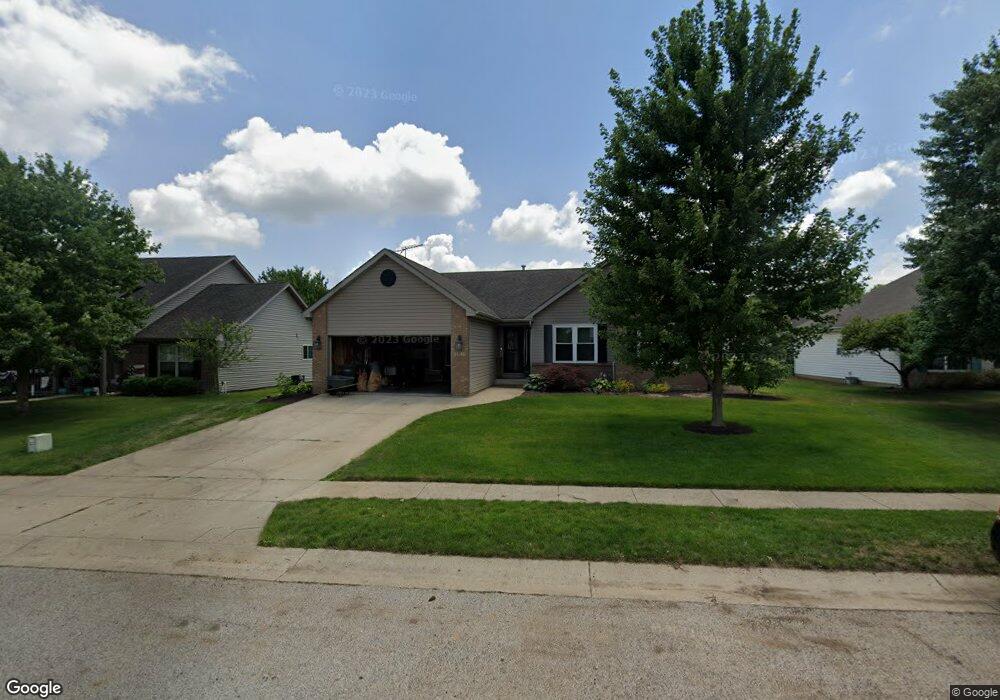
1925 Abbotsbury Way Lafayette, IN 47909
Estimated Value: $341,000 - $399,000
Studio
--
Bath
1,590
Sq Ft
$227/Sq Ft
Est. Value
About This Home
This home is located at 1925 Abbotsbury Way, Lafayette, IN 47909 and is currently estimated at $360,385, approximately $226 per square foot. 1925 Abbotsbury Way is a home located in Tippecanoe County with nearby schools including Wea Ridge Elementary School, Wea Ridge Middle School, and McCutcheon High School.
Ownership History
Date
Name
Owned For
Owner Type
Purchase Details
Closed on
Jun 30, 2006
Sold by
Halstead Gary L and Halstead Monica B
Bought by
Robinson John G and Robinson Melissa D
Current Estimated Value
Home Financials for this Owner
Home Financials are based on the most recent Mortgage that was taken out on this home.
Original Mortgage
$158,400
Outstanding Balance
$93,200
Interest Rate
6.68%
Mortgage Type
Unknown
Estimated Equity
$267,185
Purchase Details
Closed on
May 31, 2005
Sold by
Aw Hauling Inc
Bought by
Halstead Gary L and Halstead Monica B
Home Financials for this Owner
Home Financials are based on the most recent Mortgage that was taken out on this home.
Original Mortgage
$161,250
Interest Rate
5.91%
Mortgage Type
Construction
Purchase Details
Closed on
May 18, 2005
Sold by
Cedar Run Ltd Inc
Bought by
A W Hauling Inc
Home Financials for this Owner
Home Financials are based on the most recent Mortgage that was taken out on this home.
Original Mortgage
$161,250
Interest Rate
5.91%
Mortgage Type
Construction
Create a Home Valuation Report for This Property
The Home Valuation Report is an in-depth analysis detailing your home's value as well as a comparison with similar homes in the area
Purchase History
| Date | Buyer | Sale Price | Title Company |
|---|---|---|---|
| Robinson John G | -- | None Available | |
| Halstead Gary L | -- | -- | |
| A W Hauling Inc | -- | -- |
Source: Public Records
Mortgage History
| Date | Status | Borrower | Loan Amount |
|---|---|---|---|
| Open | Robinson John G | $158,400 | |
| Previous Owner | Halstead Gary L | $161,250 |
Source: Public Records
Tax History
| Year | Tax Paid | Tax Assessment Tax Assessment Total Assessment is a certain percentage of the fair market value that is determined by local assessors to be the total taxable value of land and additions on the property. | Land | Improvement |
|---|---|---|---|---|
| 2025 | $3,085 | $325,300 | $62,700 | $262,600 |
| 2024 | $3,085 | $307,900 | $62,700 | $245,200 |
| 2023 | $2,933 | $293,300 | $62,700 | $230,600 |
| 2022 | $2,505 | $250,500 | $38,700 | $211,800 |
| 2021 | $2,305 | $230,500 | $38,700 | $191,800 |
| 2020 | $2,138 | $213,200 | $38,700 | $174,500 |
| 2019 | $2,010 | $200,400 | $38,700 | $161,700 |
| 2018 | $2,096 | $209,000 | $38,700 | $170,300 |
| 2017 | $1,950 | $194,400 | $38,700 | $155,700 |
| 2016 | $1,940 | $193,400 | $38,700 | $154,700 |
| 2014 | $1,826 | $183,300 | $38,700 | $144,600 |
| 2013 | $1,847 | $184,700 | $38,700 | $146,000 |
Source: Public Records
Map
Nearby Homes
- 50 Shadow Valley Ct
- 5 Rushgrove Ct
- 1709 Stonegate Cir
- 4100 Homerton St
- 3981 Scoria St
- 4013 Penny Packers Mill Rd
- 2131 E 430 S
- 2293 Scoria Ct
- 3917 John Adams Rd
- 8151 John Adams Rd
- 8165 John Adams Rd
- 8171 John Adams Rd
- 8157 John Adams Rd
- TBD John Adams Rd
- 4006 John Adams Rd
- 3322 Crosspoint Ct S
- 4031 George Washington Rd
- 4615 Beringer Dr
- 1940 Honeybrook Way
- 4660 Fieldstone Dr
- 1929 Abbotsbury Way
- 1921 Abbotsbury Way
- 1926 Kyverdale Dr
- 1917 Abbotsbury Way
- 1933 Abbotsbury Way
- 1930 Kyverdale Dr
- 1922 Kyverdale Dr
- 1924 Abbotsbury Way
- 1928 Abbotsbury Way
- 1934 Kyverdale Dr
- 1918 Kyverdale Dr
- 1920 Abbotsbury Way
- 1913 Abbotsbury Way
- 1937 Abbotsbury Way
- 1916 Abbotsbury Way
- 1914 Kyverdale Dr
- 1930 Abbotsbury Way
- 1938 Kyverdale Dr
- 1909 Abbotsbury Way
- 1912 Abbotsbury Way
Your Personal Tour Guide
Ask me questions while you tour the home.