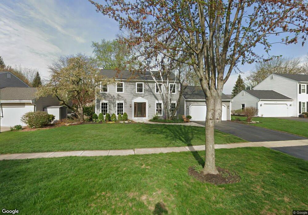
1926 Buckingham Dr Wheaton, IL 60189
Stonehedge NeighborhoodEstimated Value: $653,909 - $759,000
4
Beds
3
Baths
2,268
Sq Ft
$314/Sq Ft
Est. Value
About This Home
This home is located at 1926 Buckingham Dr, Wheaton, IL 60189 and is currently estimated at $713,227, approximately $314 per square foot. 1926 Buckingham Dr is a home located in DuPage County with nearby schools including Whittier Elementary School, Edison Middle School, and Wheaton Warrenville South High School.
Ownership History
Date
Name
Owned For
Owner Type
Purchase Details
Closed on
Aug 22, 2006
Sold by
Relocation Advantage Llc
Bought by
King Gerald W and King Mary L
Current Estimated Value
Home Financials for this Owner
Home Financials are based on the most recent Mortgage that was taken out on this home.
Original Mortgage
$384,000
Outstanding Balance
$229,795
Interest Rate
6.7%
Mortgage Type
Purchase Money Mortgage
Estimated Equity
$483,432
Purchase Details
Closed on
Aug 10, 2006
Sold by
Samson James R and Samson Kathleen M
Bought by
Relocation Advantage Llc
Home Financials for this Owner
Home Financials are based on the most recent Mortgage that was taken out on this home.
Original Mortgage
$384,000
Outstanding Balance
$229,795
Interest Rate
6.7%
Mortgage Type
Purchase Money Mortgage
Estimated Equity
$483,432
Create a Home Valuation Report for This Property
The Home Valuation Report is an in-depth analysis detailing your home's value as well as a comparison with similar homes in the area
Home Values in the Area
Average Home Value in this Area
Purchase History
| Date | Buyer | Sale Price | Title Company |
|---|---|---|---|
| King Gerald W | $512,000 | First American Title Ins Co | |
| Relocation Advantage Llc | $462,000 | First American Title Ins Co |
Source: Public Records
Mortgage History
| Date | Status | Borrower | Loan Amount |
|---|---|---|---|
| Open | King Gerald W | $384,000 |
Source: Public Records
Tax History
| Year | Tax Paid | Tax Assessment Tax Assessment Total Assessment is a certain percentage of the fair market value that is determined by local assessors to be the total taxable value of land and additions on the property. | Land | Improvement |
|---|---|---|---|---|
| 2024 | $11,309 | $185,861 | $51,778 | $134,083 |
| 2023 | $10,872 | $171,080 | $47,660 | $123,420 |
| 2022 | $10,628 | $161,680 | $45,040 | $116,640 |
| 2021 | $10,594 | $157,840 | $43,970 | $113,870 |
| 2020 | $10,561 | $154,230 | $43,560 | $110,670 |
| 2019 | $10,321 | $150,160 | $42,410 | $107,750 |
| 2018 | $10,623 | $152,670 | $39,960 | $112,710 |
| 2017 | $10,468 | $147,040 | $38,490 | $108,550 |
| 2016 | $10,331 | $141,160 | $36,950 | $104,210 |
| 2015 | $9,457 | $124,650 | $35,250 | $89,400 |
| 2014 | $8,806 | $114,610 | $34,740 | $79,870 |
| 2013 | $8,580 | $114,950 | $34,840 | $80,110 |
Source: Public Records
Map
Nearby Homes
- 141 Loretto Ct
- 1378 Colonial Square
- 24 Winners Cup Cir Unit 3
- 30 Danada Dr
- 121 Brighton Dr
- 26W055 Cree Ln
- 1605 Burning Trail
- 1S538 Bayberry Ln
- 1601 W Wiesbrook Rd
- 1519 Foothill Dr
- Lot 1 Foothill Dr
- 1028 Lodalia Ct
- 1127 Hibbard Rd
- 2552 Weatherbee Ln
- 110 E Farnham Ln
- 1219 Golf Ln
- 1526 Gainesboro Dr
- 1021 Greenwood Dr
- 1542 Castlewood Dr
- 3S700 Delles Rd
- 1920 Buckingham Dr
- 1925 Somerset Ln
- 1931 Somerset Ln
- 1938 Buckingham Dr
- 1914 Buckingham Dr
- 1919 Somerset Ln
- 1925 Buckingham Dr
- 1931 Buckingham Dr
- 1919 Buckingham Dr
- 1913 Somerset Ln
- 1937 Somerset Ln
- 1908 Buckingham Dr Unit 5
- 1944 Buckingham Dr
- 1913 Buckingham Dr
- 1937 Buckingham Dr
- 1943 Somerset Ln
- 1907 Somerset Ln
- 1943 Buckingham Dr
- 1907 Buckingham Dr
- 1950 Buckingham Dr
Your Personal Tour Guide
Ask me questions while you tour the home.